Alabama 811 | Know What's Below.

Archive for April 6th, 2016

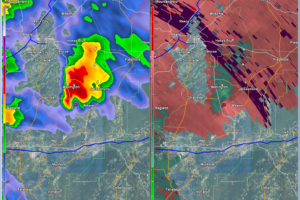
Significant Weather Advisory – Chilton, Bibb, Perry Until 9:45 PM CDT

Significant Weather Advisory – Chilton, Bibb, Perry Until 9:45 PM CDT

| April 6, 2016 @ 9:06 pm

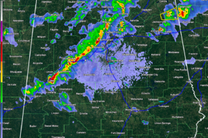
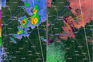
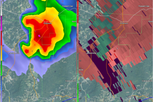
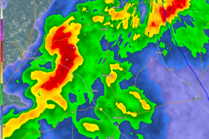
A Significant Weather Advisory has been issued for Chilton, northeastern Perry, and Bibb counties until 9:45 PM CDT. A strong storm was located from the Brierfield Ironworks stretching to near Harrisburg. Storm was moving east at 40 MPH. Heavy rains, frequent lightning, winds up to 50 MPH, and some small hail can be expected. Locations […]

Read More

Latest Severe Weather Thoughts

Latest Severe Weather Thoughts

| April 6, 2016 @ 8:44 pm

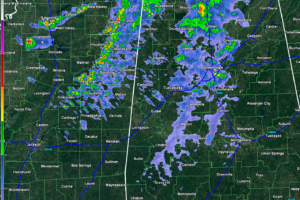
As the first wave of storms have pushed through the state and have made their way into Georgia, we can now focus all of our attention to the second and third waves. The line that is affecting the I-20 and I-59 corridors presently, is associated with a pre-frontal trough. There is a small severe threat […]

Read More

Latest Update On Storms Currently In Progress

Latest Update On Storms Currently In Progress

| April 6, 2016 @ 8:15 pm

The first line of thunderstorms are exiting the state, and the last part of it hangs tough in Calhoun and Cleburne counties. A Severe Thunderstorm Warning remains in effect for these counties until 8:45 PM CDT. Nickel-size hail has been reported with this storm. The second line of storms is close to approaching the Birmingham […]

Read More

Severe Thunderstorm Warning – Calhoun, Cherokee, Cleburne Until 8:45 PM

Severe Thunderstorm Warning – Calhoun, Cherokee, Cleburne Until 8:45 PM

| April 6, 2016 @ 7:55 pm

A Severe Thunderstorm Warning has been issued until 8:45 PM CDT for southeastern Cherokee, northeastern Cleburne, and northeastern Calhoun counties. A severe thunderstorm was located near Jacksonville, and is moving east at 45 MPH. Locations in the path of this storm are listed below. If you are in the path of this storm, seek shelter […]

Read More

Significant Weather Advisory For Calhoun, Cherokee, and Cleburne Until 8:00 PM CDT

Significant Weather Advisory For Calhoun, Cherokee, and Cleburne Until 8:00 PM CDT

| April 6, 2016 @ 7:46 pm

A strong thunderstorm located near Piedmont was moving east at 40 MPH. Nickel-size hail was reported at Jacksonville as the storm was passing through. Expect heavy rainfall, frequent lightning, nickel-size hail, and wind gust up to 50 MPH with this storm. Locations in the path are: Jacksonville, Piedmont, Pleasant Gap, Jacksonville State University, Knightens Crossroads, […]

Read More

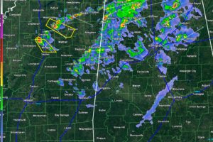
Lightning Starting To Pick Up On West Alabama Storms

Lightning Starting To Pick Up On West Alabama Storms

| April 6, 2016 @ 7:38 pm

A line of storms stretching from just west of Cullman, down to the southwest to Tuscaloosa, and back to Aliceville, is starting to intensify and lightning is increasing. A strong storm is located at Jasper and stretches up to the northwest to the northeast corner of Walker county. There is frequent lightning associated with this […]

Read More

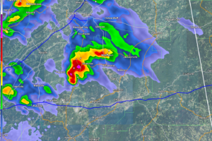
Keep An Eye Open On This Storm Approaching Jacksonville

Keep An Eye Open On This Storm Approaching Jacksonville

| April 6, 2016 @ 7:26 pm

This strong thunderstorm is starting to show signs of rotation. There is no warning currently in effect for this storm, but it is worth keeping an eye on it. Jacksonville and Piedmont are the next towns in the path. Expect strong winds, some hail, and frequent lightning.

Read More

Significant Weather Advisory for Calhoun and St. Clair Counties Until 7:45 PM

Significant Weather Advisory for Calhoun and St. Clair Counties Until 7:45 PM

| April 6, 2016 @ 7:06 pm

A strong thunderstorm was located near Ragland, moving to the northeast at 40 MPH. Expect heavy rainfall, hail, and frequent lightning. There is a possibility that this storm could strengthen. Locations impacted include: Anniston, Jacksonville, Piedmont, Saks, Glencoe, Weaver, Ragland, Ohatchee, Neely Henry Lake, Alexandria, Jacksonville State University, Southside, Knightens Crossroads, Neely Henry Dam, Wellington, […]

Read More

Storms Are Producing Hail But Are Still Below Severe Limits

Storms Are Producing Hail But Are Still Below Severe Limits

| April 6, 2016 @ 6:53 pm

Within the past 30 minutes (of this post) a few storms developed in Jefferson and Shelby county that produced pea-size hail. This will be the issue with some of the storms tonight, as the second and third lines move closer. We have also seen reports of trees being blown down in Walker county just from […]

Read More

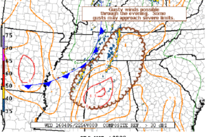
Severe Thunderstorm Watch Possible

Severe Thunderstorm Watch Possible

| April 6, 2016 @ 6:31 pm

The Storm Prediction Center is discussing issuing a Severe Thunderstorm Watch for areas in far south-central Kentucky, portions of middle into eastern Tennessee, eastern Mississippi, north and central Alabama, and northwest Georgia. MESOSCALE DISCUSSION 0339 NWS STORM PREDICTION CENTER NORMAN OK 0623 PM CDT WED APR 06 2016 AREAS AFFECTED…FAR SOUTH-CENTRAL KY…PORTIONS OF MIDDLE INTO […]

Read More

Storms Are Starting To Move In

Storms Are Starting To Move In

| April 6, 2016 @ 6:00 pm

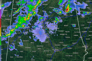
A broken line of showers with a few embedded thunderstorms are pushing their way across the northwestern part of the state at and is approaching the I-65 corridor. Another line of heavier rain and thunderstorms will be pushing across the state line from Mississippi between now and 7PM CDT. There is another broken line of […]

Read More

Late Afternoon Weather Update

Late Afternoon Weather Update

| April 6, 2016 @ 4:27 pm

Currently at 4PM across the state, a few showers have developed in Autauga county just south of Billingsley. Showers are starting to push across the Mississippi-Alabama state line in Lauderdale, Colbert, Franklin, Marion, and Lamar counties. There are no active watches or warnings for the state at the moment. Temperatures across the state are mostly […]

Read More

Strong Storms Early Tonight

Strong Storms Early Tonight

| April 6, 2016 @ 2:58 pm

RADAR CHECK: Nothing on radar across Alabama as I write this shortly before 3:00, but a band of showers and storms is passing through Memphis… This activity will scoot through North Alabama early tonight, and they could be fairly strong with potential for gusty straight line winds and some small hail. SPC now has North […]

Read More

SPC Upgrades Severe Weather Risk

SPC Upgrades Severe Weather Risk

| April 6, 2016 @ 12:55 pm

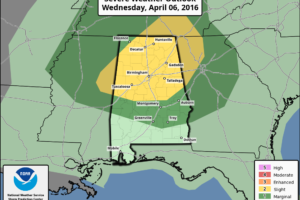
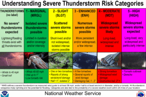
The Storm Prediction Center upgraded the severe weather risk for the northern half of Alabama for this afternoon and tonight from MARGINAL to SLIGHT. Here is an excellent graphic explaining the different risk tiers: THOUGHTS ON THE THREAT …Available moisture for this event is limited. Dewpoints will only be in the middle 50s, which is […]

Read More