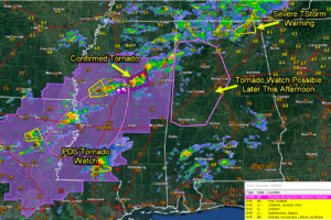
Big Picture at 4 pm: Tornado Watch Will be Needed for Parts of Central Alabama in Next Couple of Hours
Some notes on the evolving severe weather threat and some timing for Alabama.

Some notes on the evolving severe weather threat and some timing for Alabama.
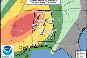
Coverage of showers and storms will increase over the next few hours statewide. SPC has pushed the “moderate risk” (level 4/5) into Northwest Alabama, including parts of Franklin, Colbert, Marion, Winston, Lamar, Fayette, and Pickens counties. An “enhanced risk” (level 3/5) extends over to Huntsville, Gardendale, and Tuscaloosa. A “slight risk” (level 2/5) covers most of the rest of the state.

It’s not too late to get your severe weather plan in place before the expected severe weather late this afternoon and tonight… When severe weather threatens, stack the odds in your favor by having a plan and a reliable way to get warnings immediately. Think about the place you will go on a moment’s notice […]

The WeatherBrains crew includes your host, James Spann, plus other notable geeks like Troy Kimmel, Bill Murray, Rick Smith, James Aydelott, Jen Narramore, Dr. Neil Jacobs, and Dr. Kim Klockow-McClain. They bring together a wealth of weather knowledge and experience for another fascinating podcast about weather.
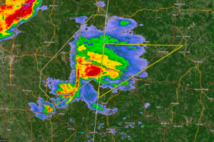
The storms over Northwest Alabama may contain large hail, but the wind and tornado threat with them is low. That will be changing as we go into the late afternoon and evening hours.
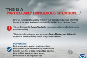
The SPC issued PDS Tornado Watches when they have a high confidence that there will be strong to violent tornadoes.
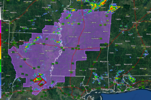
The watch does not include any part of Alabama. Tornado watches will likely be required for our state later this afternoon or tonight.

Elevated storm entering Northwest Alabama has a threat of large hail.
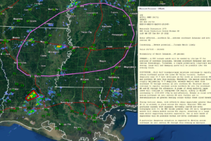
A significant severe weather situation is setting up for later today and tonight across areas to the west of Alabama. This severe weather will move into western Alabama tonight.

Elevated (or non-surface-based storms) over northern Mississippi pose mainly a hail threat as they push east-northeastward into the Tennessee Valley of North Alabama and southern Tennessee into the early afternoon hours. The higher, more impactful severe threat looks like it will start to ramp up starting around 1 p.m. back in northern Louisiana and Central Mississippi with an increasing tornado threat.
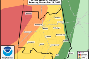
It’s the waiting game as a very dynamic system is destabilizing the atmosphere over the Southeast and will bring severe storms to Alabama today and tonight. The SPC maintains has expanded the “moderate risk” (level 4/5) into West Alabama, Pickens, Lamar, Fayette, Marion, Winston, Walker, and Franklin counties.
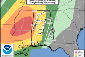
Severe thunderstorms are possible across Alabama tonight ahead of a dynamic weather system. SPC has defined an “enhanced risk” (level 3/5) for the far western counties of the state… there is a “slight risk” (level 2/5) as far east as Guntersville, Prattville, and Brewton, and a “marginal risk” (level 1/5) down to Opelika and Enterprise.
Notifications