Warm Afternoons Through Sunday; Cooler Next Week
REFRESHING MORNING: Here are some temperatures across North/Central Alabama just before daybreak…
Black Creek 52
Decatur 52
Russellville 52
Cullman 53
Haleyville 53
Gadsden 54
Heflin 56
While the morning is cool, we warm quickly today and temperatures will reach the mid 80s this afternoon with a good supply of sunshine.
THE WEEKEND: Tomorrow will be partly sunny, warm, and more humid with a high in back in the mid 80s. And, most of the day Sunday will be warm and dry with a high between 82 and 85 degrees along with a mix of sun and clouds. But, we will bring in a chance of showers late Sunday and Sunday night ahead of a cold front. Nothing too heavy or widespread; rain amounts will be under 1/4″ for most places.
RACE WEEKEND AT TALLADEGA: Warm, dry weather today and tomorrow with highs in the 80s. For the Alabama 500 Sunday, we project afternoon temperatures in the low to mid 80s with only a slight risk of shower; a few showers are more likely Sunday night ahead of a cold front.
FOOTBALL WEATHER: A clear sky for the high school football games tonight; temperatures will fall from near 80 at kickoff through the 70s during the games.
Alabama will host the Arkansas Razorbacks tomorrow evening (6:15p CT kickoff) at Bryant-Denny Stadium in Tuscaloosa for homecoming… the sky will be mostly fair. About 82 degrees at kickoff, falling to near 75 by the final whistle.
Auburn travels to Baton Rouge to take on LSU tomorrow afternoon (2:30p CT kickoff)… the game will be played under a sunny sky; the temperature will be close to 88 degrees at kickoff, falling back into the low 80s by the fourth quarter.
UAB will host Middle Tennessee at Legion Field in Birmingham tomorrow evening (5:30p CT kickoff)… expect a clear sky with temperatures falling from near 83 at kickoff, into the 70s by the second half.
NATIONAL SHRIMP FESTIVAL: Beautiful weather for the big event in Gulf Shores today and tomorrow with a good supply of sunshine both days; a few scattered showers and storms are possible Sunday with a mix of sun and clouds. Highs in the 80s, lows around 70.
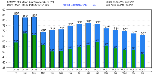
NEXT WEEK: On Monday the sky becomes mostly sunny. The day will be breezy and much cooler with a high only in the upper 60s. And, by early Tuesday temperatures drop into the 40s with a clear sky. The rest of the week looks dry and pleasant with highs in the 70s and lows in the upper 40s and low 50s. Perfect fall weather. See the Weather Xtreme video for maps, graphics, and more details.
TROPICS: A disturbance east of the Leeward Islands has a low chance of development over the next five days; it will turn northward and seems to be no threat to land if by chance something pops there. And, Hurricane Ophelia will become post-tropical in the eastern Atlantic this weekend, moving toward Ireland early next week. The rest of the Atlantic basin is quiet.
BEACH FORECAST: Click here to see the AlabamaWx Beach Forecast Center page. The Beach Forecast is partially underwritten by the support of Brett/Robinson Vacation Rentals in Gulf Shores and Orange Beach. Click here to see Brett/Robinson’s Hot Deals now!
WEATHER BRAINS: Don’t forget you can listen to our weekly 90 minute netcast anytime on the web, or on iTunes. This is the show all about weather featuring many familiar voices, including our meteorologists here at ABC 33/40.
CONNECT: You can find me on all of the major social networks…
Facebook
Twitter
Google Plus
Instagram
Pinterest
Snapchat: spannwx
Look for the next Weather Xtreme video here by 4:00 this afternoon… enjoy the day!
Category: Alabama's Weather, ALL POSTS, Weather Xtreme Videos
About the Author (Author Profile)
James Spann is one of the most recognized and trusted television meteorologists in the industry. He holds the AMS CCM designation and television seals from the AMS and NWA. He is a past winner of the Broadcast Meteorologist of the Year from both professional organizations.Subscribe
If you enjoyed this article, subscribe to receive more just like it.


