Cooler Today; Not Much Sun This Week
ON THE MAP: We have a sharp cold front lined up from near Heflin to Montgomery to Jackson this morning; this will bring a sharp temperature contrast to Alabama today. North of the front, we are seeing low to mid 30s over the Tennessee Valley, but to the south Auburn reports 61 just before daybreak. And, on radar, we see a few patches of light rain in the colder air over the northern quarter of the state.
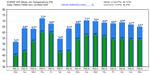
Today will be mostly cloudy with a broad southwest flow remaining in place, but we expect only isolated showers through tonight. Temperatures won’t get out of the 40s over the northern third of the state; the high will be in the 50-55 degree range for places like Tuscaloosa, Birmingham, Anniston, and Gadsden. And, down in South Alabama, the high today will be well up in the 60s, with low 70s possible in spots.
TOMORROW/WEDNESDAY: Not much sun tomorrow; the sky will remain generally cloudy, but showers should be pretty hard to find. The way will be warmer; we expect low 60s across North/Central Alabama, with 50s for the Tennessee Valley. Then, on Wednesday, moisture deepens and we will mention a chance of showers for the northern half of the state with a high in the 60s.
THURSDAY/FRIDAY: Thursday looks mostly cloudy and mild with some risk of showers; the high will be in the 60s. Then, on Friday, a surface front crosses into the state with rain likely at times. The high Friday will be in the 50s; temperatures could fall into the 40s over the northern quarter of the state. No severe weather issues, and we don’t expect any flooding problems.
THE ALABAMA WEEKEND: Saturday, for now, looks dry with a pretty decent amount of sun. We start the day close to the freezing mark, and climb into the 50s. Clouds will increase Sunday, but for now it looks like any showers will be widely scattered. Sunday’s high will be in the 60-65 degree range.
NEXT WEEK AND BEYOND: Rain seems likely at times Monday as another surface front approaches. But, the upper air pattern will keep the really cold air bottled up to the north, and the week looks generally mild. No sign of any long lasting Arctic air shots, snow, or ice for Alabama for the rest of February. See the Weather Xtreme video for maps, graphics, and more details.
BEACH FORECAST: Click here to see the AlabamaWx Beach Forecast Center page.
WEATHER BRAINS: Don’t forget you can listen to our weekly 90 minute netcast anytime on the web, or on iTunes. This is the show all about weather featuring many familiar voices, including our meteorologists here at ABC 33/40. We will produce this week’s show tonight at 8:30 CT… you can watch it live here.
CONNECT: You can find me on all of the major social networks…
Facebook
Twitter
Google Plus
Instagram
Pinterest
Snapchat: spannwx
I have a weather program this morning at Alexandria Elementary in Calhoun County… look for the next Weather Xtreme video here by 4:00 this afternoon. Enjoy the day!
Category: Alabama's Weather, ALL POSTS, Weather Xtreme Videos
About the Author (Author Profile)
James Spann is one of the most recognized and trusted television meteorologists in the industry. He holds the AMS CCM designation and television seals from the AMS and NWA. He is a past winner of the Broadcast Meteorologist of the Year from both professional organizations.Subscribe
If you enjoyed this article, subscribe to receive more just like it.


