

One More Mild Day, Then Sharply Colder
FINE JANUARY DAY: With a good supply of sunshine, temperatures are in the 60s over the northern half of Alabama this afternoon, with a few 70s across the southern counties. Montgomery and Eufaula report 73 degrees at 3:00.
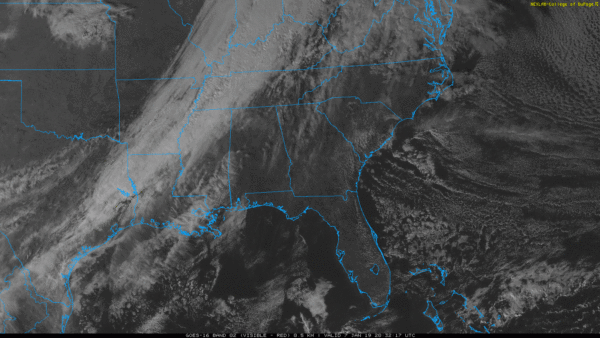
Clouds will increase tonight ahead of a cold front, and that front could squeeze out a few widely scattered showers across North/Central Alabama tomorrow. Moisture will be very limited, and rain amounts will be light and spotty. The weather stays mild tomorrow with a high in the 60s.
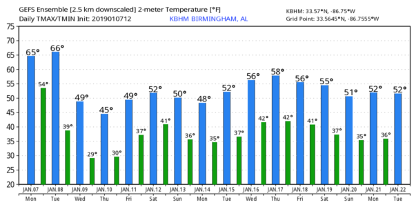
COLDER DAYS: Wednesday will be sunny, but windy and colder with a high between 50 and 55; a north wind of 10-20 mph will make it feel colder. The wind will die down Wednesday night, and by Thursday morning most communities across the northern half of the state will see a low in the 20s. Thursday and Friday will be cold and dry; the high Thursday will be in the 46-51 degree range, and close to 50 Friday. We expect sunshine in full supply Thursday, and just a few scattered clouds Friday.
THE ALABAMA WEEKEND: A wave of low pressure will move across the Gulf States as the weekend begins, and for now Saturday looks cool and wet with periods of rain; the high will be only in the 48-52 degree range for North Alabama, and 55-60 for the southern counties. Sunday will be mostly cloudy and colder with highs only in the 40s across the northern half of the state; we could see some lingering light rain or drizzle during the morning hours.
NEXT WEEK: The week looks fairly quiet at this point; generally dry Monday through Wednesday, with some potential for light rain by Thursday or Friday. See the Weather Xtreme video for maps, graphics, and more details…
ON THIS DATE IN 1988: A major southern snow storm; heaviest snow in Alabama was over the Tennessee Valley, where Huntsville measured 9.6?. Storm total accumulations ranged from around 2 inches in the Smith Lake area of southern Cullman County to over 10 inches in the far northeast corner of Alabama, with the majority of the area seeing over a half a foot. At least a trace of snow remained on the ground in Huntsville for nine days after the snow began, with at least a half a foot of snow remaining on the ground for four days. Around a million chickens were killed when the houses they were in collapsed due to snow and ice accumulations. Around a quarter million birds survived, but were not economically salvageable. Damage to poultry houses were estimated to be over $15 million in Cullman, Morgan, Marshall, DeKalb, and Lawrence counties. This prompted Governor Guy Hunt to declare a state of emergency for North Alabama.
BEACH FORECAST: Click here to see the AlabamaWx Beach Forecast Center page.
WEATHER BRAINS: Don’t forget you can listen to our weekly 90 minute show anytime on your favorite podcast app. This is the show all about weather featuring many familiar voices, including our meteorologists here at ABC 33/40.
CONNECT: You can find me on all of the major social networks…
Facebook
Twitter
Instagram
Pinterest
Snapchat: spannwx
Look for the next Weather Xtreme video here by 7:00 a.m. tomorrow…
Category: Alabama's Weather, ALL POSTS, Weather Xtreme Videos
About the Author (Author Profile)
James Spann is one of the most recognized and trusted television meteorologists in the industry. He holds the AMS CCM designation and television seals from the AMS and NWA. He is a past winner of the Broadcast Meteorologist of the Year from both professional organizations.Subscribe
If you enjoyed this article, subscribe to receive more just like it.


