

Severe Storms Possible Tomorrow Night
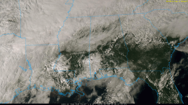
A CALMER AFTERNOON: Thankfully the radar is fairly quiet this afternoon after another morning packed with showers and thunderstorms. We are just seeing a few isolated showers at mid-afternoon across East-Central and Northwest Alabama, otherwise most communities are dry for a change.
A well defined front continues to bisect Alabama; temperatures are in the 50s north of the front, but to the south Montgomery has soared to 84 degrees at 3:00 p.m. The front hasn’t moved much today, but it should drift northward tonight as a deep upper trough lifts out of the western U.S.
A few showers are possible tonight across the state tonight, but nothing too heavy or widespread.
SEVERE STORMS POSSIBLE TOMORROW NIGHT: Tomorrow will be a warm, windy day with temperatures rising well into the 70s over North Alabama… and once again some South Alabama communities will visit the 80s. A few showers are possible during the day, but a band of strong to severe storms will move into the state tomorrow night ahead of a cold front with good upper air support.
SPC has moved the “enhanced risk” area (level 3/5) back into far Northwest Alabama… the standard “slight risk” (level 2/5) is up as far east as Demopolis, Birmingham, and Scottsboro, and a “marginal risk” (level 1/5) extends over to Jackson, Prattville, and Heflin.

TIMING: The main window for severe storms will come from 6:00 p.m. until 3:00 a.m. Initially over Northwest Alabama, with the threat moving south and east during the night.
THREATS: The highest tornado threat is in the “enhanced risk” over Northwest Alabama, but an isolated tornado or two can’t be ruled out in the “slight risk” as well. But, the most significant threat will come from strong straight line winds. And, remember, with the saturated soil conditions trees will tend to fall more easily. Some hail is possible as well.
GRADIENT WINDS: Away from storms, gusty south winds of 12-22 mph tomorrow could also bring down a few trees during the day. Those gradient winds will shift around to the west after midnight late tomorrow night when the front passes.
Be sure you have a way of hearing severe weather watches and warnings tomorrow night in the event they are needed. Remember, this is the severe weather “tax free” weekend in Alabama; not a bad time to get a new NOAA Weather Radio with fresh batteries for backup in the event of a power failure. Every home and business in the state needs one.
RIVER FLOODING: Heavy rains this week have elevated Alabama Power lake levels, and rain this weekend is expected to push lake levels even higher in some locations. The rain has resulted in some Alabama Power storage reservoirs on the Coosa and Black Warrior rivers reaching summer pool levels or higher. Consistent with flood operations, spillgates are operating at some lakes.
Weiss Lake is above summer pool level and may continue to rise to 567 feet by this weekend. Spillgates are operating.
Smith Lake is expected to approach summer pool early next week.
Logan Martin Lake will rise above summer pool and could reach an elevation of up to 472.5 feet by early next week. Spillgates are operating. Alabama Power continues to coordinate operations with the United States Army Corps of Engineers.
SUNDAY AND NEXT WEEK: Drier air finally returns to Alabama Sunday as the sky becomes partly to mostly sunny; the high will be in the 60s. And, dry weather continues Monday and Tuesday before showers return to the state at mid-week Wednesday. See the Weather Xtreme video for maps, graphics, and more details.

ON THIS DATE IN 1998: Seven tornadoes struck east central Florida late on this date and early on the 23rd. Three of the tornadoes were rated F3 on the Fujita scale. 24 people were killed in Kissimmee alone. A total of 42 people were killed with 265 injured, and total damage was $106 million dollars.
BEACH FORECAST: Click here to see the AlabamaWx Beach Forecast Center page.
WEATHER BRAINS: Don’t forget you can listen to our weekly 90 minute show anytime on your favorite podcast app. This is the show all about weather featuring many familiar voices, including our meteorologists here at ABC 33/40.
CONNECT: You can find me on all of the major social networks…
Facebook
Twitter
Instagram
Pinterest
Snapchat: spannwx
Look for my next Weather Xtreme video here Monday morning by 7:00 a.m… and keep an eye on the blog for updates on the weekend severe weather situation.
Category: Alabama's Weather, ALL POSTS, Weather Xtreme Videos
About the Author (Author Profile)
James Spann is one of the most recognized and trusted television meteorologists in the industry. He holds the AMS CCM designation and television seals from the AMS and NWA. He is a past winner of the Broadcast Meteorologist of the Year from both professional organizations.Subscribe
If you enjoyed this article, subscribe to receive more just like it.


