Much Cooler Air Arrives This Weekend
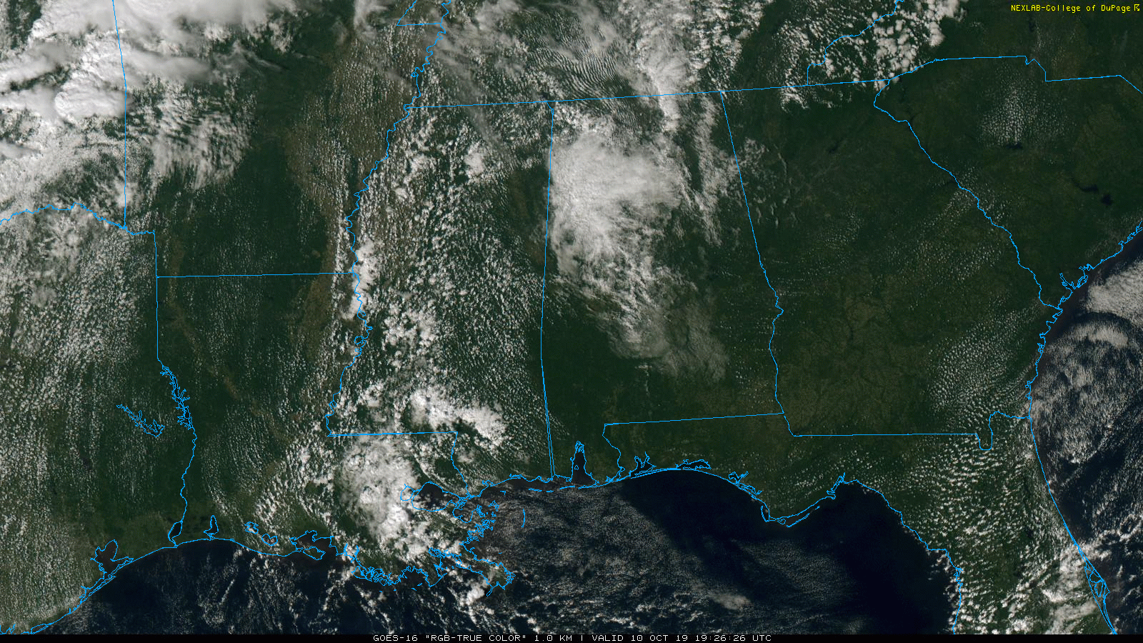
RADAR CHECK: A few showers are over parts of West Alabama this afternoon… otherwise the state is dry with a partly sunny sky. Temperatures are generally in the upper 70s and low 80s over the northern half of the state, with mid 80s over South Alabama.
The weather won’t change much tomorrow; look for a mix of sun and clouds with a high between 80 and 85 degrees. The risk of any one spot seeing a shower remains small.
TOMORROW NIGHT AND THE WEEKEND: A cold front will push a band of showers into the state tomorrow night into Saturday morning. It looks like the main window for showers will come from 9:00 p.m. tomorrow through 9:00 a.m. Sunday, and rain amounts should be under 1/4 inch for most locations. Some thunder is not totally out of the question, but severe storms are not expected with limited moisture and the primary dynamic support well to the north.
The coolest air so far this season will blow into the state Saturday. Many places north of Birmingham won’t make it out of the 50s all day; the high will be in the 60s for the central counties, with 70s and 80s for South Alabama. The front will become nearly stationary by Saturday evening.
Then, on Sunday, moisture begins to ride up and over the shallow layer of cool air near the surface, and rain will become widespread by afternoon over the northern half of the state. Rain will continue into Sunday night as the “overrunning” pattern continues.
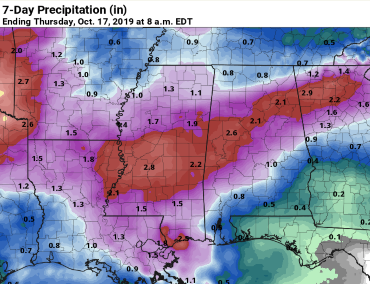
NEXT WEEK: On Monday, the best chance of rain shifts down into South Alabama, but Tuesday looks fairly wet statewide with periods of rain likely. Lingering showers are possible Wednesday, then Thursday and Friday are looking cool and dry. Rain amounts for places like Birmingham, Tuscaloosa, Anniston, and Gadsden are expected to be around two inches over the next seven days. See the Weather Xtreme video for maps, graphics, and more details.
DROUGHT MONITOR: The new drought monitor released this morning shows drought conditions continuing, mainly over the eastern half of Alabama.

TROPICS: A non-tropical storm (nor’easter) is bringing wind and rain to the New England coast today, otherwise the tropics are quiet.
RACE WEEKEND AT TALLADEGA: A few showers are likely around the Superspeedway late tomorrow night or Saturday… rain amounts should be light and spotty. For Sunday, the sky will be mostly cloudy, and some rain is likely by afternoon during the big race. The high Saturday will be in the low 60s, followed by low 70s Sunday. Sunday morning will be chilly with lows in the upper 40s.
FOOTBALL WEATHER: For the high school games tomorrow night, the sky will be mostly cloudy, and scattered showers are possible over the western third of the state. Temperatures will be in the 70s at kickoff, falling into the upper 60s by the fourth quarter.
Alabama travels to College Station to take on the Texas A&M Aggies (2:30p CT kickoff)… the sky will be sunny with a kickoff temperature near 71 degrees.
UAB will also be in Texas Saturday; they play at UTSA (5:00p CT kickoff). Temperatures will fall from near 70 at kickoff, through the 60s during the game with a brisk northwest breeze (although the game will be played in a dome). Mostly fair; no risk of rain.
Jacksonville State will take on Eastern Illinois Saturday (12:00 noon CT kickoff) in Charleston, IL… the day will be cool and dry with mid 50s at kickoff; sunshine will be in full supply during the game.
ON THIS DATE LAST YEAR: Hurricane Michael made landfall near Mexico Beach, Florida… it was the first Category 5 hurricane to strike the contiguous United States since Andrew in 1992. In addition, it was the third-most intense Atlantic hurricane to make landfall in the contiguous United States in terms of pressure, behind the 1935 Labor Day hurricane and Hurricane Camille of 1969. It was the first Category 5 hurricane on record to impact the Florida Panhandle, and was the fourth-strongest landfalling hurricane in the contiguous United States, in terms of wind speed.
At least 74 deaths were attributed to the storm, including 59 in the United States and 15 in Central America. Hurricane Michael caused an estimated $25.1 billion in damages, including $100 million in economic losses in Central America, damage to U.S. fighter jets with a replacement cost of approximately $6 billion at Tyndall Air Force Base, and at least $6.23 billion in insurance claims in the U.S. Losses to agriculture alone exceeded $3.87 billion.
BEACH FORECAST: Click here to see the AlabamaWx Beach Forecast Center page.
WEATHER BRAINS: Don’t forget you can listen to our weekly 90 minute show anytime on your favorite podcast app. This is the show all about weather featuring many familiar voices, including our meteorologists here at ABC 33/40.
CONNECT: You can find me on all of the major social networks…
Facebook
Twitter
Instagram
Pinterest
Snapchat: spannwx
I had a great time today seeing the third graders at Cherokee Bend Elementary in Mountain Brook… be looking for them on the Pepsi KIDCAM today at 5:00 on ABC 33/40 News! The next Weather Xtreme video will be posted here by 7:00 a.m. tomorrow…
Category: Alabama's Weather, ALL POSTS, Weather Xtreme Videos
About the Author (Author Profile)
James Spann is one of the most recognized and trusted television meteorologists in the industry. He holds the AMS CCM designation and television seals from the AMS and NWA. He is a past winner of the Broadcast Meteorologist of the Year from both professional organizations.Subscribe
If you enjoyed this article, subscribe to receive more just like it.


