

Severe Clear Today; Gulf System To Bring Rain Saturday
TONS O’ SUN: A very dry airmass covers Alabama this morning, and we are clear and very cool to start the day. Most places are in the 40s over the northern and central counties of the state, but colder pockets are on the 30s. Vic Bell, our Skywatcher at Black Creek, northeast of Gadsden, reports 36 degrees just before daybreak. Today will feature a cloudless sky with a high between 67 and 70 degrees.
TOMORROW AND THE WEEKEND: For most of Alabama, tomorrow will be mostly sunny and pleasant with a high in the low 70s. But, clouds will creep up into the southern quarter of the state ahead of a developing tropical system in the Gulf, and some rain is possible there late in the day and tomorrow night.
NHC is now giving the disturbance in the western Gulf of Mexico a 70 percent chance of becoming a tropical (or subtropical) depression or storm within the next 48 hours. It will move northeast, coming onshore somewhere over the Florida Panhandle Saturday. With rather harsh upper winds, it expected to remain well below hurricane strength, and the main impact will be heavy rain and rough surf.
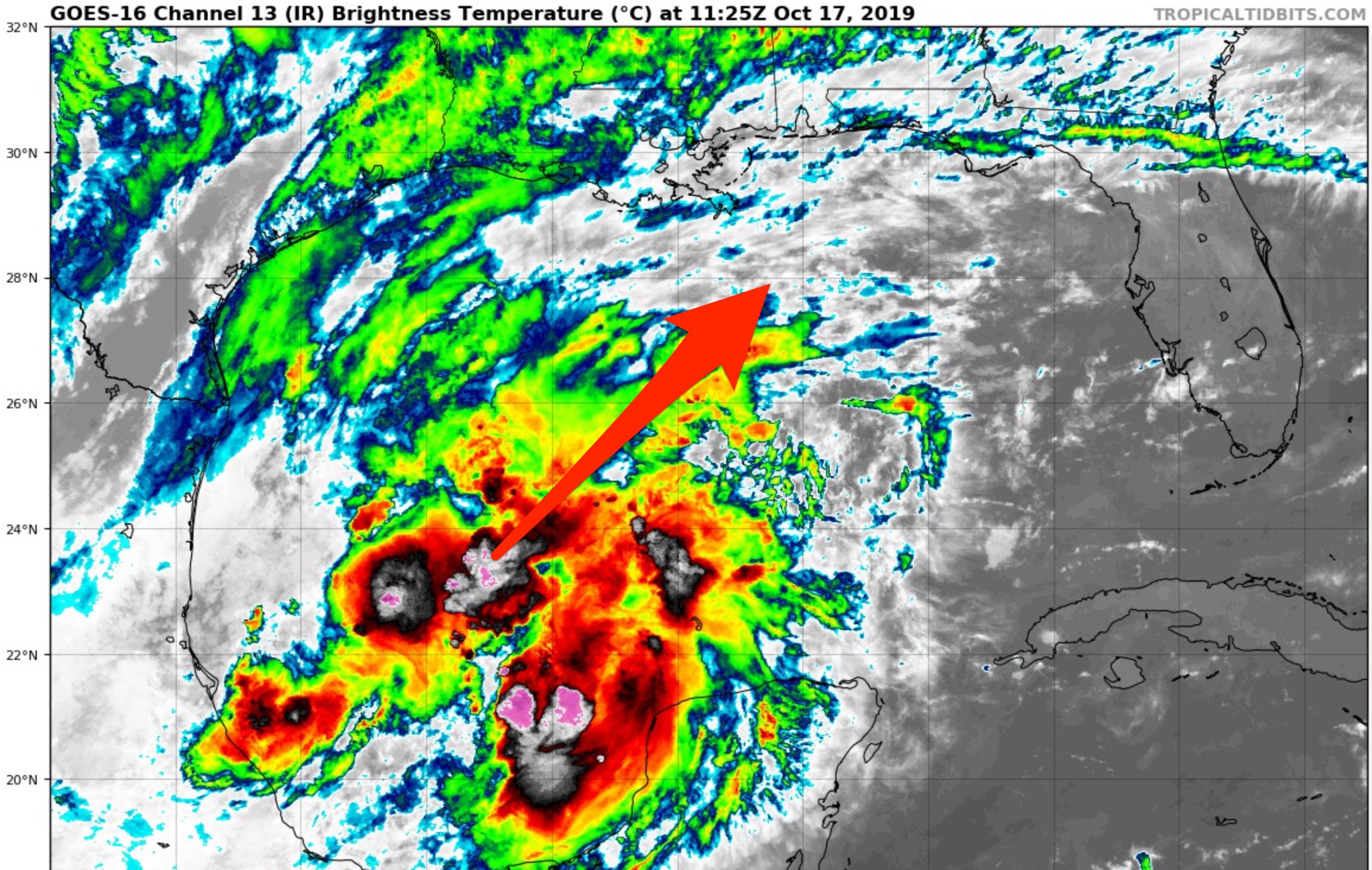
The latest guidance shows a track that keeps a decent part of Alabama on the drier, west side of the system. Most of the rain across Alabama will come over the eastern and southern counties of the state… areas north and west of Birmingham could see some light rain Saturday, but many communities there will be dry. Heaviest rain, most likely, will come over the southeast part of the state, south and east of Montgomery.
Sunday looks dry statewide as the tropical system moves back out into the Atlantic. The high Saturday will be in the upper 60s, then into the mid to upper 70s Sunday.
NEXT WEEK: A cold front will bring a round of showers and storms to Alabama late Monday and Monday night. SPC has the southern two-thirds of the state in a severe weather risk on their “Day Five” outlook…
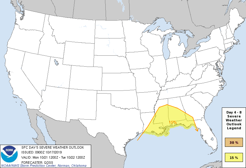
For now it looks like the main threat will come from strong straight line winds, but we need to get the tropical system out of here before we can really focus and gather details about this event.
The middle of the week looks dry and pleasant, then another cold front will bring a chance of showers and storms late in the week on Friday. See the Weather Xtreme video for maps, graphics, and more details.
FOOTBALL WEATHER: For the high school games tomorrow night, dry weather is expected over the northern half of Alabama with temperatures in the 60s. But, to the south, rain is good possibility for the southern quarter of Alabama as the tropical low approaches.
Auburn travels to Fayetteville, Arkansas to take on the Razorbacks Saturday (11:00a CT kickoff)… showers and thunderstorms are possible during the first half of the game. The kickoff temperature will be close to 64 degrees, rising into the upper 60s by the final whistle.
Alabama will host Tennessee Saturday night at Bryant-Denny Stadium in Tuscaloosa (8:00p CT kickoff)… it now looks like the bulk of the rain will remain east of Tuscaloosa, and we are now forecasting dry conditions. Temperatures will be in the mid to upper 60s. A little light rain is possible during the day, before the game.
UAB hosts Old Dominion Saturday afternoon at Legion Field in Birmingham (3:00p CT kickoff)… the sky will be mostly cloudy, and some light rain is possible during the game. Kickoff temperature will be near 70 degrees, falling back into the upper 60s by the final whistle.
Jacksonville State hosts Southeast Missouri State Saturday (3:00p CT kickoff)… the sky will be mostly cloudy; rain is possible. Temperatures will fall from near 70 at kickoff, into the upper 60s by the fourth quarter.
ON THIS DATE IN 1910: A category 4 hurricane moved north-northeast, passing just east of the Dry Tortugas. The maximum storm surge observed in Key West was 8 feet, with 15-foot waves at what is now Fort Zachary Taylor State Park.
BEACH FORECAST: Click here to see the AlabamaWx Beach Forecast Center page.
WEATHER BRAINS: Don’t forget you can listen to our weekly 90 minute show anytime on your favorite podcast app. This is the show all about weather featuring many familiar voices, including our meteorologists here at ABC 33/40.
CONNECT: You can find me on all of the major social networks…
Facebook
Twitter
Instagram
Pinterest
Snapchat: spannwx
I have a weather program this morning at Ivalee Elementary in Etowah County, and then at the Gadsden Public Library. Look for the next Weather Xtreme video here by 4:00 this afternoon. Enjoy the day!
Category: Alabama's Weather, ALL POSTS, Weather Xtreme Videos
About the Author (Author Profile)
James Spann is one of the most recognized and trusted television meteorologists in the industry. He holds the AMS CCM designation and television seals from the AMS and NWA. He is a past winner of the Broadcast Meteorologist of the Year from both professional organizations.Subscribe
If you enjoyed this article, subscribe to receive more just like it.


