Unsettled/Wet Through Tomorrow; Dry Air Returns Sunday
RADAR CHECK: A large mass of rain covers most of North and West Alabama this afternoon, north of a warm front over South Alabama. This has been a soaking rain event… here are some rain totals since midnight
Rainbow City 5.38″
Black Creek 4.64″
Moody 4.20″
Montevallo 3.18″
Weaver 2.45″
Most of the rain tonight will continue over the northern and western counties. A few severe storms can’t be ruled out over parts of West and Southwest Alabama tonight, but for most places it will be just good ole fashioned rain.
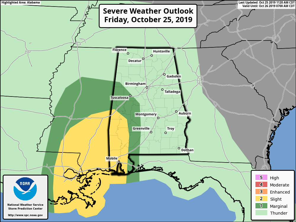
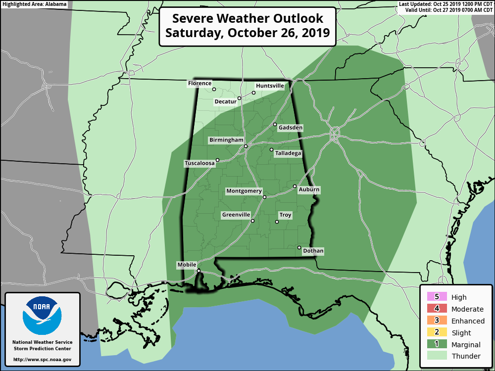
TOMORROW: The warm front will move up into far southern Tennessee, and very moist airmass will remain over Alabama. It won’t rain all day, but occasional showers and thunderstorms are likely. SPC has introduced a “marginal risk” (level 1/5) for most of the state, with the exception of the Tennessee Valley…
A few of the thunderstorms tomorrow could produce strong gusty winds, and a brief, isolated tornado or two is not totally out of the question. Additional rain amounts of around one inch are likely tomorrow, and flooding is not expected to be a major issue. The day will be rather windy with south winds averaging 10-20 mph along with higher gusts.
Showers and storms will end from west to east during the late afternoon and nighttime hours, and by midnight all of the rain will be out of the state.
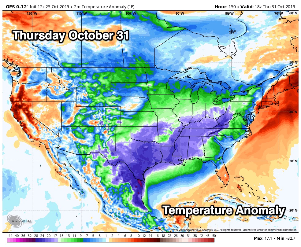
SUNDAY AND NEXT WEEK: The weather will be dry and mild Sunday through Tuesday with highs in the 70s. A cold front will bring rain back to the state Wednesday, followed by the coolest air so far this season Thursday and Friday. Some North Alabama communities could see their first freeze of the season by Friday morning… See the Weather Xtreme video for maps, graphics, and more details.
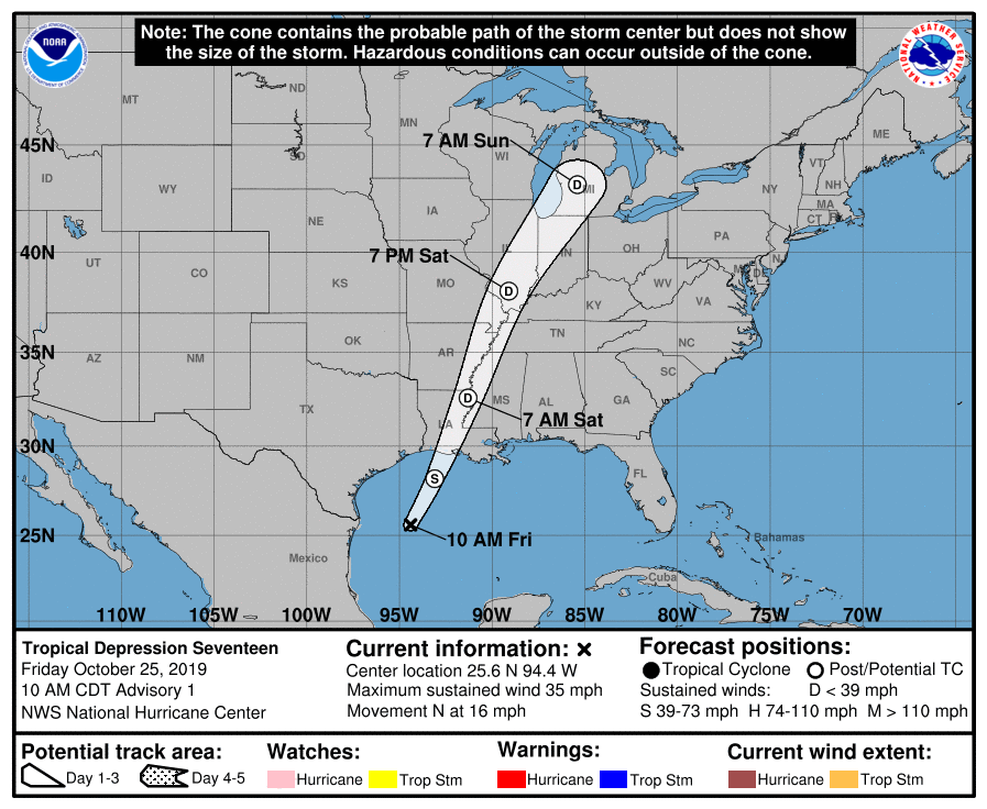
TROPICS: Tropical Depression 17, in the Gulf of Mexico, is now Tropical Storm Olga… but it will become a post-tropical system tonight as it merges with a cold front. It will still produce gale force winds tonight near the Louisiana coast. The system will enhance rain tonight and tomorrow morning over Louisiana and Mississippi.
HIGH SCHOOL FOOTBALL WEATHER: Rain is likely for high school games tonight generally north and west of Birmingham. Temperatures will be in the 60s.
MAGIC CITY CLASSIC: 2:30p CT, Legion Field Birmingham. Cloudy with occasional showers; a thunderstorm possible. But, there will be breaks in the rain. Temperatures in the low to mid 70s; gusty south winds of 12-25 mph.
AUBURN AT LSU: 2:30p CT, Baton Rouge. High confidence now that the rain will be over there early in the day. The sky becoming partly sunny during the game; temperatures around 70 degrees.
MURRAY STATE AT JACKSONVILLE STATE: 3:00p CT, Jacksonville. Cloudy, windy, occasional showers. Temperatures between 68 and 72.
ARKANSAS AT ALABAMA: 6:00p CT, Tuscaloosa. Models are now showing the cold front coming through at a faster pace, and there is a chance the rain will be over by kickoff. We will still mention the chance of lingering showers during the first quarter, but there is a very reasonable chance the game will be dry. Temperatures in the upper 60s.
BEACH FORECAST: Click here to see the AlabamaWx Beach Forecast Center page.
WEATHER BRAINS: Don’t forget you can listen to our weekly 90 minute show anytime on your favorite podcast app. This is the show all about weather featuring many familiar voices, including our meteorologists here at ABC 33/40.
CONNECT: You can find me on all of the major social networks…
Facebook
Twitter
Instagram
Pinterest
Snapchat: spannwx
Look for my next Weather Xtreme video here by 7:00 a.m. Monday… enjoy the weekend!
Category: Alabama's Weather, ALL POSTS, Weather Xtreme Videos
About the Author (Author Profile)
James Spann is one of the most recognized and trusted television meteorologists in the industry. He holds the AMS CCM designation and television seals from the AMS and NWA. He is a past winner of the Broadcast Meteorologist of the Year from both professional organizations.Subscribe
If you enjoyed this article, subscribe to receive more just like it.


