Showers/Storms Tomorrow; Much Colder Thursday
THIS AFTERNOON: Clouds cover much of Alabama this afternoon, and rain continues to fall on areas south of a line from Auburn to Montgomery to Camden. Temperatures over the northern half of the state are mostly in the upper 60s and low 70s; the average high at Birmingham on October 29 is 71.
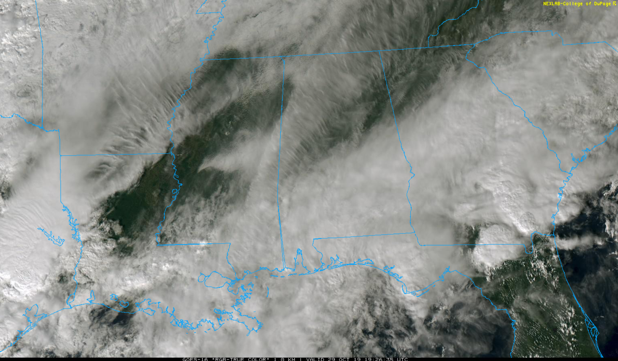
Rain will spread northward tonight, and tomorrow promises to be a fairly wet day with occasional showers and thunderstorms statewide. The latest model data suggests the air will become unstable by afternoon, and a few strong storms are possible over Northwest Alabama, where SPC has a “marginal risk” (level 1/5) defined.
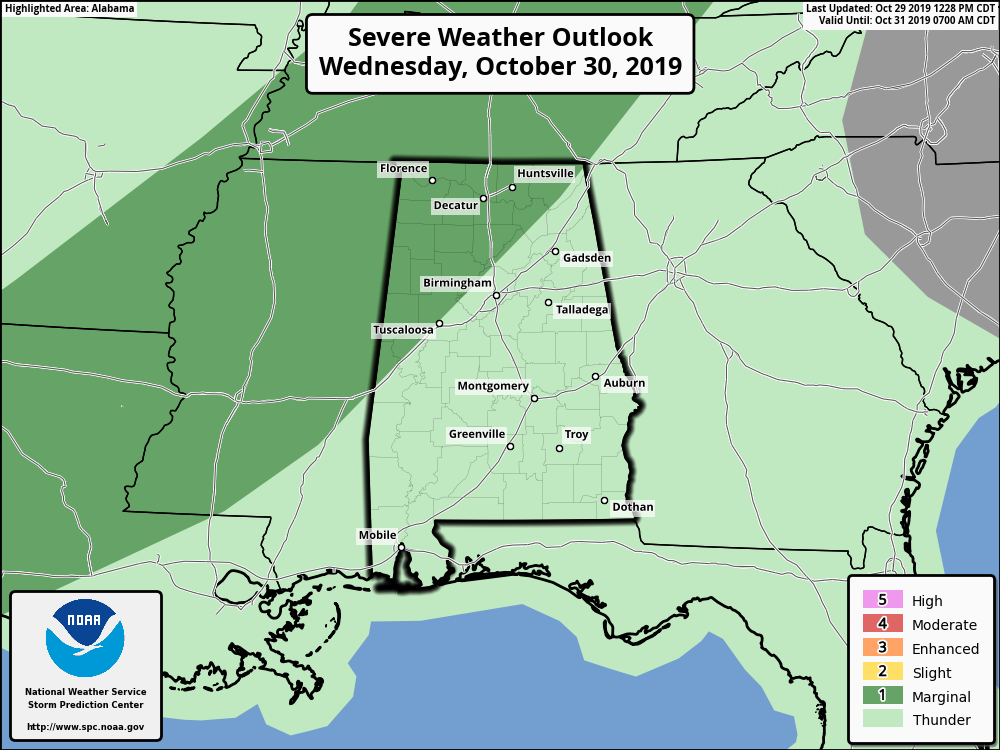
Heavier storms tomorrow afternoon could produce strong, gusty winds, and there is a low risk of an isolated tornado.
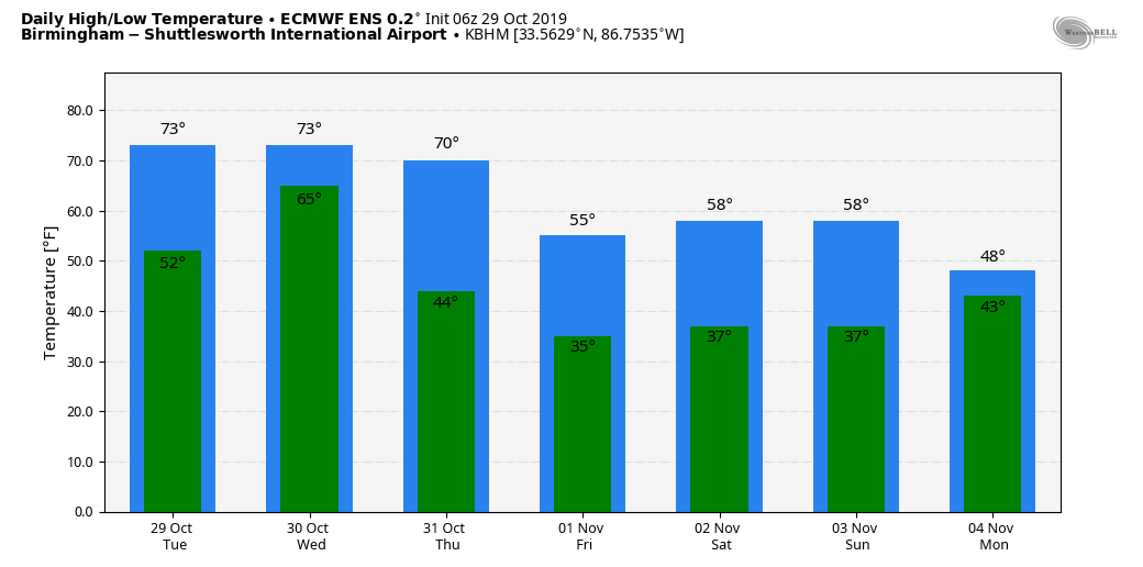
HALLOWEEN: Rain is likely Thursday morning, but the rain ends from the northwest during the afternoon hours. The good news is that the weather looks dry for trick or treaters Thursday evening. The bad news is that the weather will be brisk and cold. The coldest air so far season will blow into the state; areas from Birmingham south and east will begin the day around 70, but temperatures will fall quickly during the morning, and we will be in the 40s by afternoon with a brisk northwest wind. Some Northwest Alabama communities could wind up in the 30s during the evening hours. Little ghosts and goblins will need to bundle up!
Rain amounts between now and Thursday night will be in the 2-3 inch range over the northern half of the state, with 1-2 inches for South Alabama.
FRIDAY AND THE WEEKEND: Look for sunny cool days and clear cold nights. Highs 55-60, lows well down in the 30s. Colder pockets will see a freeze on a few mornings, and most other places will see lots of frost.
NEXT WEEK: The weather looks dry most of the week; highs return to the low 70s by mid-week. See the Weather Xtreme video for maps, graphics, and more details.
TROPICS: A disturbance in the North Atlantic could become a sub-tropical storm over the next few days, but it is far from land. The rest of the Atlantic basin is quiet.
ON THIS DATE IN 2012: “Superstorm Sandy” made landfall in New Jersey, resulting in more than 70 fatalities and approximately $50 billion in damage.
BEACH FORECAST: Click here to see the AlabamaWx Beach Forecast Center page.
WEATHER BRAINS: Don’t forget you can listen to our weekly 90 minute show anytime on your favorite podcast app. This is the show all about weather featuring many familiar voices, including our meteorologists here at ABC 33/40.
CONNECT: You can find me on all of the major social networks…
Facebook
Twitter
Instagram
Pinterest
Snapchat: spannwx
I had a great time today seeing the students at Brooks Elementary in Killen… be looking for them on the Pepsi KIDCAM today at 5:00 on ABC 33/40 News! The next Weather Xtreme video will be posted here by 7:00 a.m. tomorrow…
Category: Alabama's Weather, ALL POSTS, Weather Xtreme Videos
About the Author (Author Profile)
James Spann is one of the most recognized and trusted television meteorologists in the industry. He holds the AMS CCM designation and television seals from the AMS and NWA. He is a past winner of the Broadcast Meteorologist of the Year from both professional organizations.Subscribe
If you enjoyed this article, subscribe to receive more just like it.


