Freeze Warning Tonight For North Alabama
BLUSTERY, COLD HALLOWEEN: As advertised, the coldest air so far season is settling into Alabama this afternoon. Temperatures are mostly in the 40-45 degree range with a brisk northwest wind. Patches of lingering light rain near the Georgia border will end soon.
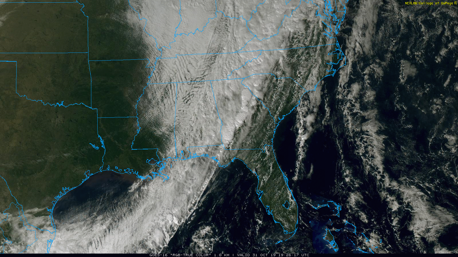
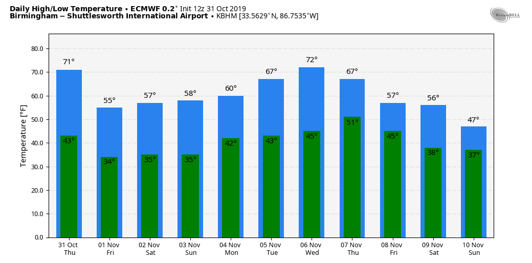
The sky will clear tonight, and freezing temperatures are likely over the northern third of the state, where the NWS maintains a freeze warning. Temperatures over North Alabama will dip into the 28-32 degree range early tomorrow morning, with mid to upper 30s for the southern counties of the state. The day tomorrow will feature sunshine in full supply with a high in the mid 50s.
THE ALABAMA WEEKEND: Mornings will stay cold and frosty; lows early Saturday and Sunday morning will be around the freezing mark with lots of frost; days will be sunny with afternoon highs in the 57-61 degree range.
NEXT WEEK: The first half of the week looks dry with a slow warming trend; the high will be close to 70 by Tuesday and Wednesday. The latest GFS hints rain returns late in the week on Friday November 8, followed by dry air for Saturday November 9. This, of course, is very much subject to change. See the Weather Xtreme video for maps, graphics, and more details.
FOOTBALL WEATHER: Clear and cold for the high school games in the state tomorrow night; temperatures will be in the 40s.
Saturday evening, Auburn hosts Ole Miss (6:00p CT kickoff)… the sky will be clear with temperatures falling from near 54 at kickoff, into the 40s by halftime.
UAB travels to Knoxville to take on the Tennessee Volunteers (6:00p CT kickoff); clear and cold weather there with 51 degrees at kickoff. Temperatures will fall through the 40s, possibly reaching the upper 30s by the final whistle.
Jacksonville State is also on the road in Tennessee, they play UT-Martin Saturday (2:00p CT kickoff)… the sky will be sunny with temperatures in the mid 50s during the game.
TIME CHANGE: Don’t forget we go back on standard time this weekend; set your clocks back one hour before you go to bed Saturday night. The sunset Sunday at Birmingham will be at 4:53p CST.
ON THIS DATE IN 1991: A severe winter storm, dubbed the Great Halloween Mega Storm, struck the upper Midwest. Minnesota bore the brunt of this storm. Blizzard conditions occurred with winds gusting frequently to 40 and 50 mph. By the time it was all over on November 2nd, Duluth recorded 37 inches, Minneapolis 28 inches, International Falls 18 inches and 11.2 inches in 24-hours at Sioux Falls, SD, their earliest heavy snowfall of 6 inches or more and snowiest October on record. For Duluth and Minneapolis, the snow amounts set new all-time records for the greatest amount of snow in a single storm. The storm gave these two cities nearly half of their average seasonal snowfall.
BEACH FORECAST: Click here to see the AlabamaWx Beach Forecast Center page.
WEATHER BRAINS: Don’t forget you can listen to our weekly 90 minute show anytime on your favorite podcast app. This is the show all about weather featuring many familiar voices, including our meteorologists here at ABC 33/40.
CONNECT: You can find me on all of the major social networks…
Facebook
Twitter
Instagram
Pinterest
Snapchat: spannwx
I had a great time today visiting with the kindergarten students at Walnut Park Elementary in Gadsden… be looking for them on the Pepsi KIDCAM today at 5:00 on ABC 33/40 News! The next Weather Xtreme video will be posted here by 7:00 a.m. tomorrow…
Category: Alabama's Weather, ALL POSTS, Weather Xtreme Videos
About the Author (Author Profile)
James Spann is one of the most recognized and trusted television meteorologists in the industry. He holds the AMS CCM designation and television seals from the AMS and NWA. He is a past winner of the Broadcast Meteorologist of the Year from both professional organizations.Subscribe
If you enjoyed this article, subscribe to receive more just like it.


