Mild Afternoon; Rain and Storms Arrive Tonight
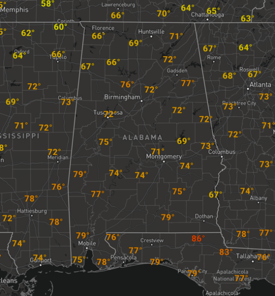
IRON BOWL FORECAST: No weather woes for the biggest game of the year in the state of Alabama this afternoon as the Alabama Crimson Tide is on the Plains of Auburn to take on the Auburn Tigers. The weather has been sunny through the morning hours, and as we approach that 2:30 PM kickoff, the weather is quite nice for the final day of November. We are seeing more sun than clouds, but clouds will be increasing through the game, but it will remain dry. Temperatures are in 70s and will hold in the 60s until after the game. Expect breezy southerly winds at times at 10-20 mph.
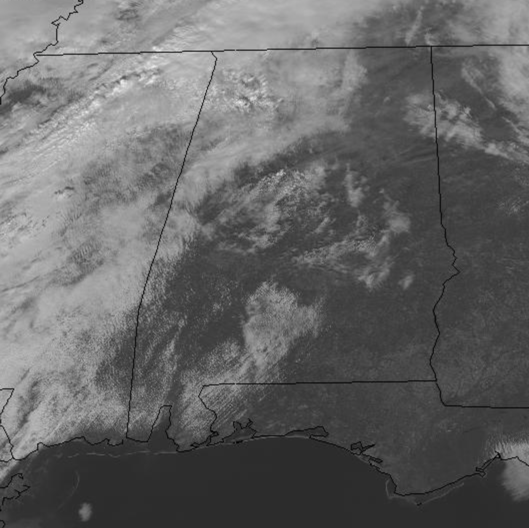
RAIN/STORMS ON THE WAY: Most of today has been pretty nice across the state, but as we head through the rest of today and into tonight clouds are increasing along with southerly breezes which have allowed temperatures to warm into the 70s this afternoon.
The cold front to our west is making its way towards the state and will bring rain and storms back to Alabama later this evening and overnight, and some of those storms could be a strong and locally severe.
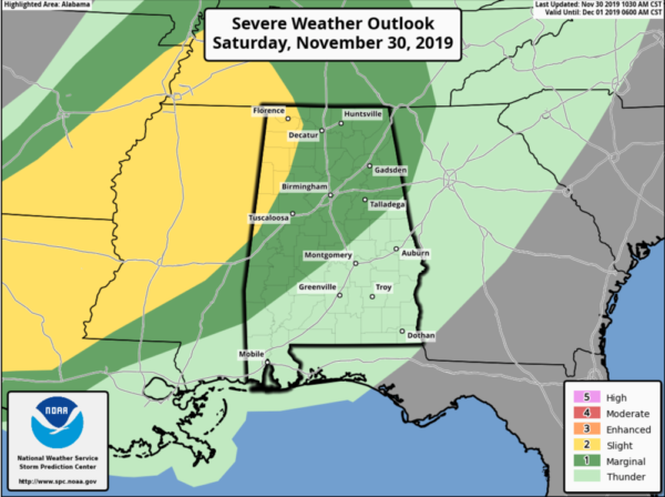
The Storm Prediction Center has a “slight risk” (level 2/5) for severe storms for the extreme west and northwestern parts of the state, roughly west of a line from Reform to Fayette to Floence, while a “marginal risk” is up for a good portion of the rest of Central Alabama north and west of a line from Grove Hill to Selma to Rockford to Wedowee, including Tuscaloosa, Birmingham, Anniston, Gadsden, Cullman, and Huntsville.
Rain and storms will move into western portions of the state by 6-7PM, then pushing east and south through the state between 7PM and midnight through Central Alabama, finally pushing south and east towards Alex City, Montgomery, and Auburn after midnight with all storms out of the state by sunrise tomorrow. The main threat with any of the stronger storms will be damaging winds up to 60 MPH, with a few brief tornadoes possible. The rain and storms will be moving through the state rapidly, and rain amounts with this system will be less than one inch in most locations so we are not expecting any flooding issues.
This is not a classic spring-time severe weather setup, so we are not expecting organized, widespread severe weather. But, this is a more typical cool season set-up with ample dynamics and wind shear with only marginal instability, which will be more than sufficient for strong storms in Alabama. Of course, with any severe weather threat coming through the state during the overnight hours, you want to make sure you have multiple ways to receive warnings especially one that will wake you up in case a warning is issued for your location while you are asleep. Go ahead and have those safety kits and place of safety ready. Keep those batteries charged in those smartphones and have fresh ones in your flashlights and in your NOAA WeatherRadio.
SUNNY SUNDAY: The rain and storms will be out of the state by tomorrow morning and drier air will flow into the state tomorrow. Tomorrow should feature a clearing sky and cooler temps with highs in the 50s and lower 60s. It will be breezy at times as well, and by tomorrow night, the clear sky will allow for temperatures to drop into the 30s by first thing Monday morning.
BEACH FORECAST CENTER: Get the latest weather and rip current forecasts for the beaches from Fort Morgan to Panama City on our Beach Forecast Center page. There, you can select the forecast of the region that you are interested in visiting.
WORLD TEMPERATURE EXTREMES: Over the last 24 hours, the highest observation outside the U.S. was 124.2F at Vioolsdrif, South Africa. The lowest observation was -56.9F at Delyankir, Russia.
CONTIGUOUS TEMPERATURE EXTREMES: Over the last 24 hours, the highest observation was 91F at Rio Grande Village, TX. The lowest observation was -13F at Mammoth Lakes, CA.
WEATHER ON THIS DATE IN 1976: MacLeod Harbor, AK, reported a precipitation total for November of 70.99 inches, which established a state record for any month of the year.
Category: Alabama's Weather, ALL POSTS
About the Author (Author Profile)
Macon, Georgia Television Chief Meteorologist, Birmingham native, and long time Contributor on AlabamaWX. Stormchaser. I did not choose Weather, it chose Me. College Football Fanatic. @Ryan_StinnetSubscribe
If you enjoyed this article, subscribe to receive more just like it.


