Rain Returns Friday; Slow Warming Trend Ahead
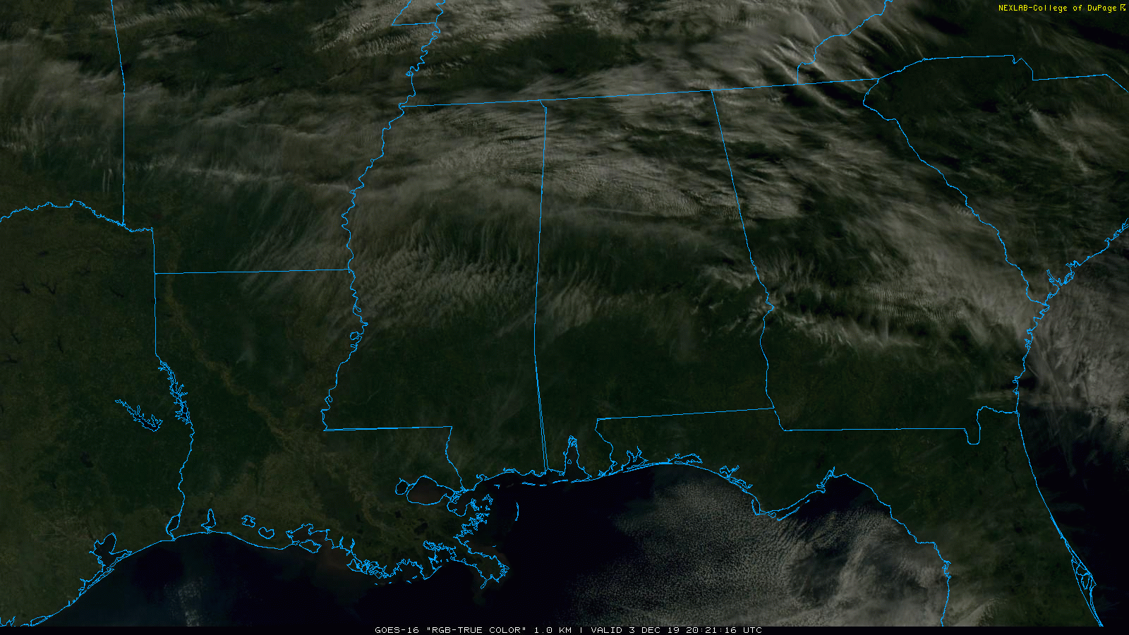
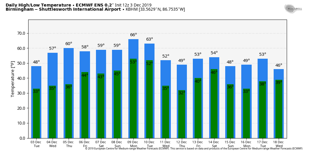
COOL, DRY DAY: We have some high cirrus clouds over North Alabama this afternoon, otherwise we are enjoying a good supply of sunshine with temperatures in the 47-52 degree range for most places. Tonight will be fair and cold with a low between 30 and 38 early tomorrow. Then, we stay dry tomorrow and Thursday with a partly to mostly sunny sky; we rise to near 60 degrees tomorrow, followed by low 60s Thursday. Clouds will increase Friday ahead of a wave approaching from the west.
FRIDAY AND THE WEEKEND: Friday will be a cloudy, cool day with periods of rain. It won’t rain all day, and we expect amounts generally under 1/2 inch. With a stable airmass, there is no risk of severe storms, and we probably won’t have much thunder. The rain will end Friday evening from west to east.
THE ALABAMA WEEKEND: Saturday will be a dry, pleasant day… the sky partly sunny with a high in the low 60s. Moisture will increase Sunday, and a few afternoon showers are possible, but for now it looks like rain won’t be really widespread or heavy. The high Sunday will remain in the 60-64 degree range.
NEXT WEEK: Showers are possible Monday, but rain will be more widespread Monday night and Tuesday morning as a cold front passes through the state. We rise into the upper 60s Monday, but Tuesday will be colder with a high in the 48-54 degree range. For now the rest of the week looks dry with cool days and cold nights… See the Weather Xtreme video for maps, graphics, and more details.
RAIN UPDATE: Birmingham’s rain total since January 1 is 47.70″; the deficiency for the year is 1.90″. Other totals and departures from average include…
Mobile 59.38″ (-2.03″)
Tuscaloosa 56.26″ (+7.90″)
Huntsville 53.93″ (+4.97″)
Anniston 49.71″ (+3.85″)
Montgomery 41.55″ (-7.00″)
ON THIS DATE IN 1983: The 1983 Iron Bowl game is one of the greatest in the history of the rivalry. It was played at Legion Field on December 3rd. The game started in beautiful warm sunshine after a stormy night of very heavy rains that caused severe flooding in the Birmingham area. 9.22 inches of rain fell at the National Weather Service Forecast Office, which was on Oxmoor Road at the time. IF the amount had been recorded at the Airport, it would have stood as the all-time 24 hour rainfall record for the city (until Hurricane Ivan).
In the second half, a line of severe thunderstorms was approaching western Jefferson County and a tornado warning was issued. The radar at Centreville showed a well defined hook echo heading directly toward the stadium. Legion Field Public Address announcer Simpson Pepper read the warning over the loudspeakers but the game was not stopped. By ten minutes to go in the game, the rain was coming down in torrents as Auburn tried to control the ball and win the game in the horrible conditions as they clung to a 23-20 lead. The rain began to fall so heavily that you could barely see the field on the cameras.

BEACH FORECAST: Click here to see the AlabamaWx Beach Forecast Center page.
WEATHER BRAINS: Don’t forget you can listen to our weekly 90 minute show anytime on your favorite podcast app. This is the show all about weather featuring many familiar voices, including our meteorologists here at ABC 33/40.
CONNECT: You can find me on all of the major social networks…
Facebook
Twitter
Instagram
Pinterest
Snapchat: spannwx
I had a great time today visiting with 4th graders at Oak Mountain Intermediate School… be looking for them on the Pepsi KIDCAM today at 5:00 on ABC 33/40 News! The next Weather Xtreme video will be posted here by 7:00 a.m. tomorrow…
Category: Alabama's Weather, ALL POSTS, Weather Xtreme Videos
About the Author (Author Profile)
James Spann is one of the most recognized and trusted television meteorologists in the industry. He holds the AMS CCM designation and television seals from the AMS and NWA. He is a past winner of the Broadcast Meteorologist of the Year from both professional organizations.Subscribe
If you enjoyed this article, subscribe to receive more just like it.


