

Periods Of Rain Today; Some Thunder
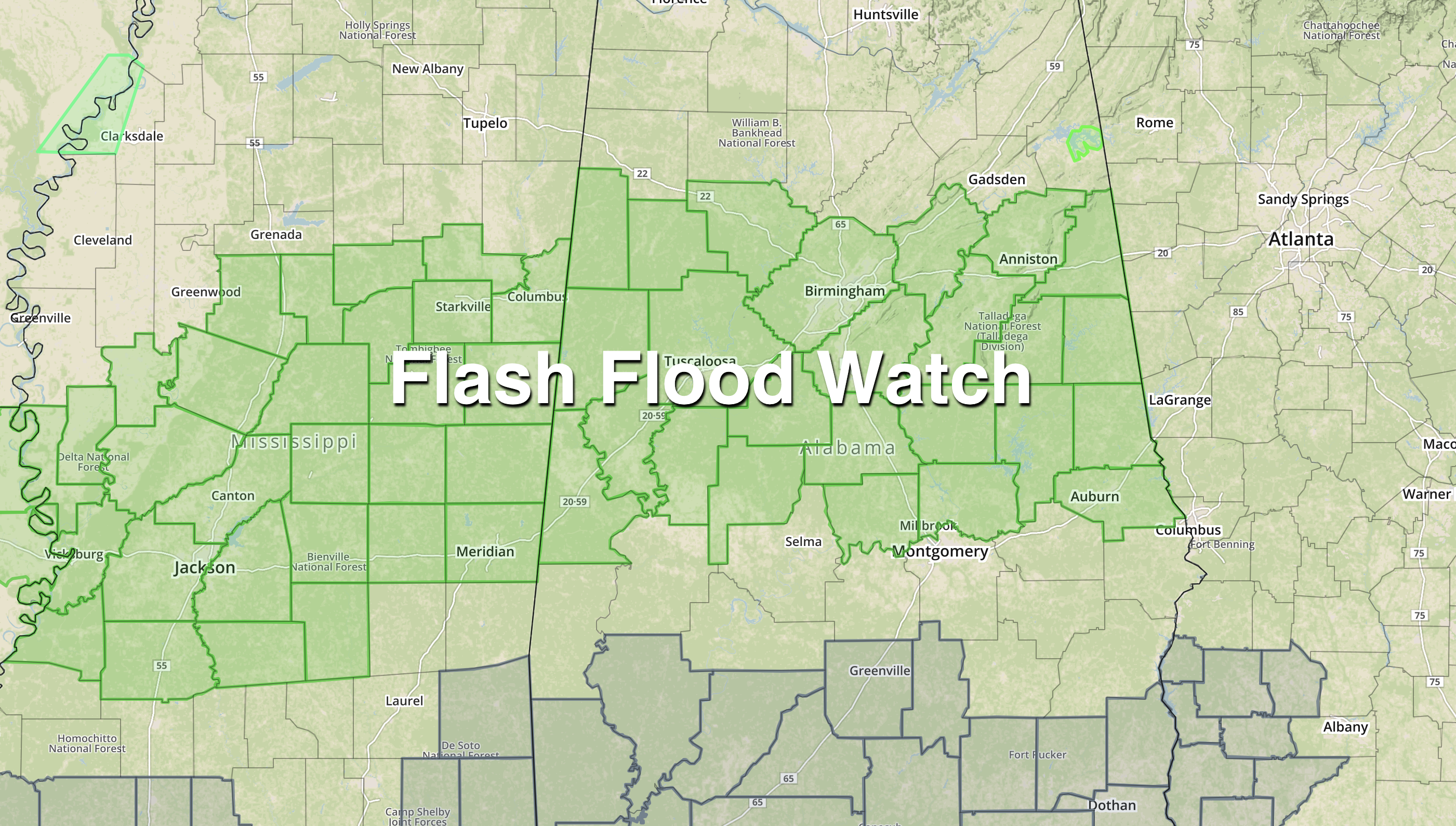
WET AGAIN: Birmingham’s rain total for the month of February is 9.20″, and we should go above 10 inches by tomorrow morning as rain returns to the state. Look for a cloudy, mild day today with periods of rain and a few thunderstorms. A flash flood watch is in effect for much of Central Alabama due to the saturated soil conditions.
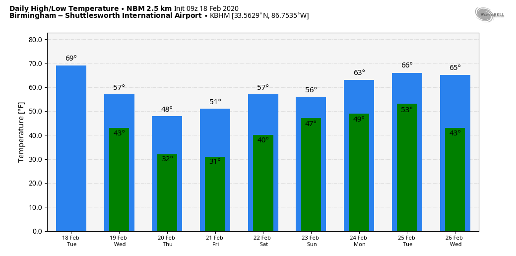
On the positive side, no severe thunderstorms are expected through tonight, although temperatures will reach the 65-70 degree range this afternoon. Rain continues tonight, but it will taper off early tomorrow morning as a surface front pushes into South Alabama. A decent part of the day tomorrow will be dry; the sky will be mostly cloudy with a high back in the 50s.
Then, a wave of low pressure moves along the stalled front, and rain becomes widespread again on Thursday. This will be a cold rain with temperatures holding in the 40s over the northern half of the state. There is actually some risk of a few patches of snow or sleet over far North Alabama early Thursday morning as the precipitation begins; if that happens for now we are not expecting any impact with surface temperatures above freezing.
Rain will end from west to east Thursday evening as dry air pushes into the state. Rain amounts between now and Thursday night will be in the 2-3 inch range for much of North/Central Alabama.
FRIDAY AND THE WEEKEND: Friday and Saturday will be dry with cold mornings; early morning lows will be in the 28-32 degree range. With sunshine in full supply, the high Friday will be close to 50, followed by upper 50s Saturday. Clouds will increase Sunday, and rain returns to the state Sunday night.
NEXT WEEK: Rain will end Monday morning, but more rain is likely by Wednesday as the active pattern continues. See the Weather Xtreme video for maps, graphics, and more details.
RIVER FLOODING: The Tombigbee River at Demopolis is at 85.2 feet early morning… flood state there is 68 feet. Levels will slowly begin to fall after today as the crest moves downstream.
ON THIS DATE IN 1992: A thunderstorm spawned an unusually strong F4 tornado for so far north for the time of the year in southern Van Wert County in Ohio. The tornado touched down just west of US Route 127 and traveled northeastward for about 3 miles. One house was completely leveled, and nine others experienced severe damage. Six people were injured.
BEACH FORECAST: Click here to see the AlabamaWx Beach Forecast Center page.
WEATHER BRAINS: Don’t forget you can listen to our weekly 90 minute show anytime on your favorite podcast app. This is the show all about weather featuring many familiar voices, including our meteorologists here at ABC 33/40.
CONNECT: You can find me on all of the major social networks…
Facebook
Twitter
Instagram
Pinterest
Snapchat: spannwx
I have weather programs today at Moon Lake Elementary in Mentone, and Alexandria Elementary in Calhoun County… look for the next Weather Xtreme video here by 4:00 this afternoon. Enjoy the day!
Category: Alabama's Weather, ALL POSTS, Weather Xtreme Videos
About the Author (Author Profile)
James Spann is one of the most recognized and trusted television meteorologists in the industry. He holds the AMS CCM designation and television seals from the AMS and NWA. He is a past winner of the Broadcast Meteorologist of the Year from both professional organizations.Subscribe
If you enjoyed this article, subscribe to receive more just like it.


