Showers Remain Few And Far Between Through Tomorrow
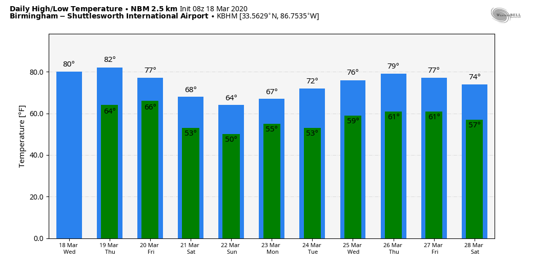
CALM PATTERN THROUGH TOMORROW: Not much change in the Alabama weather situation over the next 48 hours. While showers are certainly possible today and tomorrow, they should be very widely scattered. Otherwise, look for a mix of sun and clouds both days with a high between 77 and 80 today, followed by low 80s tomorrow. The average high for Birmingham on March 18 is 67.
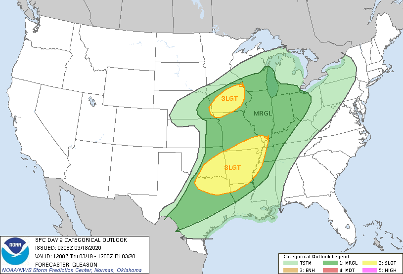
To the west, severe storms are likely tomorrow over states like Arkansas, where SPC maintains the standard “slight risk” (level 2/5) of severe thunderstorms…
FRIDAY AND THE WEEKEND: Rain becomes likely statewide Friday ahead of a cold front. The good news is that we don’t expect any severe thunderstorms in our state as the main dynamic support lifts well to the north. Rain amounts of 1/2 to 1 inch are likely, with the main window for rain coming from noon Friday through midnight Friday night. Then, on Saturday, the front pushes all the way down to the Gulf Coast. Cooler, drier air pushes into the northern 2/3 of the state; the sky becomes partly sunny with a high in the mid 60s. Any showers Saturday should be confined to the Gulf Coast, and even there it won’t rain too much.
Clouds will increase Saturday night, and rain becomes likely statewide Sunday as the front pushes northward as a warm front. The high Sunday will be in the 60s for the northern half of the state, with 70s for South Alabama.
NEXT WEEK: The first half of the week looks pretty calm with only isolated showers; the high Monday will be around 70, and by Wednesday the high will be near 80 degrees. A few scattered showers are possible over the latter half of the week, but again we see no signs of any severe thunderstorm or flooding issues for Alabama for the next 7-10 days. See the Weather Xtreme video for maps, graphics, and more details.
ON THIS DATE IN 1925: The great “Tri-State Tornado” occurred, the deadliest tornado in U.S. history. The storm claimed 695 lives (including 234 at Murphysboro, IL, and 148 at West Frankfort, IL), and caused seventeen million dollars property damage. It cut a swath of destruction 219 miles long and as much as a mile wide from east-central Missouri to southern Indiana between 1 PM and 4 PM. The tornado leveled a school in West Frankfort, Illinois, and picked up sixteen students setting them down unharmed 150 yards away. Seven other tornadoes claimed an additional 97 lives that day.
BEACH FORECAST: Click here to see the AlabamaWx Beach Forecast Center page.
WEATHER BRAINS: Don’t forget you can listen to our weekly 90 minute show anytime on your favorite podcast app. This is the show all about weather featuring many familiar voices, including our meteorologists here at ABC 33/40.
CONNECT: You can find me on all of the major social networks…
Facebook
Twitter
Instagram
Pinterest
Snapchat: spannwx
Look for the next Weather Xtreme video here by 4:00 this afternoon… enjoy the day!
Category: Alabama's Weather, ALL POSTS, Weather Xtreme Videos
About the Author (Author Profile)
James Spann is one of the most recognized and trusted television meteorologists in the industry. He holds the AMS CCM designation and television seals from the AMS and NWA. He is a past winner of the Broadcast Meteorologist of the Year from both professional organizations.Subscribe
If you enjoyed this article, subscribe to receive more just like it.


