Summer Preview Continues Through Saturday
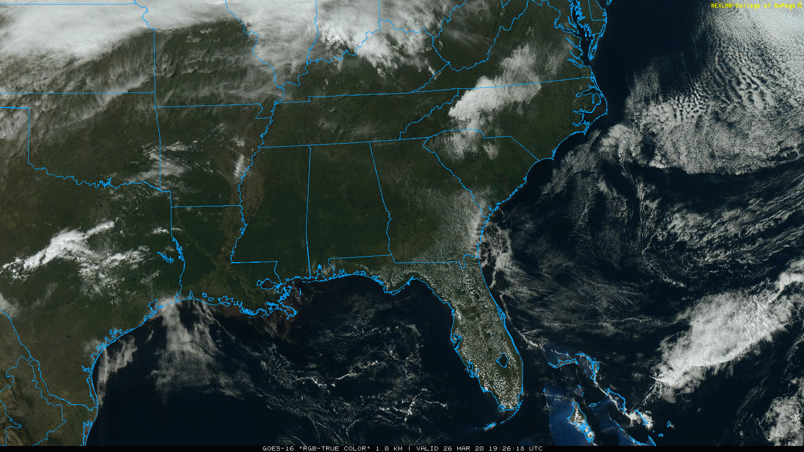
SUNNY, WARM AFTERNOON: Temperatures are mostly in the 78-85 degree range across Alabama this afternoon with a clear sky. No records so far, but maximum temperatures are reached around 4-5 p.m. this time of the year (I am writing this around 3:00). The average high for Birmingham on March 26 is 69. Tonight will be clear with a low in the 60s.
TOMORROW THROUGH THE WEEKEND: Not much change tomorrow; a partly sunny sky with afternoon temperatures near record levels. We project highs between 84 and 88 degrees for most communities, a good 15 degrees above average. Here are record highs for tomorrow (March 27)…
Birmingham 89 (1919)
Montgomery 89 (1910)
Tuscaloosa 85 (2012)
Anniston 84 (1994)
The day Saturday will be warm and mostly dry, any showers will be few and far between. And, once again, we will be flirting with record highs. Then, a band of showers and thunderstorms will move into the state Saturday night ahead of a cold front. SPC has defined a low end, “marginal risk” of severe thunderstorms for the northwest corner of the state, where gusty winds will be possible as the line approaches.
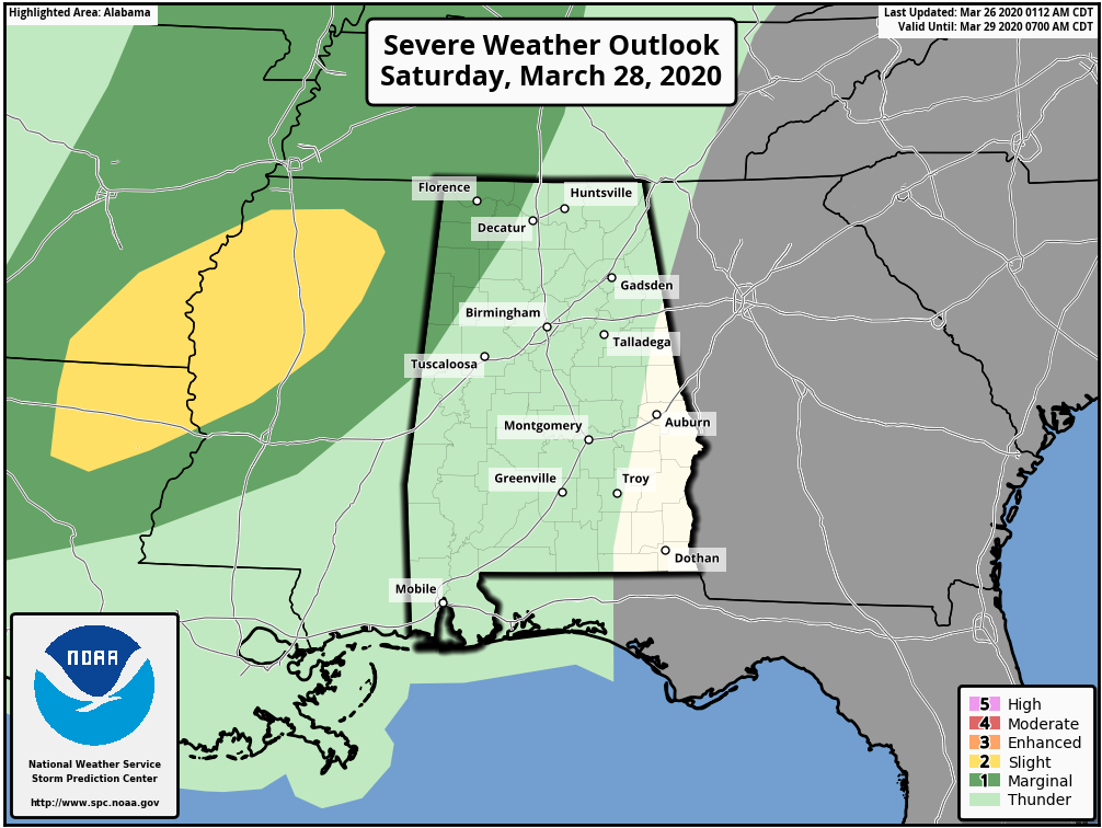
The storms should be weakening as they move into the state, and with the main dynamic support passing far to the north, severe storms are not expected over the rest of the state. Then, on Sunday, the sky becomes partly sunny as cooler, drier air moves in. Sunday’s high will be in the 69-73 degree range.
NEXT WEEK: Monday will be dry and mild, but a fast moving weather system will bring a chance of showers and thunderstorms to the state Tuesday. Too early to determined if severe storms will be an issue… then the rest of the week looks dry with seasonal temperatures. See the Weather Xtreme video for maps, graphics, and more details.
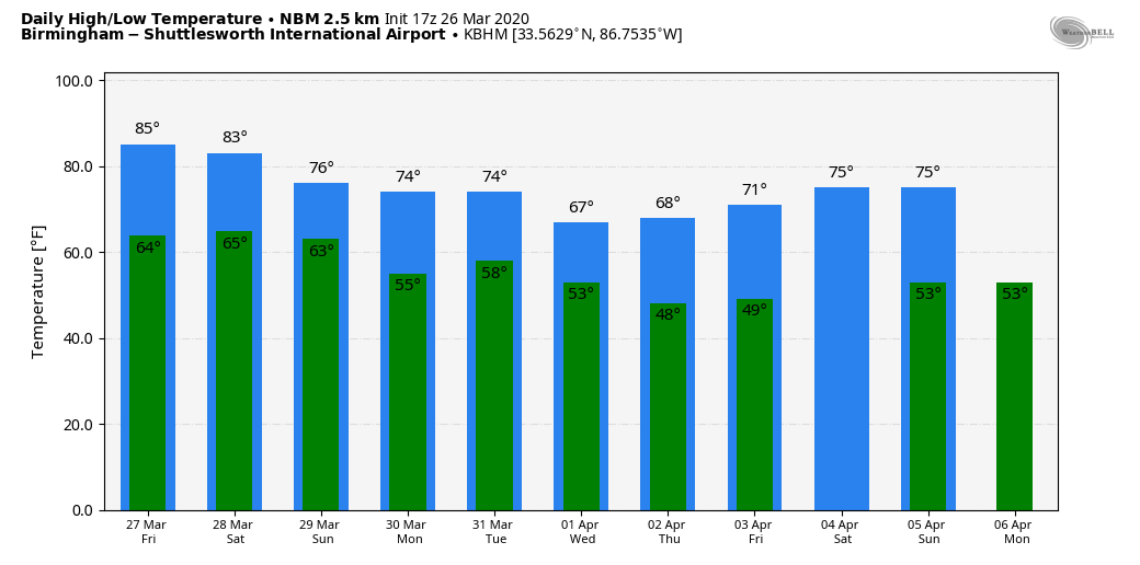
LAST FREEZE? Alabama’s weather will be very warm over the next few days, but a reminder we almost always have a late season freeze during the first half of April. The latest freeze on record at Birmingham came on April 23, 1986, when the low was 30. The coldest April temperature on record at Birmingham is 26, measured on April 11, 1973. We should also mention Birmingham received 5 inches of snow on April 3, 1987. Latest guidance from CPC suggests below average temperatures April 2-8. Every year I advise waiting until April 15 to plant anything that might be harmed by a freeze.
ON THIS DATE IN 2009: An EF-0 tornado moved through Alabaster in Shelby County. It touched down briefly near the intersection of Kent Dairy Rd. and County Road 17 just north of Maylene, causing sporadic damage as the storm moved to the east. The end of the damage path is on the east side of Interstate 65 near exit 238. Numerous trees were snapped and uprooted and three homes were damaged along the path from trees falling on them. An EF-1 tornado moved through parts of Lamar and Fayette counties the same day.
BEACH FORECAST: Click here to see the AlabamaWx Beach Forecast Center page.
WEATHER BRAINS: Don’t forget you can listen to our weekly 90 minute show anytime on your favorite podcast app. This is the show all about weather featuring many familiar voices, including our meteorologists here at ABC 33/40.
CONNECT: You can find me on all of the major social networks…
Facebook
Twitter
Instagram
Pinterest
Snapchat: spannwx
Look for the next Weather Xtreme video here by 7:00 a.m. tomorrow…
Category: Alabama's Weather, ALL POSTS, Weather Xtreme Videos
About the Author (Author Profile)
James Spann is one of the most recognized and trusted television meteorologists in the industry. He holds the AMS CCM designation and television seals from the AMS and NWA. He is a past winner of the Broadcast Meteorologist of the Year from both professional organizations.Subscribe
If you enjoyed this article, subscribe to receive more just like it.


