Showers Tomorrow; More Cool Air For The Weekend
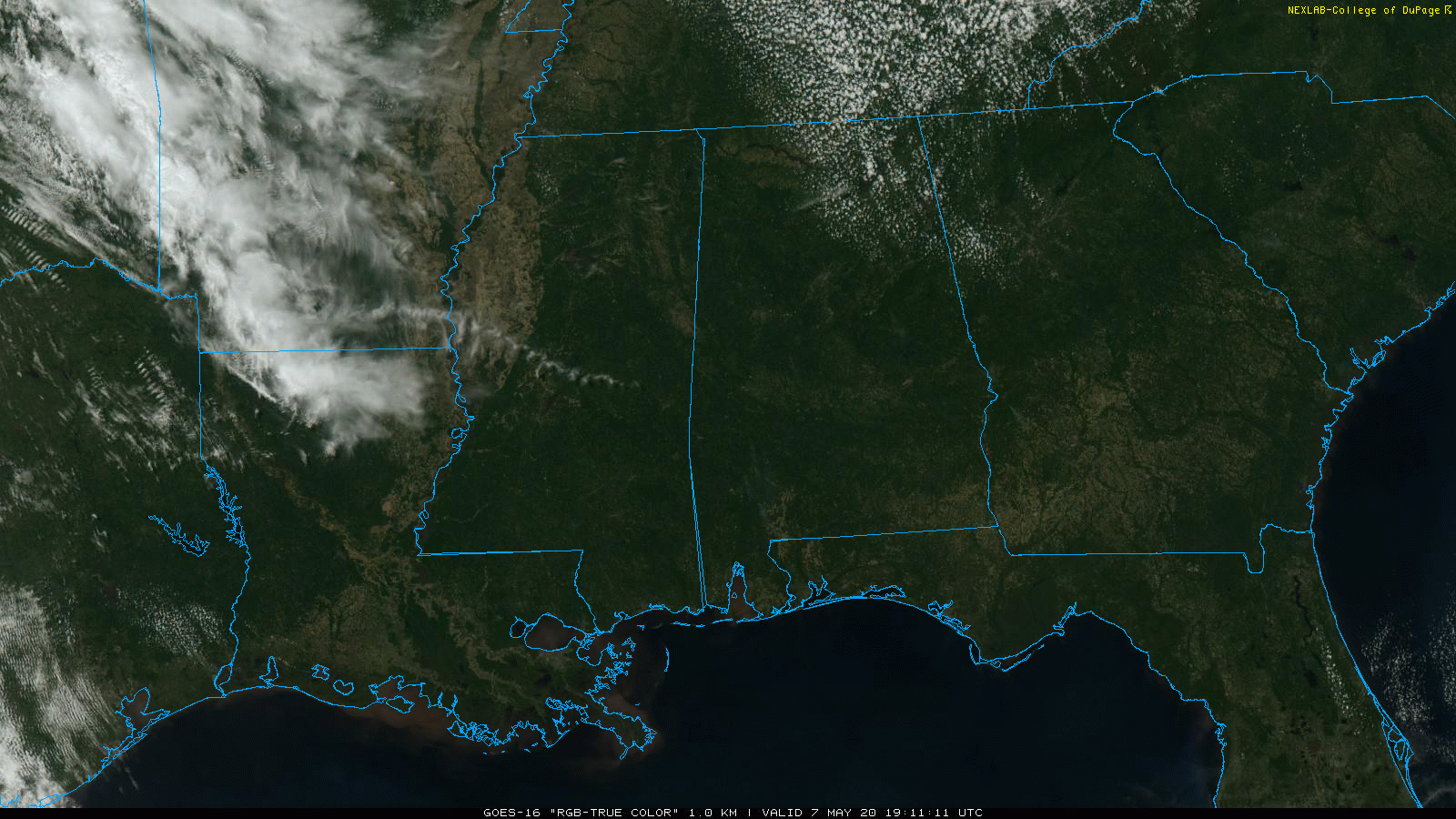
BLUE SKY: Temperatures have recovered nicely from the chilly start today; we are seeing readings mostly in the 68-72 degree range with a bright sunny sky. Clouds will increase tonight, however, ahead of the next approaching cold front.
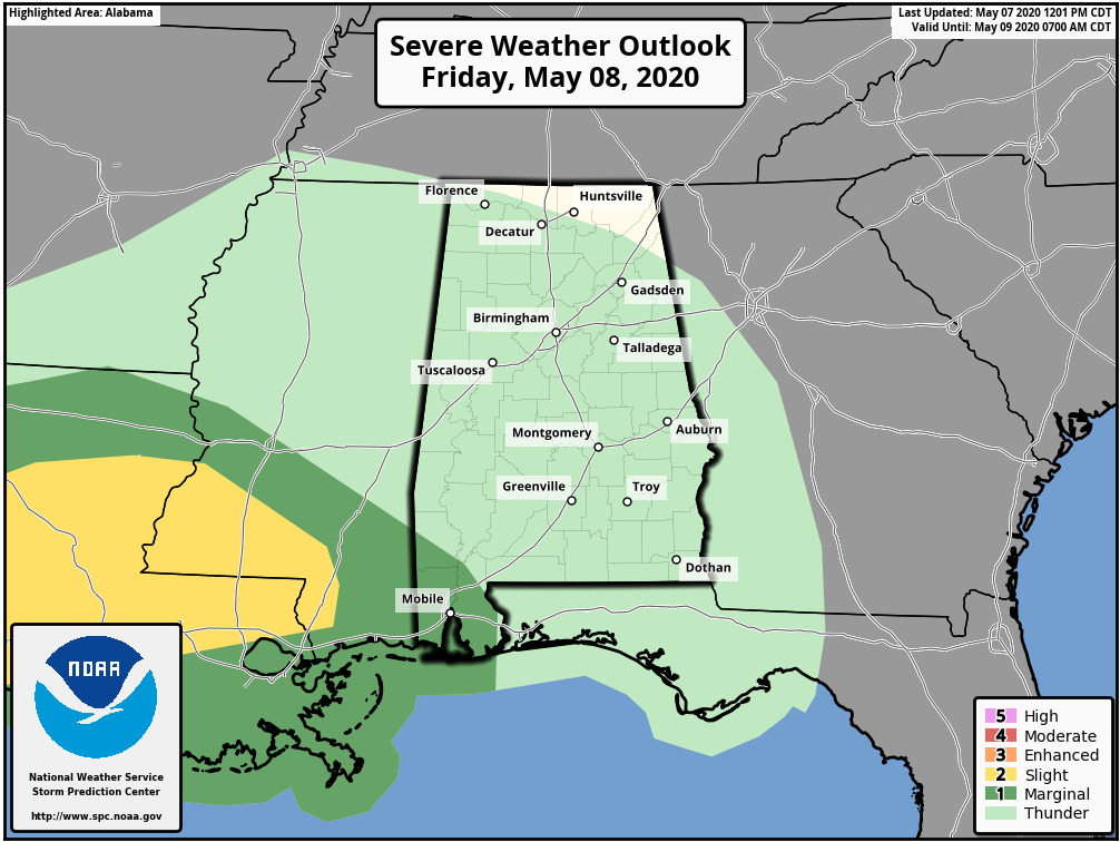
Look for occasional showers tomorrow with the front; rain amounts should be light, under 1/4 inch for most places. And, while there could be a rumble of thunder, there is no risk of severe storms over the northern half of the state. SPC does define a low end, “marginal risk” (level 1/5) of severe storms tomorrow for the southwest corner of Alabama, including Washington, Mobile, and Baldwin counties. A few storms there could produce gusty winds or small hail. Temperatures won’t get out of the 60s across North/Central Alabama tomorrow because of clouds and showers.
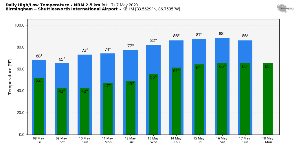
THE ALABAMA WEEKEND: Another surge of unseasonably cool air will roll into Alabama tomorrow night. We project lows over the weekend in the 36-44 degree range both Saturday and Sunday morning. The best chance of scattered front for colder spots will come early Sunday when the wind will be near calm. Dry air means a good supply of sunshine both days; the high Saturday will be in the mid-60s, followed by mid-70s Sunday.
NEXT WEEK: We expect one more temperature dip Monday as highs drop back into the 60s, then we rise into the 70s Tuesday and Wednesday, and 80s Thursday and Friday. For now the week looks rain-free… See the Weather Xtreme video for maps, graphics, and more details.
THIS MORNING: Here are low temperatures across Alabama this morning… more like February as opposed to May.
Black Creek 33 (with frost)
Valley Head 34
Cullman 35
Gadsden 37
Hueytown 37
Cottondale 37
Pell City 37
Grayson Valley 38
West Blocton 38
Bessemer 39
Anniston 39
Huntsville 39
Selma 39
Arley 40
Birmingham 41
Muscle Shoals 42
Tuscaloosa 42
Montgomery 43 (tied the record low for the May 7, last set in 1943 and 1898)
Mobile 50
ON THIS DATE IN 1840: A powerful tornado wrecked many boats at the Natchez Landing in Mississippi then plowed through the city on the bluff. The tornado killed 317 people and injured 109 others. The storm is currently the second deadliest tornado on record. The actual death toll could be higher as slaves were not counted.
BEACH FORECAST: Click here to see the AlabamaWx Beach Forecast Center page.
WEATHER BRAINS: Don’t forget you can listen to our weekly 90 minute show anytime on your favorite podcast app. This is the show all about weather featuring many familiar voices, including our meteorologists here at ABC 33/40.
CONNECT: You can find me on all of the major social networks…
Facebook
Twitter
Instagram
Pinterest
Snapchat: spannwx
Look for the next Weather Xtreme video here by 7:00 a.m. tomorrow…
Category: Alabama's Weather, ALL POSTS, Weather Xtreme Videos
About the Author (Author Profile)
James Spann is one of the most recognized and trusted television meteorologists in the industry. He holds the AMS CCM designation and television seals from the AMS and NWA. He is a past winner of the Broadcast Meteorologist of the Year from both professional organizations.Subscribe
If you enjoyed this article, subscribe to receive more just like it.


