

Warming Trend Ahead; Generally Dry Pattern
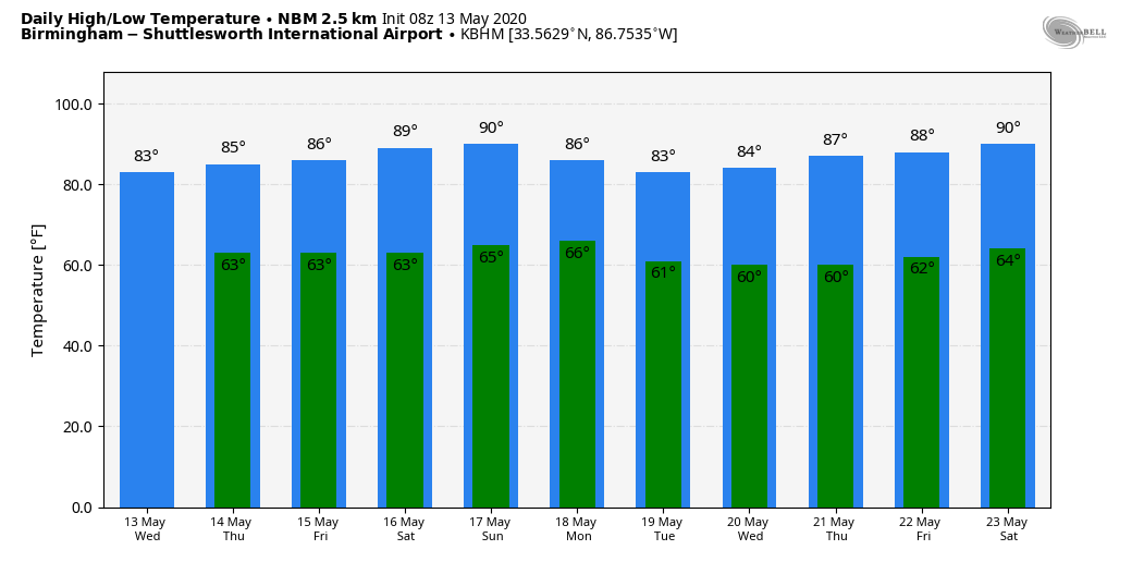
RADAR CHECK: We do note some light rain falling early this morning over far North Alabama, but most of the state is rain-free with temperatures generally in the 50s and low 50s. Expect a partly sunny sky today with a high in the low 80s; the average high for May 13 at Birmingham is 81. Any afternoon showers will be few and far between.
REST OF THE WEEK AND THE WEEKEND: No real change. An upper ridge continues to build across the Gulf Coast region, pushing highs into the 80s. Humidity levels will be rising, and while a few isolated showers could pop up each day, odds of any one spot getting wet will be in the 10-20 percent range. Partly sunny days, mostly fair nights. Most of the rain and storms will be on the periphery of the upper ridge well to the west and north of Alabama.
NEXT WEEK: Not much change. The ridge stays in place, keeping a very warm and mostly dry pattern in place. Expect highs mostly in the upper 80s, although a few spots could reach 90 degrees for the first time this year. Showers will remain few and far between… I think it is safe to say you can stick a fork in the spring severe weather season for “Dixie Alley”… the action has shifted to the Great Plains. See the Weather Xtreme video for maps, graphics, and more details.
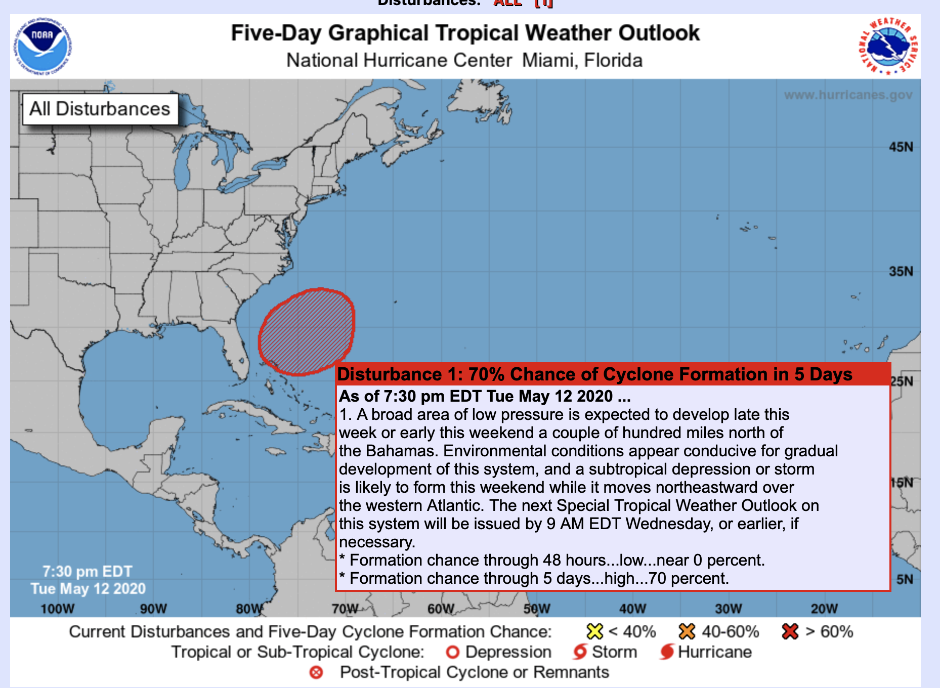
TROPICS: The National Hurricane Center is expecting a subtropical storm to develop off the U.S. East Coast late this weekend or early next week; it gives a 70 percent chance of development. The system will move northeast, and will remain offshore, but it could bring rough surf and rip current danger to parts of the Atlantic coast.
ON THIS DATE IN 1995: This outbreak produced tornadoes extending from the Mississippi River near Burlington, Iowa, to the west of Bloomington, Illinois. Two violent tornadoes, each ranked at F4 intensity, were reported. The first tornado traveled 60 miles from near Fort Madison, Iowa, to the southeast of Galesburg, Illinois producing over $10 million damage. The town of Raritan, Illinois was hit the hardest. The second violent tornado traveled 7 miles across Fulton County from Ipava to Lewistown, Illinois producing $6 million damage.
BEACH FORECAST: Click here to see the AlabamaWx Beach Forecast Center page.
WEATHER BRAINS: Don’t forget you can listen to our weekly 90 minute show anytime on your favorite podcast app. This is the show all about weather featuring many familiar voices, including our meteorologists here at ABC 33/40.
CONNECT: You can find me on all of the major social networks…
Facebook
Twitter
Instagram
Pinterest
Snapchat: spannwx
Look for the next Weather Xtreme video here by 4:00 this afternoon… enjoy the day!
Category: Alabama's Weather, ALL POSTS, Weather Xtreme Videos
About the Author (Author Profile)
James Spann is one of the most recognized and trusted television meteorologists in the industry. He holds the AMS CCM designation and television seals from the AMS and NWA. He is a past winner of the Broadcast Meteorologist of the Year from both professional organizations.Subscribe
If you enjoyed this article, subscribe to receive more just like it.


