

Scattered Storms Through Tomorrow; Then A Dry Weekend
WATCHING THE RADAR: Scattered thunderstorms will likely develop across Alabama over the next 4 hours in a moist, unstable environment over Alabama, and ahead of an upper low over Arkansas. Where storms do form, they could be strong with potential for small hail and strong winds; SPC has all of Alabama in a low end, “marginal risk” (level 1/5) of severe weather through tonight.
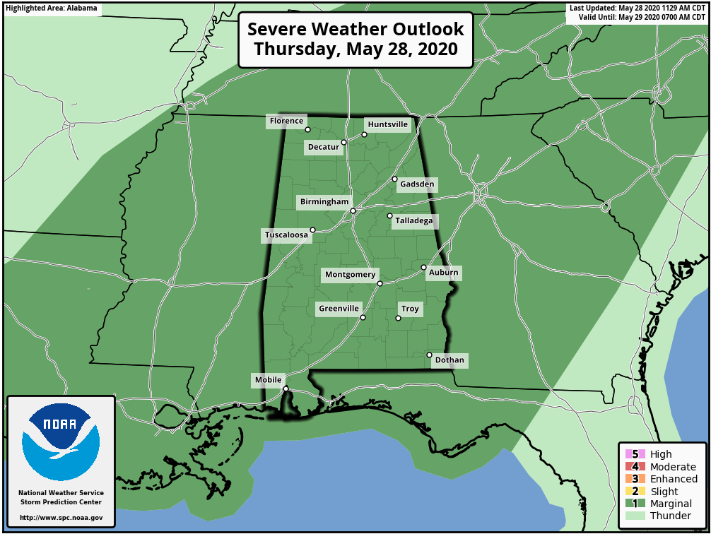
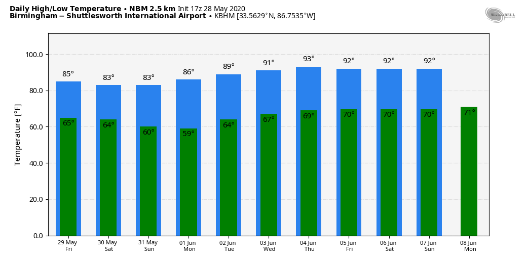
Temperatures are mostly in the low to mid-80s across Alabama this afternoon with a mix of sun and clouds. Scattered storms that form this evening will fade away late tonight.
TOMORROW AND THE WEEKEND: The upper low over Arkansas will weaken into an open trough and lift northeast. A surface cold front will approach, and we will see scattered showers and thunderstorms tomorrow, mostly during the afternoon and evening hours. The best chance of them will come from 1:00 p.m. until midnight; the high tomorrow will be in the mid-80s, very close to seasonal averages.
Then, much drier air will roll into Alabama over the weekend. We expect sunshine in full supply Saturday and Sunday with highs in the low 80s. Humidity levels will be lower, and nights cooler. Many places will dip into the 50s early Sunday morning… very refreshing for the last day of May.
NEXT WEEK: Monday morning will be cool again with a low in the 50s, but then we will see slowly rising heat and humidity levels for the rest of the week. The weather looks generally dry, although a few widely scattered showers could show up late in the week. See the Weather Xtreme video for maps, graphics, and more details.
HURRICANE SEASON BEGINS MONDAY: The “official” start of the hurricane season comes Monday (June 1). We have experienced two pre-season tropical storms this month, Arthur and Bertha. The other names for the season are Cristobal, Dolly, Edouard, Fay, Gonzalo, Hanna, Isaias, Josephine, Kyle, Laura, Marco, Nana, Omar, Paulette, Rene, Sally, Teddy, Vicky, and Wilfred.
ON THIS DATE IN 1973: An F3 tornado moved east and struck the northern portion of Athens, Georgia. Destruction was massive near Athens, with losses estimated at ten million dollars. Damage from the storm included 545 homes and 17 businesses. Hundreds of large trees more than 100 years old were destroyed.
BEACH FORECAST: Click here to see the AlabamaWx Beach Forecast Center page.
WEATHER BRAINS: Don’t forget you can listen to our weekly 90 minute show anytime on your favorite podcast app. This is the show all about weather featuring many familiar voices, including our meteorologists here at ABC 33/40.
CONNECT: You can find me on all of the major social networks…
Facebook
Twitter
Instagram
Pinterest
Snapchat: spannwx
Look for the next Weather Xtreme video here by 7:00 a.m. tomorrow…
Category: Alabama's Weather, ALL POSTS, Weather Xtreme Videos
About the Author (Author Profile)
James Spann is one of the most recognized and trusted television meteorologists in the industry. He holds the AMS CCM designation and television seals from the AMS and NWA. He is a past winner of the Broadcast Meteorologist of the Year from both professional organizations.Subscribe
If you enjoyed this article, subscribe to receive more just like it.


