Late Morning Update: Radar Getting Active
A very warm and moisture-rich air mass covers all of Alabama, making for an unstable air mass, and is why we are starting to see scattered to numerous showers and thunderstorms developing and what we are going to be seeing the rest of today and into early tonight.
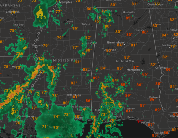
Before the rain and storms really get going, we are seeing temperatures well into the 80s at midday and we should see upper 80s and lower 90s for highs in many locations.
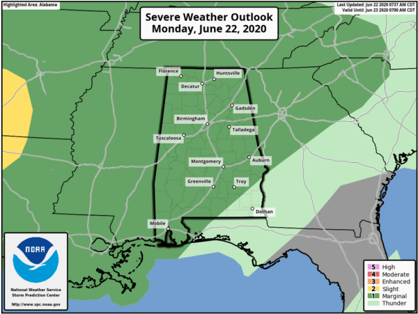
However, rain chances are very high, and the radar will be very active the rest of the today. With so much instability in place, we are going to see some stronger storms as well and the SPC has much of the state in a “marginal risk” (level 1/5) of severe thunderstorms.
Some storms this afternoon could produce small hail and strong, gusty winds, and of course intense rainfall and tremendous amounts of lightning.
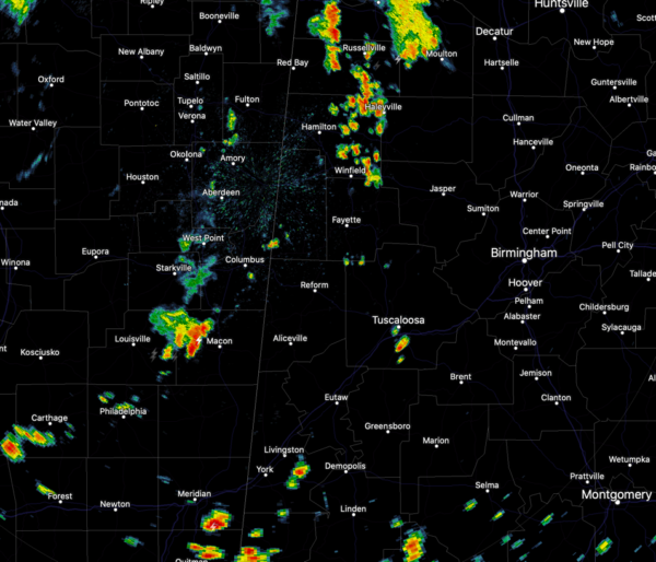
The KBMX radar continues to be down of maintenance this morning, so looking at surrounding radars such as the Columbus, Mississippi radar shows several areas of rain developing across West Alabama and East Mississippi.
Farther to the south, the Mobile, Alabama radar is very active with numerous showers and storms ongoing and these are expanding in coverage and intensity.
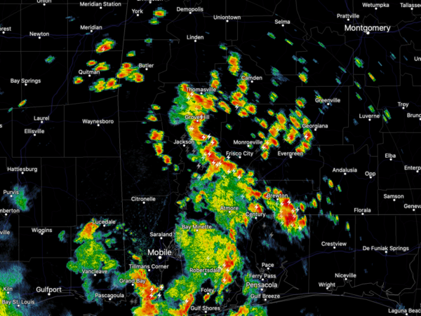
These are racing off to the northeast and will be impacting portions of South and Central Alabama the next several hours.
Category: Alabama's Weather, ALL POSTS
About the Author (Author Profile)
Macon, Georgia Television Chief Meteorologist, Birmingham native, and long time Contributor on AlabamaWX. Stormchaser. I did not choose Weather, it chose Me. College Football Fanatic. @Ryan_StinnetSubscribe
If you enjoyed this article, subscribe to receive more just like it.


