Showers/Storms Likely Tomorrow; Then Drier For The Weekend
RADAR CHECK: Again today we have random, slow moving showers and thunderstorms across Alabama and the Deep South. Stronger storms are producing heavy rain, gusty winds, and lots of lighting. They will fade away late tonight as the air cools and becomes more stable.
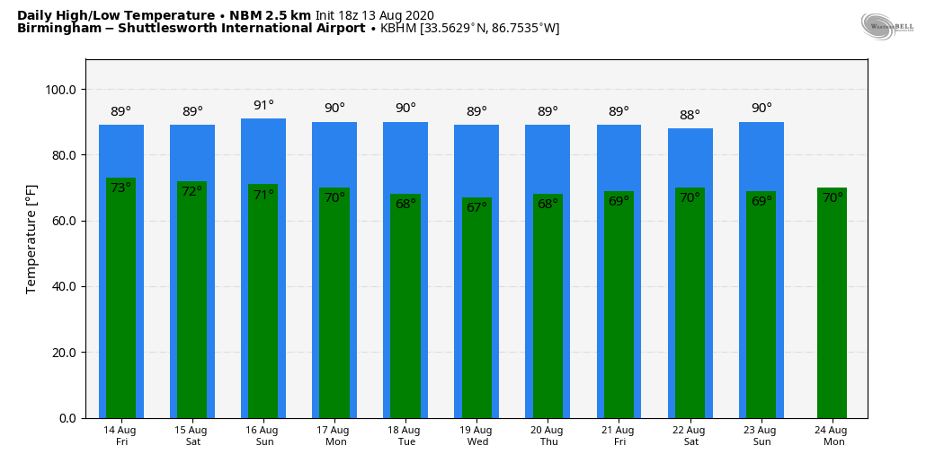
Away from the showers, temperatures have reached the low 90s, right at seasonal averages for mid-August in Alabama.
The sky tomorrow will be occasionally cloudy with scattered to numerous showers and thunderstorms by afternoon; the high will be in the 87-91 degree range for most communities.
THE ALABAMA WEEKEND: Drier air begins to slip into Alabama Saturday, and the best chance of showers will shift down into the southern half of the state. Sunday will be mostly sunny with only isolated showers; highs over the weekend will remain somewhere between 87 and 91 degrees.
NEXT WEEK: An upper trough over the eastern U.S. will keep heat levels relatively low for the middle of August; we project highs most days in the upper 80s, with lows down in the 60s. Only a few isolated showers on most days; the week looks generally dry. See the Weather Xtreme video for maps, graphics, and more details.
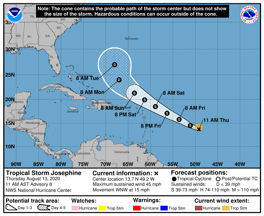
JOSEPHINE FORMS: Tropical Storm Josephine is packing winds of 45 mph, and is centered about 950 miles east of the northern Leeward Islands. It will gain latitude, and should pass north of the Leeward Islands and Puerto Rico this weekend. The system will be fighting shear and dry air, and there is a decent chance it will dissipate at some point 3-5 days from now. If it survives, it should recurve harmlessly into the open Atlantic, and seems to pose no threat to the U.S.
NHC is also monitoring a low pressure area over eastern North Carolina, which is expected to move east-northeastward across the north Atlantic well to the south of New England and the Canadian Maritime provinces for the next several days. This system could acquire some subtropical or tropical characteristics during the next two to three days while it moves over warm sea surface temperatures. No threat to land as it will be moving away from the U.S.
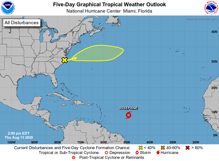
The rest of the Atlantic basin, including the Gulf of Mexico, is quiet.
ON THIS DATE IN 2004: Charley made landfall as a category four hurricane on Captiva Island, Florida, around midday and it unleashed tremendous fury on the town of Punta Gorda about an hour later. After that, Charley tracked northeastward, toward Orlando. The hurricane hit Orlando as a Category 1 hurricane after midnight with maximum sustained winds of 85 mph. A couple of hours later, Charley passed near Daytona Beach and moved out into the Atlantic. Charley was initially expected to hit further north in Tampa, and caught many Floridians off-guard due to a sudden change in the storm’s track as it approached the state. Along its path, Charley caused 10 deaths and $16.9 billion in damage to insured residential property, making it the second costliest hurricane in United States history at the time. Charley was a compact, fast-moving storm, which limited the scope and severity of the damage.
BEACH FORECAST: Click here to see the AlabamaWx Beach Forecast Center page.
WEATHER BRAINS: Don’t forget you can listen to our weekly 90 minute show anytime on your favorite podcast app. This is the show all about weather featuring many familiar voices, including our meteorologists here at ABC 33/40.
CONNECT: You can find me on all of the major social networks…
Facebook
Twitter
Instagram
Pinterest
Snapchat: spannwx
Look for the next Weather Xtreme video here by 7:00 a.m. tomorrow…
Category: Alabama's Weather, ALL POSTS, Weather Xtreme Videos
About the Author (Author Profile)
James Spann is one of the most recognized and trusted television meteorologists in the industry. He holds the AMS CCM designation and television seals from the AMS and NWA. He is a past winner of the Broadcast Meteorologist of the Year from both professional organizations.Subscribe
If you enjoyed this article, subscribe to receive more just like it.


