

Showers Becoming Fewer In Number Over The Weekend
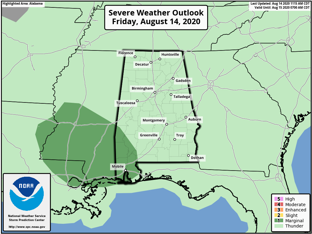
RADAR CHECK: We have numerous showers and thunderstorms in process across Alabama this afternoon… moving steadily to the east. Heavier storms are likely over the southwest part of the state this evening, where SPC has defined a “marginal risk” (level 1/5)…
Showers and storms will fade away late tonight as the air becomes more stable.
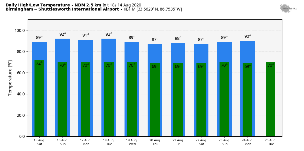
THE WEEKEND: Drier air will enter the state tomorrow, and showers should become fewer in number. Most of them will be over the eastern and southern counties of the state, otherwise the day will feature a partly sunny sky with a high in the upper 80s. Then, on Sunday, look for a good supply of sunshine with only a small risk of a shower. Sunday’s high will be close to 90 degrees.
NEXT WEEK: Showers will remain scarce Monday and Tuesday, but should increase over the latter half of the week as moisture levels rise again. Highs during the week will be mostly in the mid to upper 80s, which is below average for August in Alabama. See the Weather Xtreme video for maps, graphics, and more details.
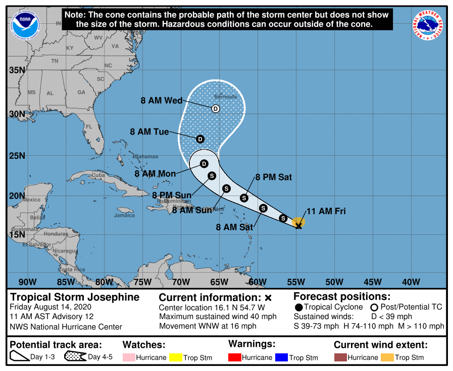
TROPICS: Tropical Storm Josephine is about 550 miles east of the northern Leeward Islands this afternoon with winds of 40 mph. The system is expected to pass north of the Leeward Islands over the weekend, then turning northward well east of the U.S. Shear will be increasing by Sunday and Monday, and the system could dissipate then. One way or another, it won’t impact the U.S.
Elsewhere, satellite imagery indicates that shower activity associated with the low pressure area located about 300 miles south-southwest of Nantucket, Massachusetts has become better organized. In addition, recent satellite wind data show that the circulation is becoming better defined, with winds to near gale force to the southeast of the center. If current trends continue, a tropical depression or tropical storm is likely to form later today or tonight. Regardless of development, this system is expected to move east-northeastward well to the southeast of New England and to the south of the Canadian Maritime provinces. No threat to the U.S.
The rest of the Atlantic basin, including the Gulf of Mexico, is quiet.
ON THIS DATE IN 1969: Hurricane Camille, a powerful, deadly, and destructive hurricane formed just west of the Cayman Islands on this day. It rapidly intensified, and by the time it reached western Cuba the next day, it was a Category 3 hurricane. Hurricane Camille was spawned on August 5th by a tropical wave off the coast of Africa. The storm became a tropical disturbance four days later on the 9th and a tropical storm on the 14th with a 999-millibar pressure center and 55 mph surface winds.
BEACH FORECAST: Click here to see the AlabamaWx Beach Forecast Center page.
WEATHER BRAINS: Don’t forget you can listen to our weekly 90 minute show anytime on your favorite podcast app. This is the show all about weather featuring many familiar voices, including our meteorologists here at ABC 33/40.
CONNECT: You can find me on all of the major social networks…
Facebook
Twitter
Instagram
Pinterest
Snapchat: spannwx
Look for my next Weather Xtreme video here by 7:00 a.m. Monday… enjoy the weekend!
Category: Alabama's Weather, ALL POSTS, Weather Xtreme Videos
About the Author (Author Profile)
James Spann is one of the most recognized and trusted television meteorologists in the industry. He holds the AMS CCM designation and television seals from the AMS and NWA. He is a past winner of the Broadcast Meteorologist of the Year from both professional organizations.Subscribe
If you enjoyed this article, subscribe to receive more just like it.


