

Wetter Pattern Ahead For Alabama; Tropics Remain Very Active
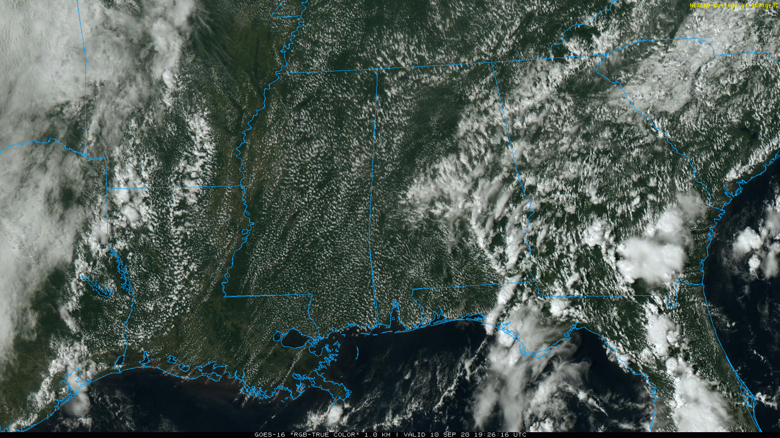
RADAR CHECK: As advertised, showers have returned to Alabama this afternoon. so far they are most numerous south of I-20 and east of I-65, and they are moving westward. Otherwise the sky is partly sunny this afternoon with temperatures in the 80s. Showers will fade away tonight as the air cools and becomes more stable.
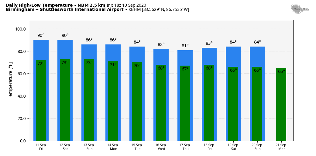
TOMORROW THROUGH THE WEEKEND: Moisture levels will continue to increase. Scattered showers and storms form again tomorrow afternoon, otherwise the day will feature a mix of sun and clouds with a high the mid to upper 80s. Then, over the weekend, the sky will feature more clouds than sun Saturday and Sunday with a good chance of showers and thunderstorms both days. It certainly won’t rain all weekend, but occasional showers are likely with some thunder possible as well. Most, not not necessarily all of the rain comes from noon to midnight, and odds of any one spot getting wet both days are in the 60/70 percent range. Highs will be in the low to mid 80s with only a limited amount of sunshine.
NEXT WEEK: A fairly moist airmass stays in place, and we will see at least scattered showers and thunderstorms on a daily basis, mostly during the afternoon and evening hours. Otherwise partly sunny days with highs in the 80s, right at seasonal averages for mid-September in Alabama. See the Weather Xtreme video for maps, graphics, and more details.
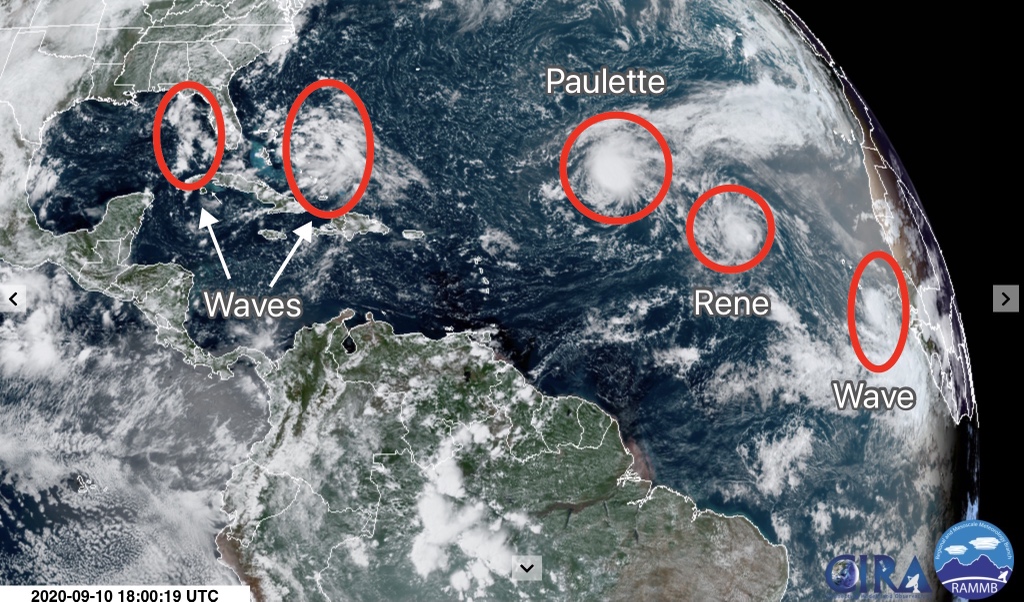
TROPICS: September 10 is the exact climatological peak of the Atlantic hurricane season, and as expected it is very busy with two tropical storms and three tropical waves on the board.
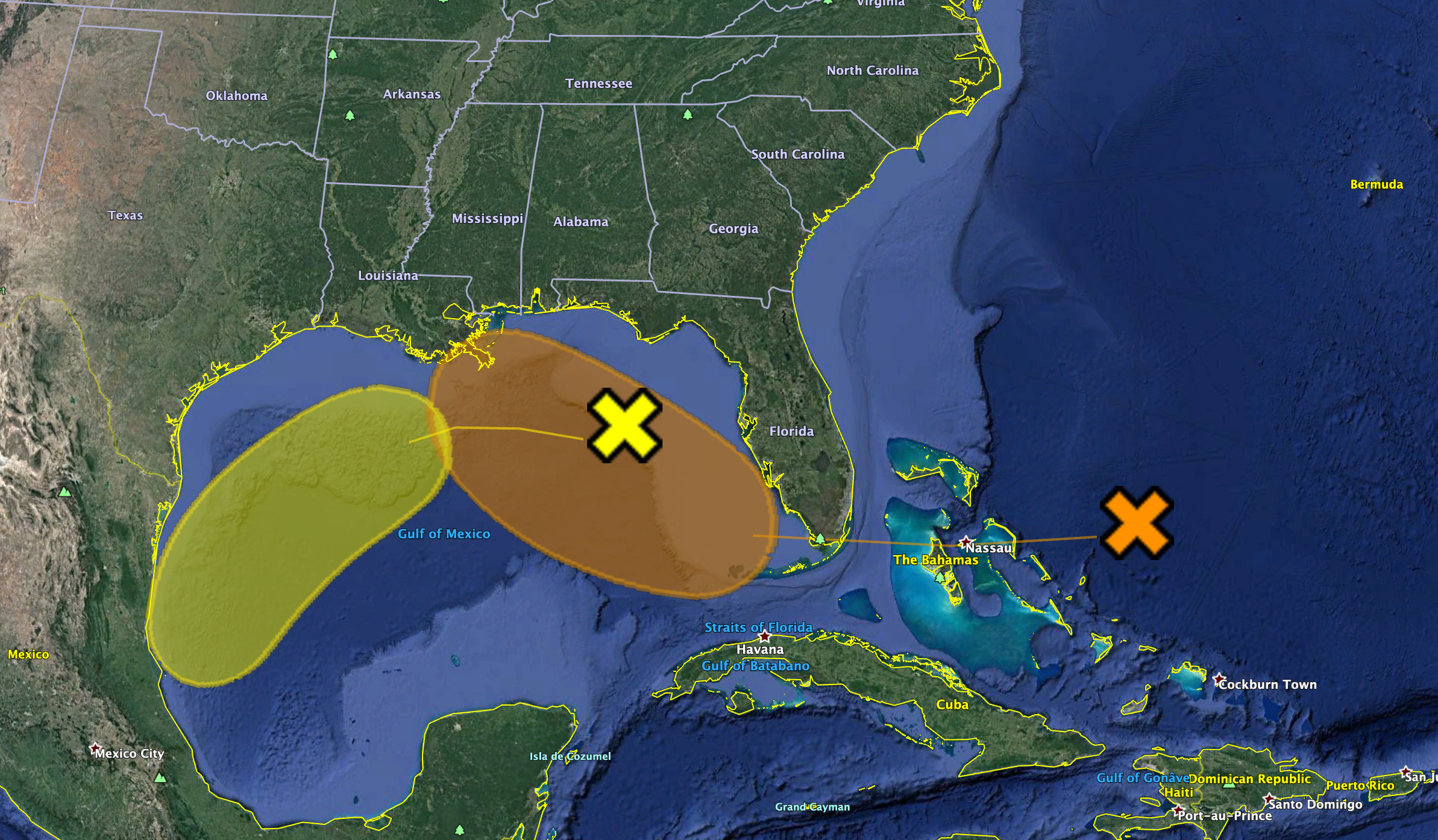
GULF OF MEXICO WAVES: One tropical wave is now over the northern Gulf of Mexico; this will move west/southwest in coming days, and NHC gives it only a 20 percent of development through early next week. Another wave is now over the Bahamas, and will move into the eastern Gulf over the weekend. NHC has upped the chance of development with this one to 40 percent, and it will bring enhanced rain coverage to parts of the Gulf Coast region Saturday through early next week. If this becomes a tropical depression, or stays an open wave, the main impact will be the higher rain coverage along the coast.
In terms of the impact to the Central Gulf Coast (Panama City Beach to Gulf Shores), this wave will bring cloudy periods and occasional tropical showers. But, the weekend won’t be a complete “wash-out”, and you will see some sun. For now NWS Mobile suggests the rip current danger will be low through the weekend, but if the system becomes better organized red flags could be raised.
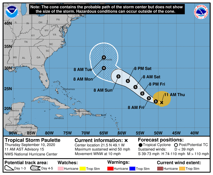
TROPICAL STORM PAULETTE: Paulette is now packing sustained winds of 50 mph, and is about 900 miles east/northeast of the northern Leeward Islands. It will turn northward around longitude 65W, and is forecast by NHC to be close to Bermuda as a category one hurricane late Monday night or early Tuesday. From there is turns northeast, and is no threat to the U.S.
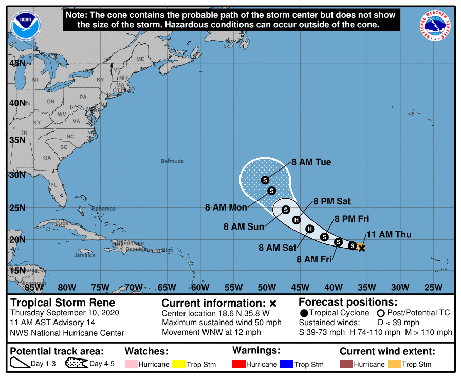
TROPICAL STORM RENE: Rene now has winds of 50 mph in the eastern Atlantic, and is forecast to briefly become a hurricane Saturday before weakening again Sunday and early next week. It gains latitude, and will likely remain far from land.
EASTERN ATLANTIC WAVES: A well organized tropical wave has emerged off the coast of Africa, and is expected to become Tropical Storm Sally in coming days. Too early to know if this one impacts the U.S. or any land mass. And, yet another wave comes off the African continent this weekend, and it will have a medium chance of developing over the next 5 days.
ON THIS DATE IN 1960: The center of Hurricane Donna passed over the middle of the Florida Keys between 2, and 3 am on this day. Donna was a Category 5 hurricane over the Atlantic and a Category 4 at landfall. This storm caused the deaths of over 100 in Puerto Rico, 50 in the United States.
BEACH FORECAST: Click here to see the AlabamaWx Beach Forecast Center page.
WEATHER BRAINS: Don’t forget you can listen to our weekly 90 minute show anytime on your favorite podcast app. This is the show all about weather featuring many familiar voices, including our meteorologists here at ABC 33/40.
CONNECT: You can find me on all of the major social networks…
Facebook
Twitter
Instagram
Pinterest
Snapchat: spannwx
Look for the next Weather Xtreme video here by 7:00 a.m. tomorrow…
Category: Alabama's Weather, ALL POSTS, Weather Xtreme Videos
About the Author (Author Profile)
James Spann is one of the most recognized and trusted television meteorologists in the industry. He holds the AMS CCM designation and television seals from the AMS and NWA. He is a past winner of the Broadcast Meteorologist of the Year from both professional organizations.Subscribe
If you enjoyed this article, subscribe to receive more just like it.


