Significant Severe Weather Event Possible Wednesday
A well organized storm system is west of Alabama this morning, but our weather will stay dry and warm today with a mix of sun and clouds; most places will see a high in the low 80s this afternoon. Showers and thunderstorms will move into the state tomorrow, but with weakening wind fields and limited instability, the severe weather risk here is rather low tomorrow. Still a strong storm can’t be ruled out with gusty winds and small hail.
Showers remain possible Tuesday, especially along and south of a stalled surface front near I-20, but severe storms are not expected.
WEDNESDAY: A vigorous upper air system will be responsible for a deepening surface low northwest of Alabama, over Missouri. Unstable air will surge northward from the Gulf of Mexico, and the large scale setup suggests potential for a significant severe weather threat for the Deep South. Thunderstorms Wednesday afternoon and Wednesday night will be capable of producing large hail, damaging winds, and tornadoes.
Analogs are valid ways of looking at events like this… you take the forecast surface and upper air pattern Wednesday, and look back at what happened with previous setups like this over the years. Analog guidance does suggest we could very well have potential for one or two violent, long track tornadoes somewhere across Mississippi or Alabama. I don’t say this to alarm anyone; we walk a fine line in the weather office. We never want to “scare” anyone, but at the same time we have a responsibility to get people prepared for severe weather days.
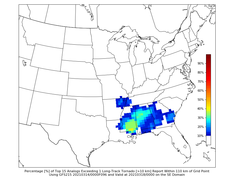
On their latest “Day 4” severe weather outlook, SPC has an enhanced risk defined Wednesday for all of Mississippi, and roughly the western half of Alabama.
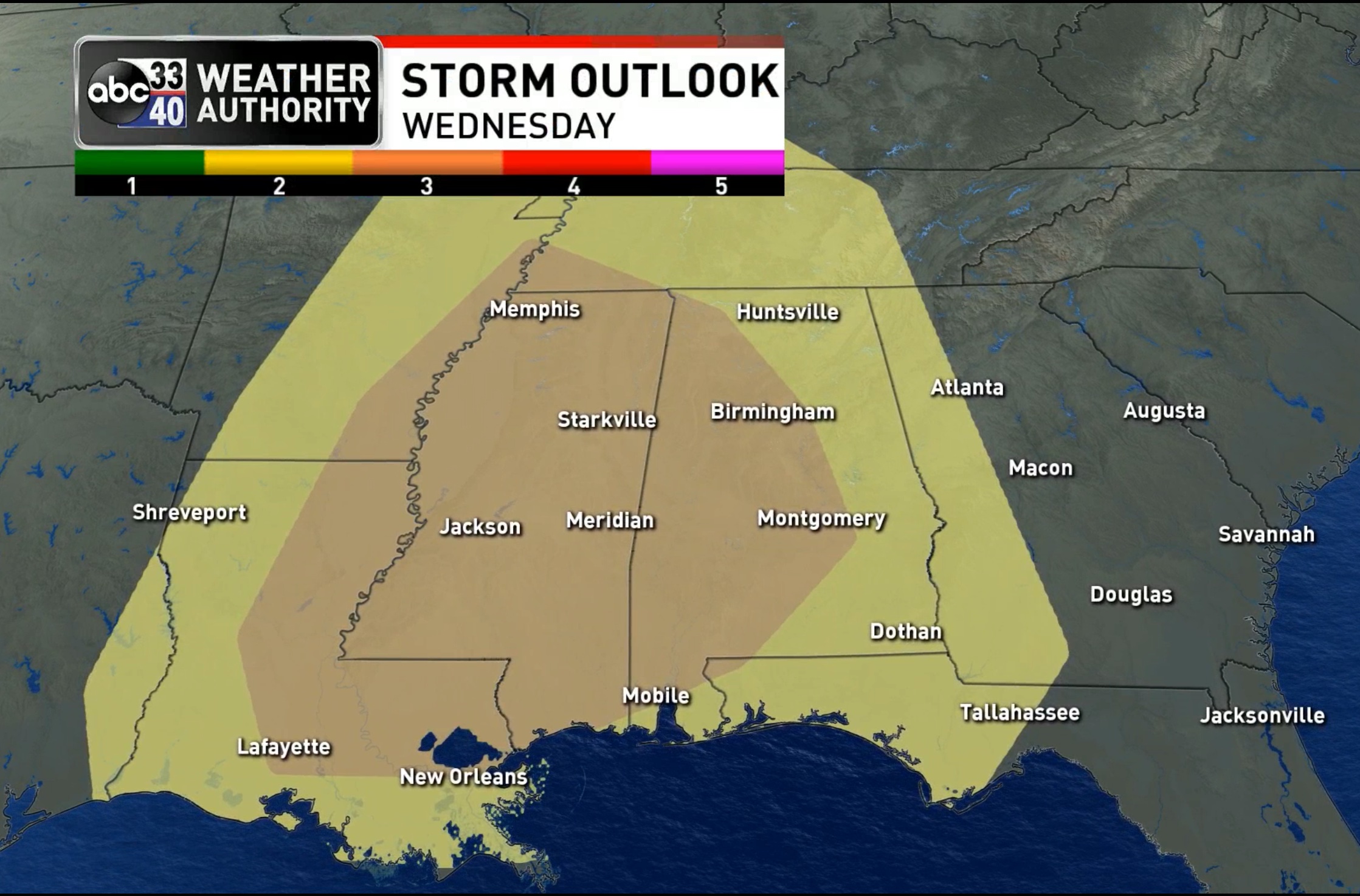
While the synoptic scale favors a significant severe weather event Wednesday, it is important to note that we don’t know how the mesoscale features will set up right now, and accordingly we can’t be more specific. At the moment it looks like the main threat of severe storms will come from noon until midnight Wednesday.
Already I am hearing the familiar question “will this be like April 27, 2011?”. Long time readers know I don’t like that question… the answer is no, but all it takes is one tornado in the entire state. If that one comes down your street, it is YOUR April 27. Events like April 27, 2011 are generational, but have to be ready for every severe weather event.
A few preparedness notes…
*Be sure WEA (Wireless Emergency Alerts) are enabled on your phone. Look under notifications. Tornado warnings, flash flood warnings, and amber alerts are pushed to your phone via WEA, and it doesn’t involve an app.
*We recommend the ABC 33/40 app for your phone also to push alerts. You can select the warnings you receive, and it works well and is very reliable.
Get the iOS version for iPhones and iPads here: https://apps.apple.com/us/app/3340-weather/id419168262
And, here is the Android version: https://play.google.com/store/apps/details?id=com.tvalabama.android.weather&hl=en_US&gl=US
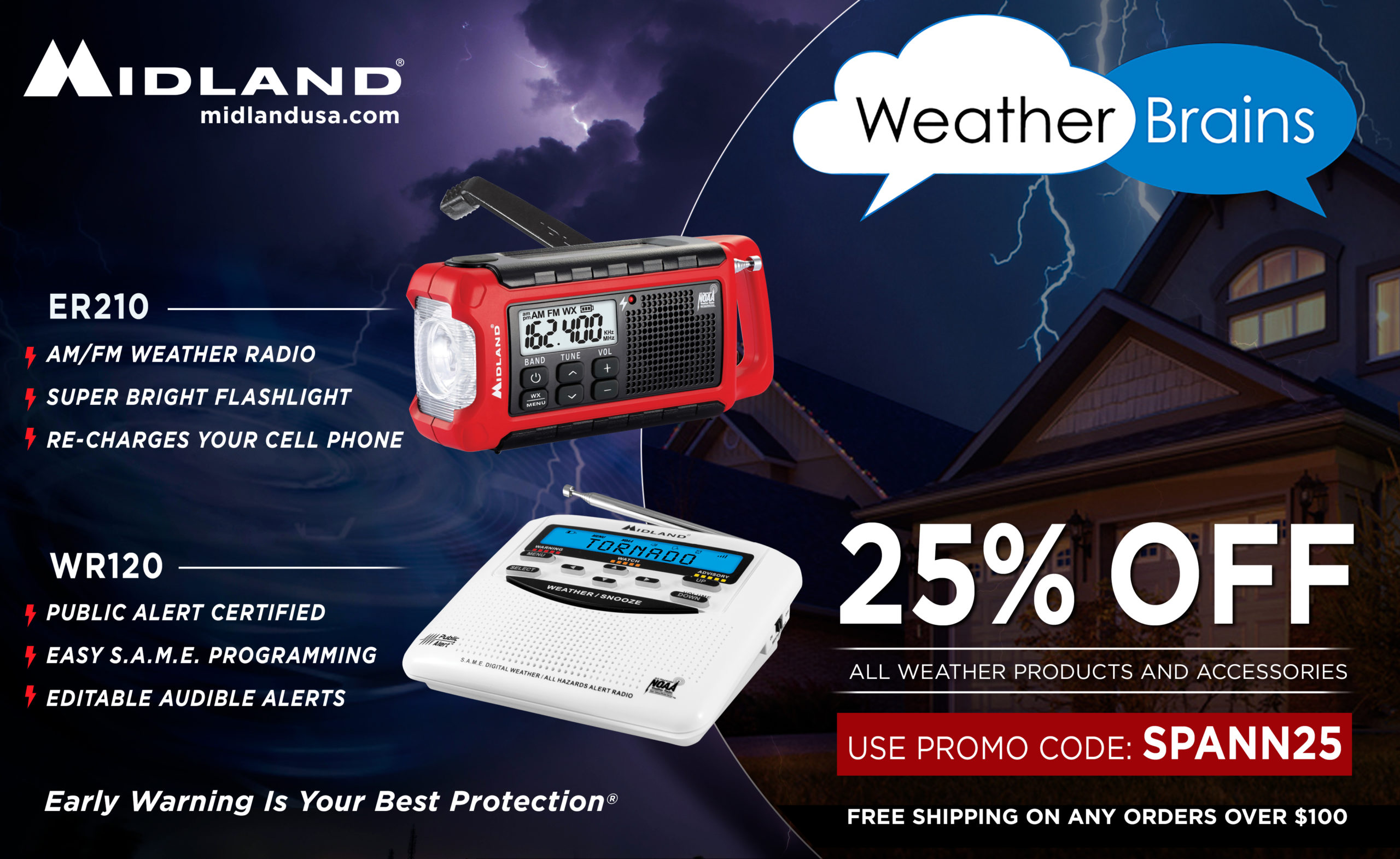
*The most popular NOAA Weather radio is the Midland WR-120. You can find it at most big box retailers, and online sellers like Amazon. Midland is offering a 25 percent discount now (if you buy it directly from them) through a partnership with our podcast WeatherBrains: https://midlandusa.com/product/wr-120-weather-radio/
*You need helmets for everyone, including adults, in your safe place. Bicycle helmets and batting helmets work very well.
*It is also a good idea for everyone to have hard soled shoes on (in case you have to walk over a debris field), and a portable air horn (in case you need to alert first responders).
*You can’t stay in a mobile home during a tornado. Know now where you will go in case you are under a tornado warning polygon. Community shelter, a business that open 24/7, etc.
Please do not be anxious or worried about Wednesday. Remember, even on major severe weather days, odds of any one spot being hit by a tornado are low. And, this is when we have severe storms and tornado threats… it is nothing unusual. Just have multiple, reliable ways of hearing warnings, and have a plan. Know your safe place, and have helmets there for everyone. Pay attention to updates, and we will get through the day together.
Category: Alabama's Weather, ALL POSTS, Weather Xtreme Videos
About the Author (Author Profile)
James Spann is one of the most recognized and trusted television meteorologists in the industry. He holds the AMS CCM designation and television seals from the AMS and NWA. He is a past winner of the Broadcast Meteorologist of the Year from both professional organizations.Subscribe
If you enjoyed this article, subscribe to receive more just like it.


