Active Weather Continues Through Tomorrow Morning
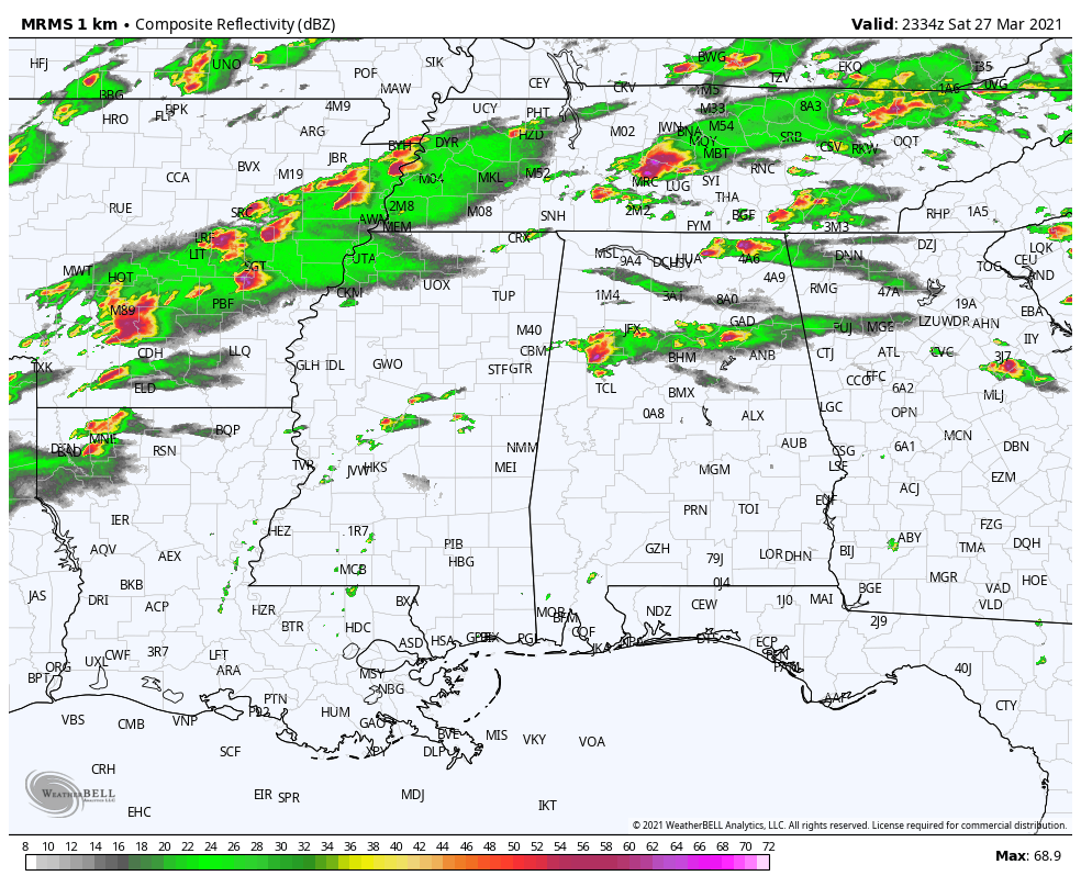
RADAR CHECK: Scattered strong to severe thunderstorms continue across the northern half of Alabama this afternoon… some producing hail and strong winds. There is a tornado watch for far North Alabama until 9p CT, but for most of the state, there is no tornado threat before midnight.
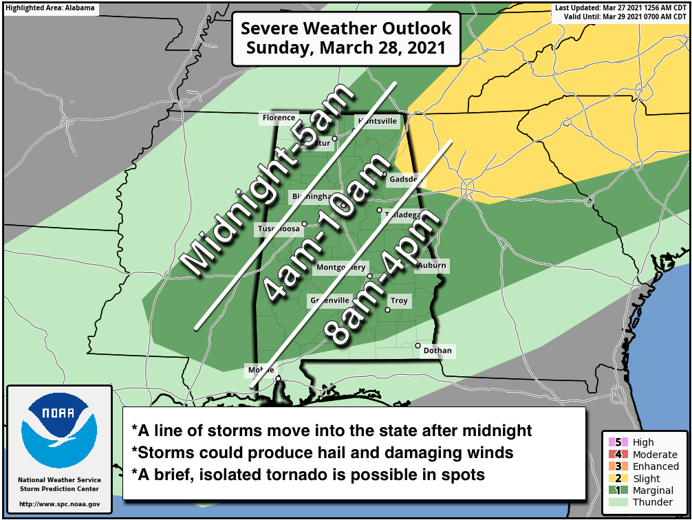
LATE TONIGHT: A line of storms will enter the northwest corner of the state a little after midnight, and will move to the southeast during the pre-dawn hours Sunday. These storms could also be strong to severe, with potential for hail, strong winds, and an isolated tornado or two.
The storms should reach I-59 (Tuscaloosa/Birmingham/Gadsden) by 6-7 a.m. tomorrow, and will be along a line from Roanoke to Montgomery to Jackson by 10-11 a.m.
Be sure you are in a position to hear severe weather warnings if they are needed… as usual a NOAA Weather Radio is the best option, along with your phone. And, please understand severe thunderstorm warnings are important as well. By definition, a severe thunderstorm produces either 58 mph winds, or hail 1″ or larger in diameter.
Category: Alabama's Weather, ALL POSTS, Severe Weather
About the Author (Author Profile)
James Spann is one of the most recognized and trusted television meteorologists in the industry. He holds the AMS CCM designation and television seals from the AMS and NWA. He is a past winner of the Broadcast Meteorologist of the Year from both professional organizations.Subscribe
If you enjoyed this article, subscribe to receive more just like it.


