Severe Storms Possible Through Tomorrow Morning
**No afternoon Weather Xtreme video today**
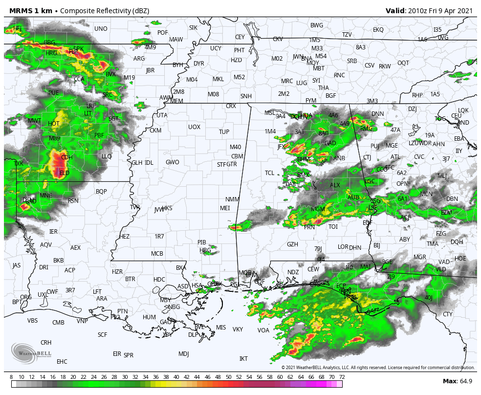
THIS AFTERNOON: Clusters of showers and thunderstorms are passing through Alabama this afternoon. Heavier storms are producing large hail and strong winds; a number of severe thunderstorm warnings have been required. These storms will fade after sunset.
LATE TONIGHT/TOMORROW MORNING: An organized band of thunderstorms will move into Alabama after midnight tonight, and they will likely be severe. SPC has parts of West and Southwest Alabama, in a broad zone from Aliceville to Mobile, in a “moderate risk” (level 4/5). An “enhanced risk” (level 3/5) extends as far east as Cullman, Sylacauga, and Andalusia, and a “slight risk” (level 2/5) covers the rest of the state. This outlook is valid through 7:00 a.m. tomorrow.
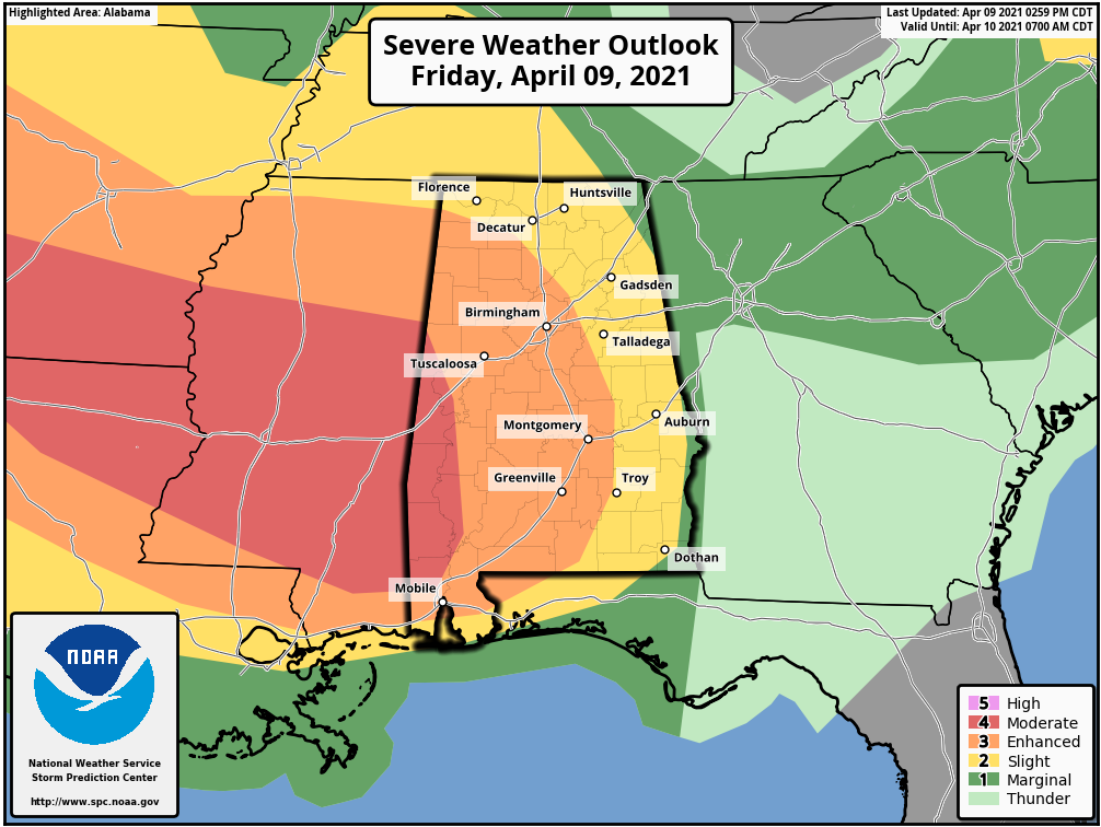
In the SPC outlook after 7:00 a.m. tomorrow, a risk of severe storms continues south and east of Birmingham, including an “enhanced risk” (level 3/5) for areas generally east of I-65, and south of I-85.
TIMING: The main band of storms will enter West Alabama 4:00 a.m…. it will be near Birmingham around 8:00 a.m…. and near Anniston around 9:30-10:00 a.m. It should clear the southeast corner of the state by 12:00 noon.
THREATS: The core threat will come from damaging straight line winds, but a few isolated tornadoes can’t be ruled out. Also, large hail is a possibility as well.
RAIN: Additional rain amounts of 1-2 inches, and some flooding issues are possible in scattered spots.
Be sure you can hear warnings if they are needed overnight, and pay close attention to severe thunderstorm warnings since the main threat will come from straight line winds.
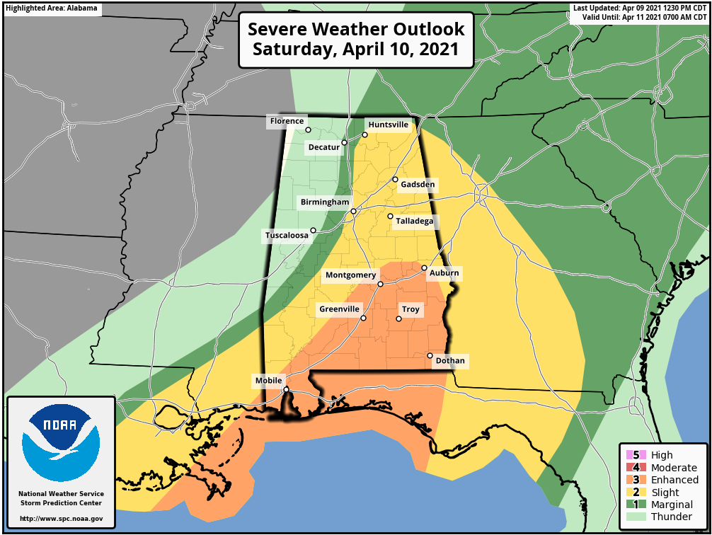
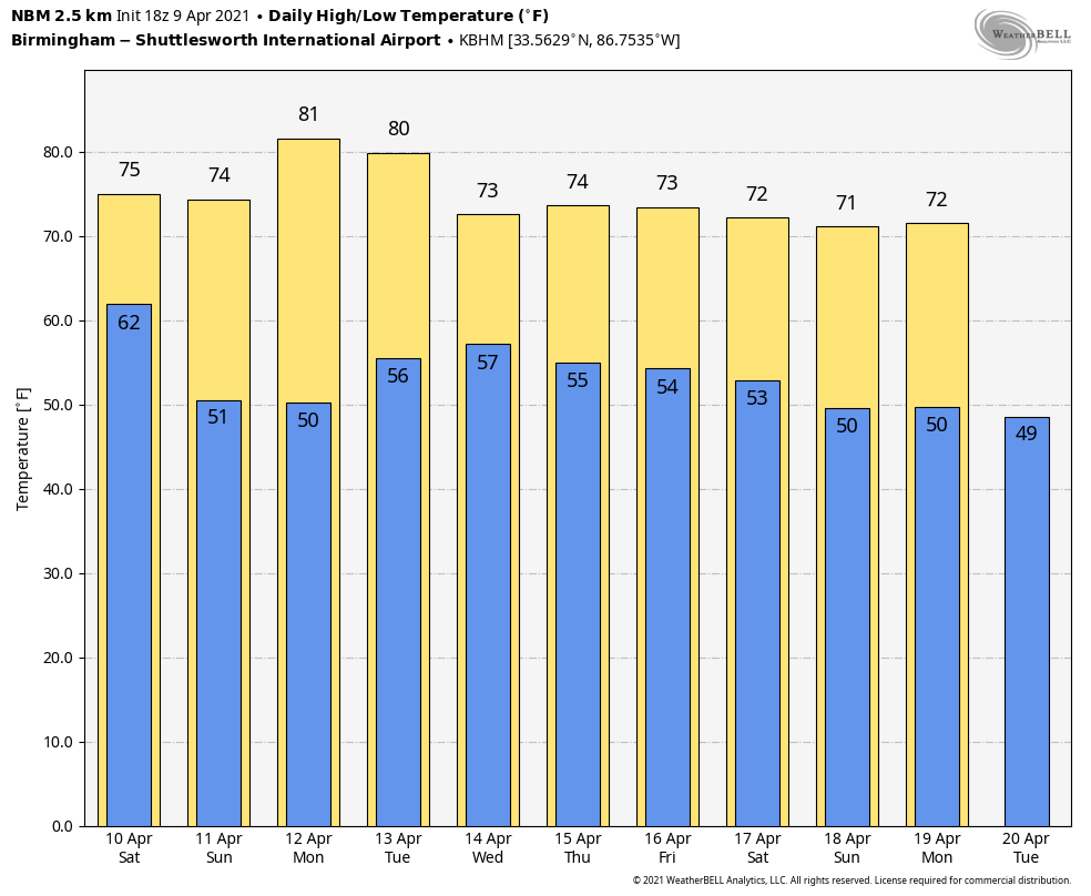
The weather should be mostly dry across the state late tomorrow morning and through the afternoon… with just a few isolated showers around. The high tomorrow will be in the low 70s.
SUNDAY AND NEXT WEEK: Sunday will be a sunny day with a high in the mid 70s. The weather stays dry Monday and Tuesday with highs around 80… then we will bring back a chance of showers, and possibly a few thunderstorms Wednesday. Thursday and Friday look dry and cooler.
ON THIS DATE IN 1947: An estimated F5 tornado struck Woodward, Oklahoma during the late evening killing 95 persons and causing six million dollars damage. The tornado, one to two miles in width, and traveling at a speed of 50 mph, killed a total of 167 persons along its 221-mile path from Texas into Kansas, injured 980 others, and caused nearly ten million dollars damage.
BEACH FORECAST: Click here to see the AlabamaWx Beach Forecast Center page.
WEATHER BRAINS: Don’t forget you can listen to our weekly 90 minute show anytime on your favorite podcast app. This is the show all about weather featuring many familiar voices, including our meteorologists here at ABC 33/40.
CONNECT: You can find me on all of the major social networks…
Look for my next Weather Xtreme video here by 6:00 a.m. Monday… enjoy the weekend!
Category: Alabama's Weather, ALL POSTS
About the Author (Author Profile)
James Spann is one of the most recognized and trusted television meteorologists in the industry. He holds the AMS CCM designation and television seals from the AMS and NWA. He is a past winner of the Broadcast Meteorologist of the Year from both professional organizations.Subscribe
If you enjoyed this article, subscribe to receive more just like it.


