Dry, Warm Afternoon; Moisture Levels Begin To Rise Tomorrow
**No afternoon Weather Xtreme video today; we are on a holiday schedule. Two a day videos return tomorrow**
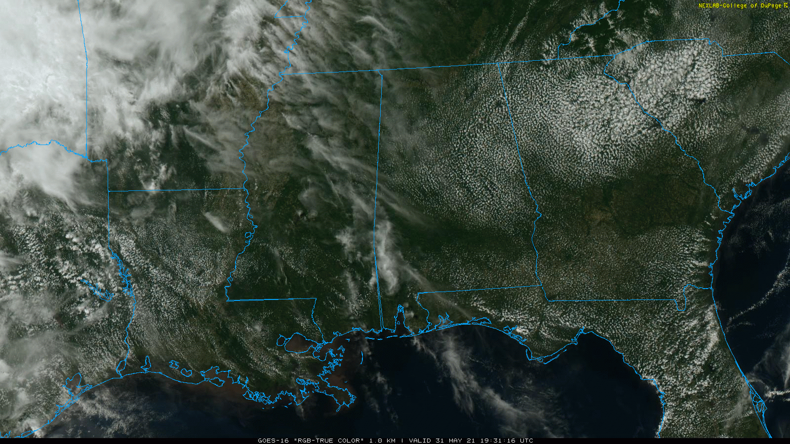
MARVELOUS MEMORIAL DAY: With a mostly sunny sky, temperatures are generally in the 77-84 degree range across Alabama this afternoon. The sky will stay mostly fair tonight with lows mostly in the 60s.
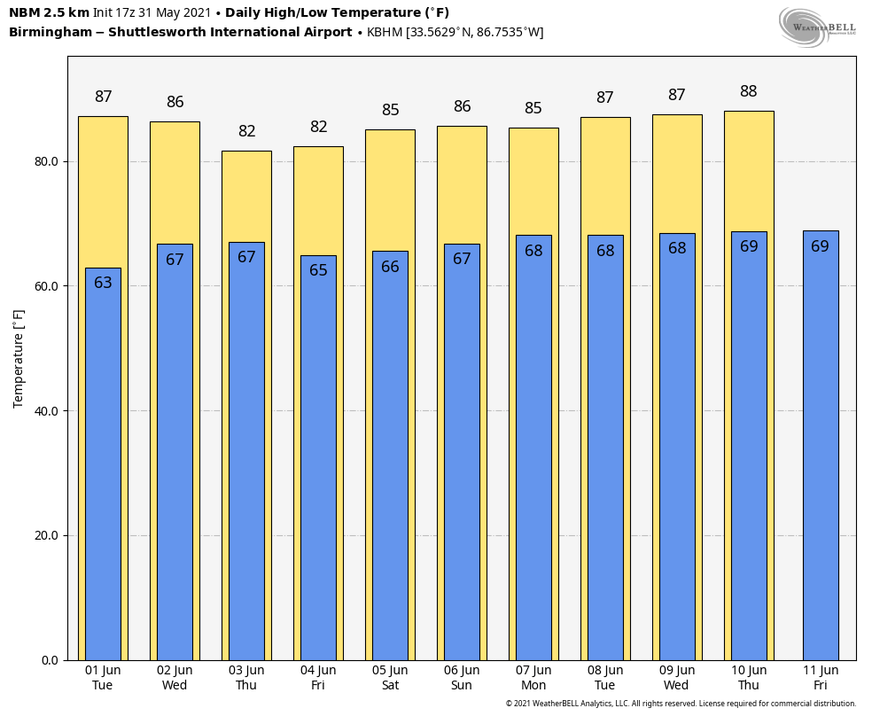
REST OF THE WEEK: Moisture levels will begin to rise across the state tomorrow; we will introduce the chance of a few isolated afternoon showers tomorrow; odds of any one spot getting wet are 10-20 perfect. Otherwise, the day will be partly sunny with a high in the mid 80s.
A few scattered afternoon showers are storms are possible Wednesday as well, but rain coverage will increase Thursday and Friday as the air becomes more unstable, and moisture levels continue to rise. We expect scattered to numerous showers and thunderstorms Thursday and Friday with highs between 78 and 82 degrees thanks a limited amount of sun.
THE ALABAMA WEEKEND: We are forecasting a mix of sun and clouds Saturday and Sunday with scattered showers and thunderstorms around both days. Most, but not necessarily all, of the rain will come during the afternoon and evening hours, mostly between 1:00 and 11:00 p.m. Odds of any one spot getting wet both days are 55-65 percent. Not a “wash-out”, but understand a few passing showers are likely over the weekend. They will be somewhat random and scattered, so no way of knowing in advance exactly when and where they will show up. You just have to watch radar trends.
NEXT WEEK: Looks like a fairly routine early summer week, with partly sunny, warm, humid days and the daily round of “scattered, mostly afternoon and evening showers and thunderstorms”. Highs will be in the 80s… See the Weather Xtreme video for maps, graphics, and more details.
TROPICS: The Atlantic basin is quiet, and tropical storm formation is not expected this week. The official start to the Atlantic season is tomorrow.
ON THIS DATE IN 2013: An intense, long-track tornado formed southwest of El Reno, Oklahoma. This exceptionally wide tornado took a complex path, rapidly changing in both speed and direction. The tornado spared El Reno and its airport from a direct hit, tracking just south of those locations. The tornado damaged numerous homes along with a few businesses near El Reno. Additionally, intense sub-vortices destroyed crops in numerous fields in the area. Eight people were killed in the tornado, all in vehicles. This included three severe storm researchers who were killed east of U.S. Highway 81 as the tornado overtook their position. Additionally, several other people were killed while attempting to escape the tornado near U.S. Highway 81. Finally, two people were killed along I-40 while waiting for the storm to pass.
BEACH FORECAST: Click here to see the AlabamaWx Beach Forecast Center page.
WEATHER BRAINS: Don’t forget you can listen to our weekly 90 minute show anytime on your favorite podcast app. This is the show all about weather featuring many familiar voices, including our meteorologists here at ABC 33/40.
CONNECT: You can find me on all of the major social networks…
Look for the next Weather Xtreme video here by 6:00 a.m. tomorrow…
Category: Alabama's Weather, ALL POSTS, Weather Xtreme Videos
About the Author (Author Profile)
James Spann is one of the most recognized and trusted television meteorologists in the industry. He holds the AMS CCM designation and television seals from the AMS and NWA. He is a past winner of the Broadcast Meteorologist of the Year from both professional organizations.Subscribe
If you enjoyed this article, subscribe to receive more just like it.


