Unsettled Weather Through Friday; Drier By The Weekend
RADAR CHECK: We have large areas of rain and embedded thunderstorms across Alabama this afternoon… some of the heaviest rain was over the northwest part of the state at mid-afternoon. The sky is mostly cloudy, and temperatures are mostly in the upper 70s and low 80s. We will maintain the chance of showers tonight as an upper trough remains nearby.
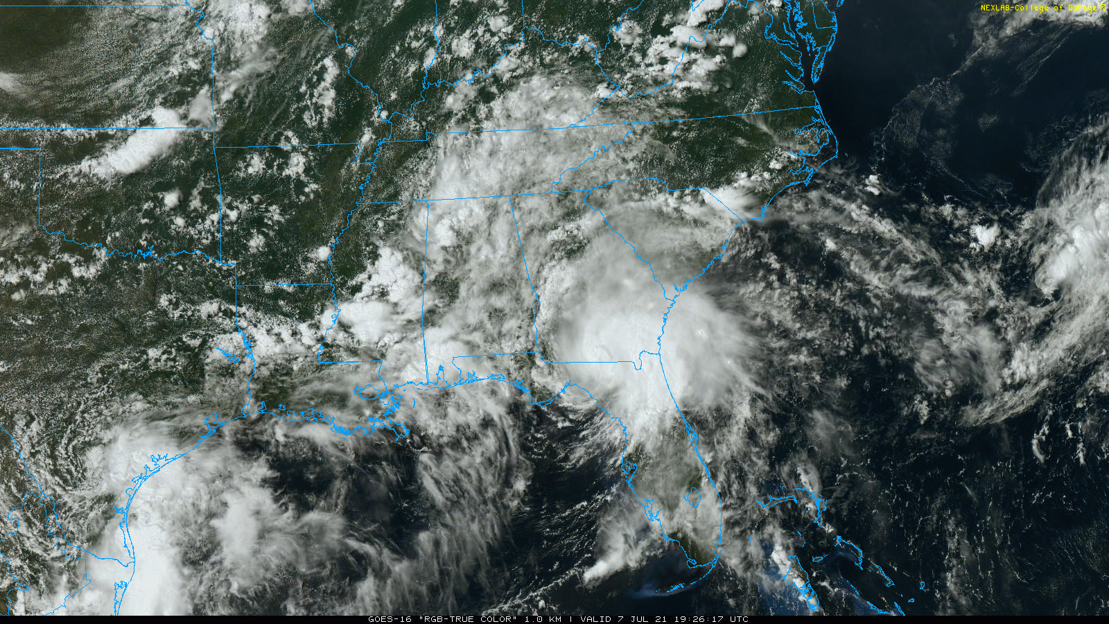
TOMORROW/FRIDAY: The weather won’t change much tomorrow and Friday; the sky will remain mostly cloudy with scattered to numerous showers and thunderstorms both days. Chance of any one spot getting wet will be in the 60-70 percent range, and highs will be in the mid 80s.
THE ALABAMA WEEKEND: Models continue suggest the air will be a bit drier by the weekend, meaning fewer showers and increasing amounts of sunshine. Look for partly sunny days with highs in the mid to upper 80s, and while showers and storms are still possible, they will fewer in number, and mostly during the afternoon and evening hours. Chance of any one location seeing rain over the weekend will be 20-30 percent.
NEXT WEEK: For now the weather looks pretty routine for mid-July in Alabama, but with temperatures below average. We are forecasting partly sunny days with the usual chance of random, scattered, mostly afternoon and evening showers and thunderstorms each day. Highs will be mostly in the upper 80s… See the Weather Xtreme video for maps, graphics, and more details.
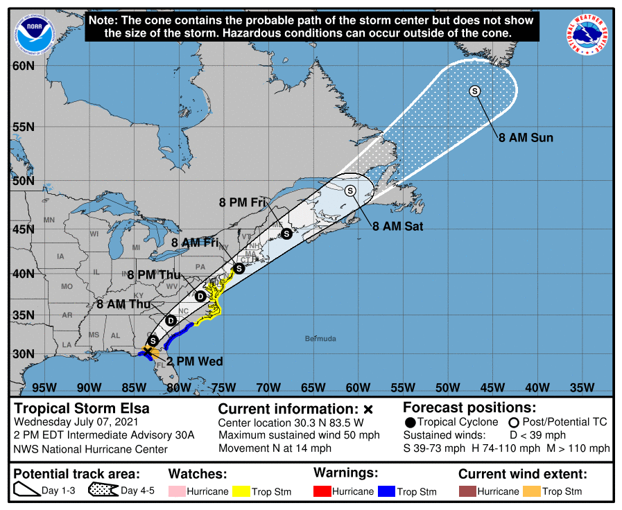
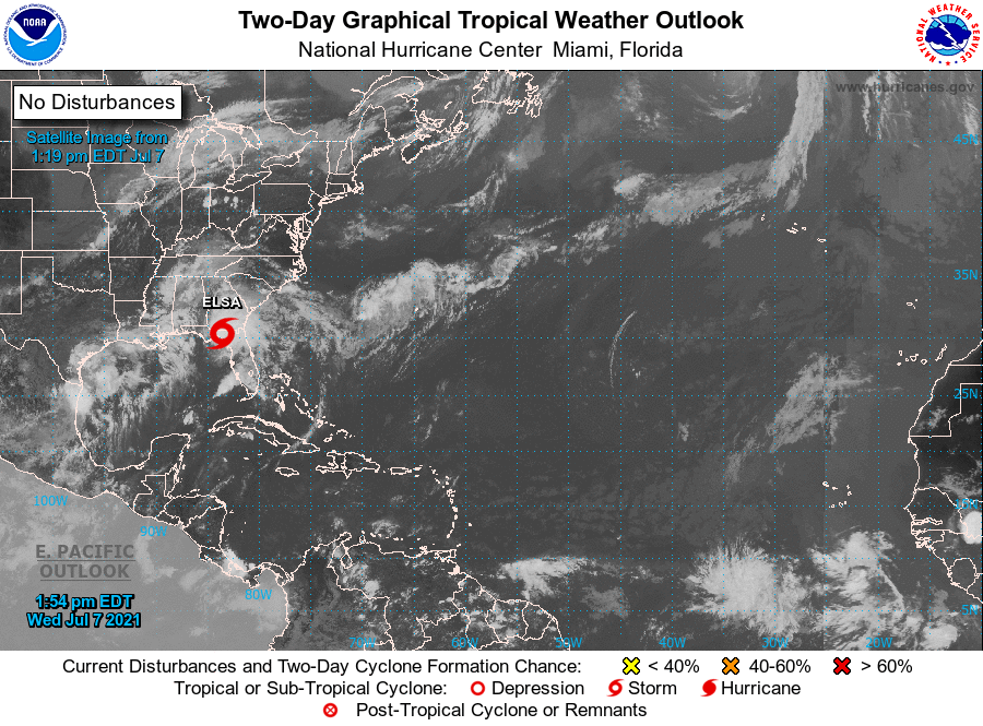
ELSA IS INLAND: Tropical Storm Elsa is inland this afternoon and weakening… the center of circulation is near the Georgia/Florida border, southeast of Valdosta. The system will move northeast and impact the U.S. East Coast over the next few days with rain and breezy conditions.
Elsewhere, a disturbance over the western Gulf of Mexico is bringing heavy rain to the southern part of Texas, but is not expected to develop. And, the rest of the Atlantic basin is very quiet… additional tropical storm formation is not expected through the weekend.
RAIN UPDATE: Here are rain totals for the year so far, and the departure from average…
Mobile 46.20″ (+11.53″)
Tuscaloosa 41.74″ (+12.30″)
Birmingham 37.08″ (+5.60″)
Dothan 34.56″ (+6.29″)
Muscle Shoals 33.83″ (+3.75″)
Huntsville 33.39″ (+3.31″)
Montgomery 30.69″ (+3.00″)
Anniston 29.04″ (-0.32″)
ON THIS DATE IN 2004: A tornado occurred in the Rockwell Pass area of Sequoia National Park, California. Since the elevation of the tornado’s ground circulation was approximately 3705 m (12,156 ft) MSL, this is the highest-elevation tornado documented in the United States.
BEACH FORECAST: Click here to see the AlabamaWx Beach Forecast Center page.
WEATHER BRAINS: Don’t forget you can listen to our weekly 90 minute show anytime on your favorite podcast app. This is the show all about weather featuring many familiar voices, including our meteorologists here at ABC 33/40.
CONNECT: You can find me on all of the major social networks…
Look for the next Weather Xtreme video here by 6:00 a.m. tomorrow…
Category: Alabama's Weather, ALL POSTS, Weather Xtreme Videos
About the Author (Author Profile)
James Spann is one of the most recognized and trusted television meteorologists in the industry. He holds the AMS CCM designation and television seals from the AMS and NWA. He is a past winner of the Broadcast Meteorologist of the Year from both professional organizations.Subscribe
If you enjoyed this article, subscribe to receive more just like it.


