Fred Moving Away; Scattered Storms Tomorrow Through Friday
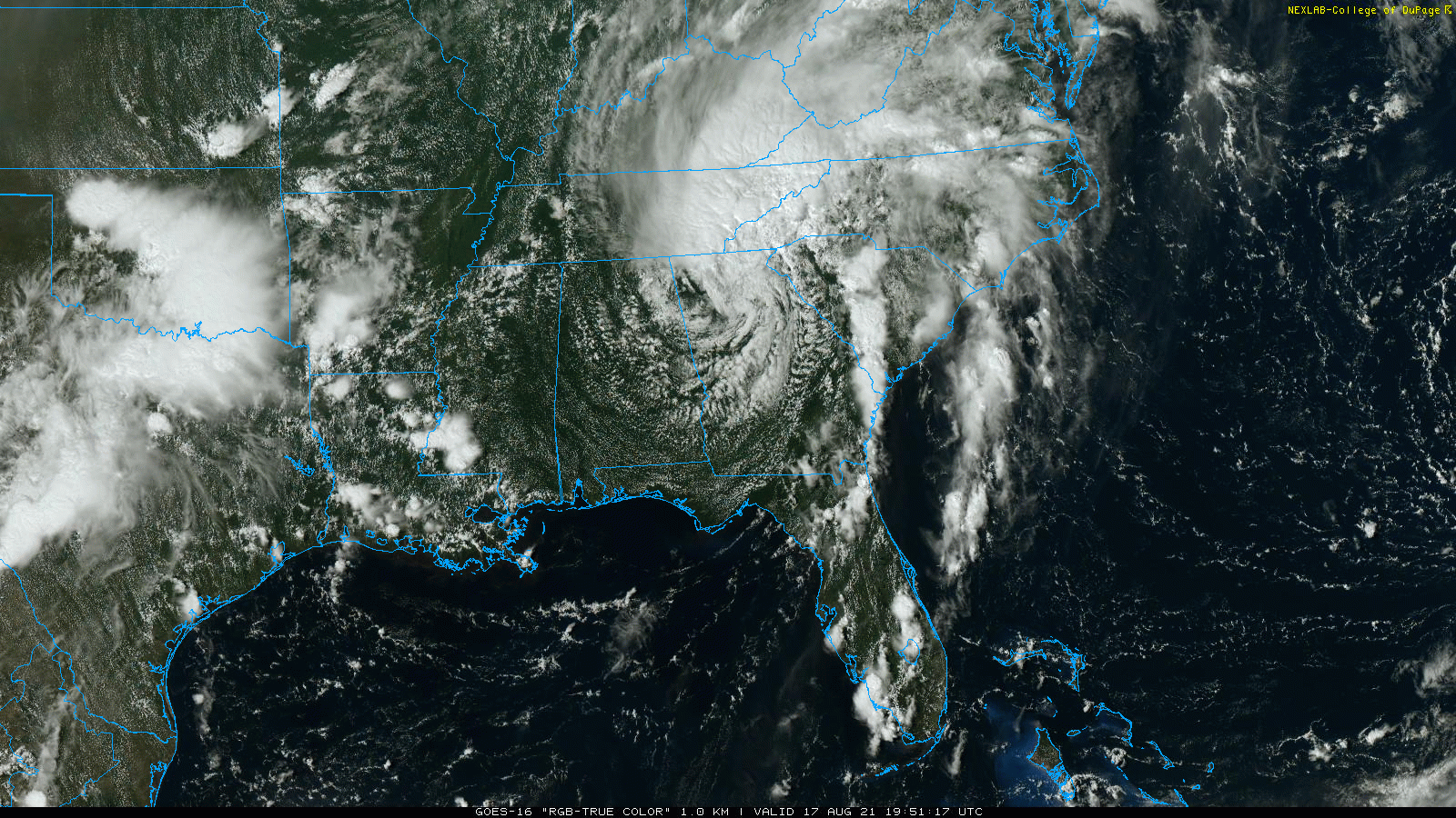
RADAR CHECK: We have a few small, spotty showers across Central Alabama this afternoon, otherwise the sky is partly sunny with temperatures mostly in the 80s. The isolated showers will end after sunset; the main impactful weather with the remnant circulation of Fred is well to the northeast of Alabama.
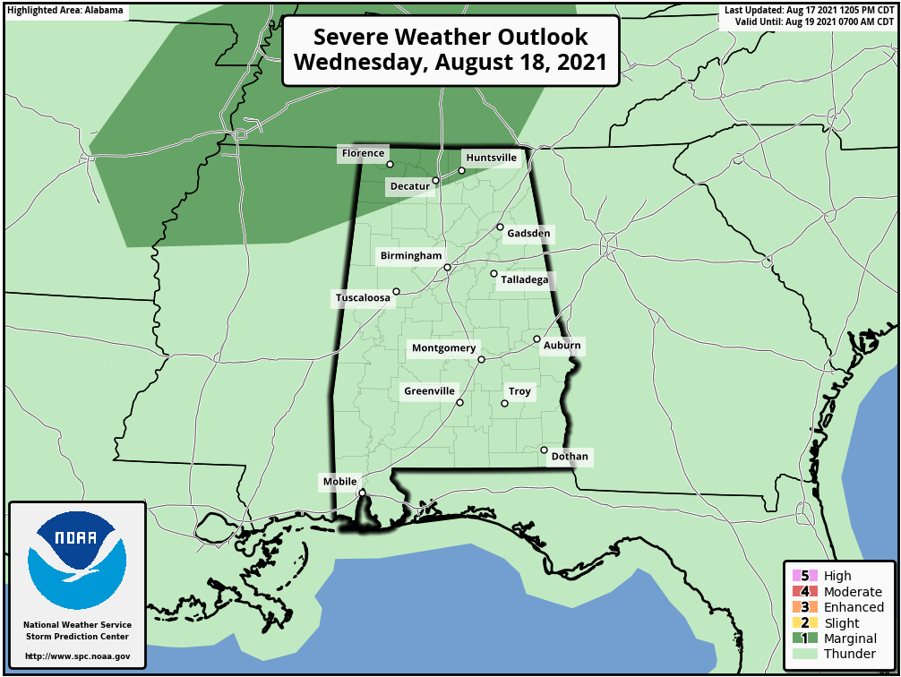
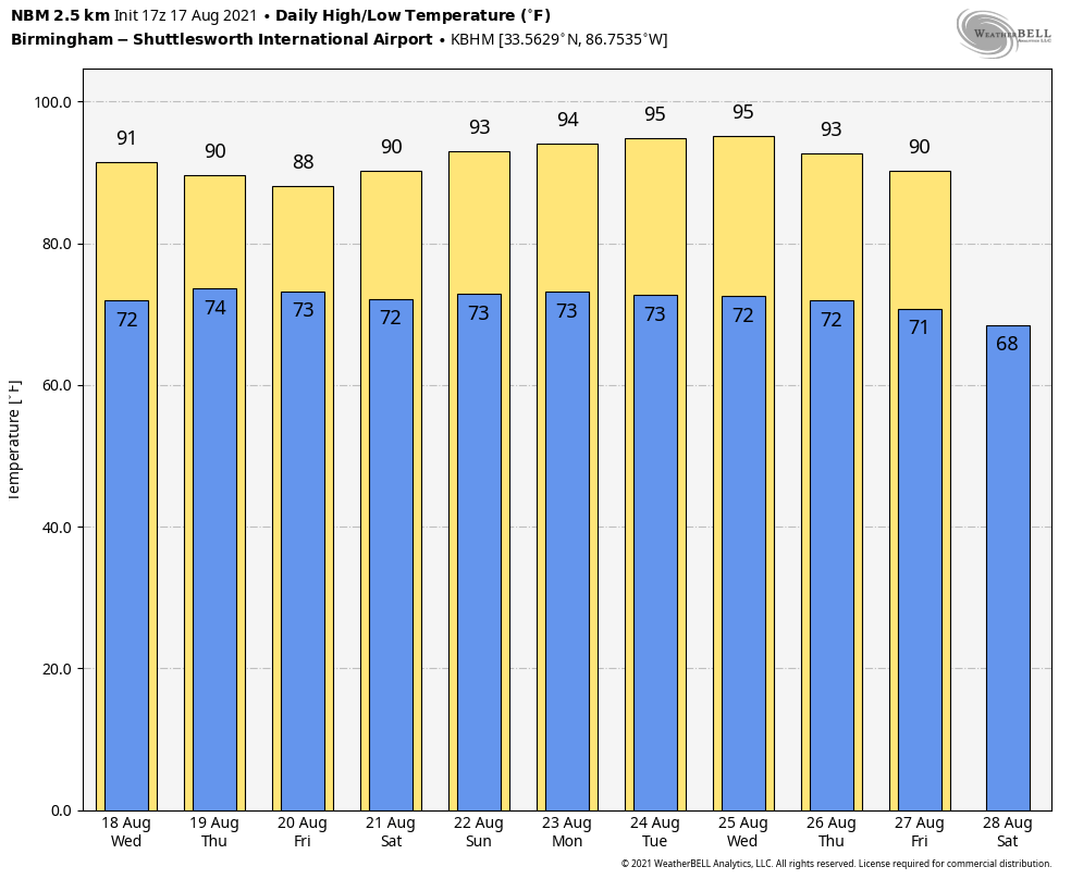
REST OF THE WEEK: Tomorrow will be a partly sunny, hot, humid day with a high around 90. Scattered showers and thunderstorms will form by afternoon, and a few strong storms are likely across the Tennessee Valley of North Alabama, where SPC has defined a “marginal risk” (level 1/5) of severe weather. The main threat will come from strong gusty winds.
Then, on Thursday and Friday, look for a mix of sun and clouds both days with scattered to numerous showers and thunderstorms, mostly during the afternoon and evening hours. The chance of any one spot getting wet on these two days is 55-65 percent, and highs will be in the 85-90 degree range.
THE ALABAMA WEEKEND: A few scattered storms are possible Saturday afternoon, but showers become scarce Sunday as an upper ridge builds across the region. Heat levels creep up over the weekend… the high Saturday will be close to 90, followed by low 90s Sunday.
NEXT WEEK: The weather will be hot and mostly dry for the first half of the week… only isolated afternoon showers with highs between 91 and 94 for most places. Scattered storms will increase by Thursday and Friday as the ridge weakens… See the Weather Xtreme video for maps, graphics, and more details.
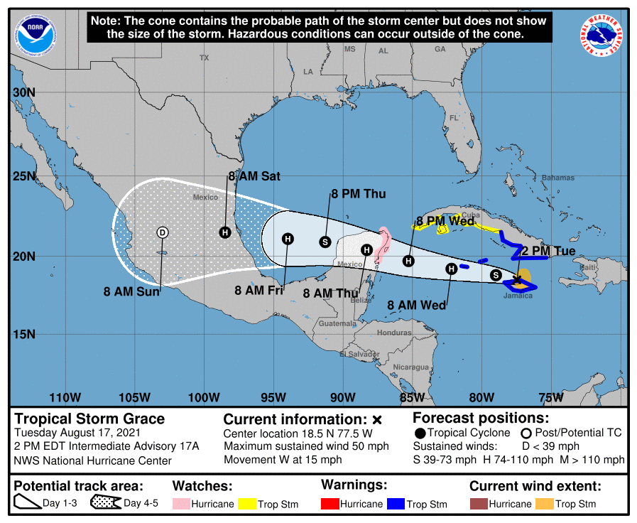
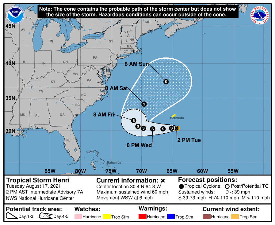
TROPICS: Fred’s remnant circulation continues to produce heavy rain and isolated tornadoes northeast of Alabama this afternoon. Elsewhere in the tropics Grace will stay well to the south, and Henri will stay well off the East Coast. There are no threats to the Central Gulf Coast through next week.
ON THIS DATE IN 1969: Hurricane Camille made landfall along the Mississippi Gulf Coast near Waveland, MS. Camille is one of only four Category 5 hurricanes ever to make landfall in the continental United States (Atlantic Basin) – the others being the 1935 Labor Day Hurricane, which impacted the Florida Keys; Hurricane Andrew in 1992, which impacted south Florida; and Hurricane Michael in 2018, which impacted the Florida panhandle. (Note: It is worth mentioning that the 1928 San Felipe Hurricane made landfall as a Category 5 Hurricane on Puerto Rico)
Camille ranks as the 2nd most intense hurricane to strike the continental US with 900 mb pressure and landfall intensity of 150 knots. Camille ranks just below the 1935 Labor Day Hurricane with 892 mb and 160 knots, while slightly stronger than Hurricane Andrew with 922 mb and 145 knots and Hurricane Michael with 919 mb and 140 knots. The actual maximum sustained winds of Hurricane Camille are not known as the hurricane destroyed all the wind-recording instruments in the landfall area. Re-analysis data found peak winds of 150 knots (roughly 175 mph) along the coast. A devastating storm surge of 24.6 feet occurred west of our area in Pass Christian, MS.
BEACH FORECAST: Click here to see the AlabamaWx Beach Forecast Center page.
WEATHER BRAINS: Don’t forget you can listen to our weekly 90 minute show anytime on your favorite podcast app. This is the show all about weather featuring many familiar voices, including our meteorologists here at ABC 33/40.
CONNECT: You can find me on all of the major social networks…
Look for the next Weather Xtreme video here by 6:00 a.m. tomorrow…
Category: Alabama's Weather, ALL POSTS, Weather Xtreme Videos
About the Author (Author Profile)
James Spann is one of the most recognized and trusted television meteorologists in the industry. He holds the AMS CCM designation and television seals from the AMS and NWA. He is a past winner of the Broadcast Meteorologist of the Year from both professional organizations.Subscribe
If you enjoyed this article, subscribe to receive more just like it.


