

Dry Air Returns To Alabama Wednesday
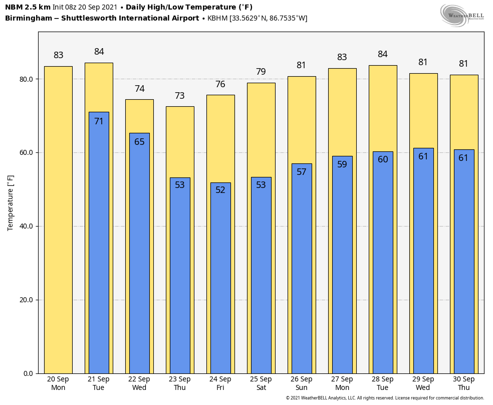
WET AT TIMES THROUGH TOMORROW: A flash flood watch remains in effect for roughly the northern half of Alabama as very moist air remains parked over the state. Look for occasional showers and a few thunderstorms through tomorrow night, with heavier rain totals over North Alabama. The ground is saturated, so a few flooding problems could develop as the showers will be very efficient rain producers. Additional rain amounts of 1-2 inches are possible in the flash flood watch area over the next 48 hours. Otherwise, look for mostly cloudy weather today and tomorrow with a high today in the upper 70s, followed by low 80s tomorrow.
MAJOR CHANGE WEDNESDAY: A cold front will push through Alabama early in the day Wednesday. Showers will end by mid-morning, and the sky becomes partly sunny by afternoon with a fresh north breeze and lowering humidity levels. Then, we expect picture perfect fall weather Thursday through the weekend with sunny pleasant days and clear cool nights. Early morning temperatures will drop into the 45-55 degree range early Thursday and Friday morning, easily the coolest so far this season. Colder spots across North Alabama could see low 40s early Friday morning.. you might even need a jacket or sweater. The weather will be perfect for high school football games across the state Thursday and Friday night with clear and cool conditions. Highs will be in the 70s Thursday, Friday and Saturday, followed by low 80s Sunday.
NEXT WEEK: A dry pattern will continue for most of the week. A cold front could bring a few isolated showers at mid-week Wednesday… otherwise expect mostly sunny days and fair nights; highs will be in the low 80s with lows mostly in the low 60s. See the Weather Xtreme video for maps, graphics, and more details.
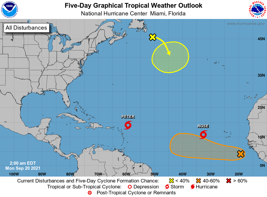
TROPICS: Tropical Storms Peter and Rose in the Atlantic are weak, disorganized, and won’t get close to the U.S. A tropical wave coming off the coast of Africa has a medium chance of developing over the next five days as it moves west/northwest… too early to know if this will impact the Lesser Antilles or the U.S. And, the remnants of Odette are drifting south over the North Atlantic this week; some chance it gains tropical characteristics again, but it is no threat to land one way or another.
There are no systems threatening the central Gulf Coast for the next 10 days.
WEEKEND RAIN: Here are some storm totals across North Alabama over the weekend…
Athens 7.54″
Trinity 7.45″
Bluff Park 5.72″
Redstone Arsenal (Huntsville) 5.56″
Waterloo 5.52″
Black Creek 4.91″
Grayson Valley 5.41″
Moulton 4.78″
Pelham 4.37″
Dunnavant 4.25″
Arley 4.05″
Gadsden 3.50″
Steele 2.62″
ON THIS DATE IN 1909: A large and deadly Category 3 hurricane made landfall near Grand Isle, Louisiana during the late evening hours. The states of Louisiana and Mississippi showed catastrophic damage resulting in 371 deaths.
BEACH FORECAST: Click here to see the AlabamaWx Beach Forecast Center page.
WEATHER BRAINS: Don’t forget you can listen to our weekly 90 minute show anytime on your favorite podcast app. This is the show all about weather featuring many familiar voices, including our meteorologists here at ABC 33/40.
CONNECT: You can find me on all of the major social networks…
Look for the next Weather Xtreme video here by 3:00 this afternoon… enjoy the day!
Category: Alabama's Weather, ALL POSTS, Weather Xtreme Videos
About the Author (Author Profile)
James Spann is one of the most recognized and trusted television meteorologists in the industry. He holds the AMS CCM designation and television seals from the AMS and NWA. He is a past winner of the Broadcast Meteorologist of the Year from both professional organizations.Subscribe
If you enjoyed this article, subscribe to receive more just like it.


