Sunny Tomorrow; Rain Returns Late Wednesday Night
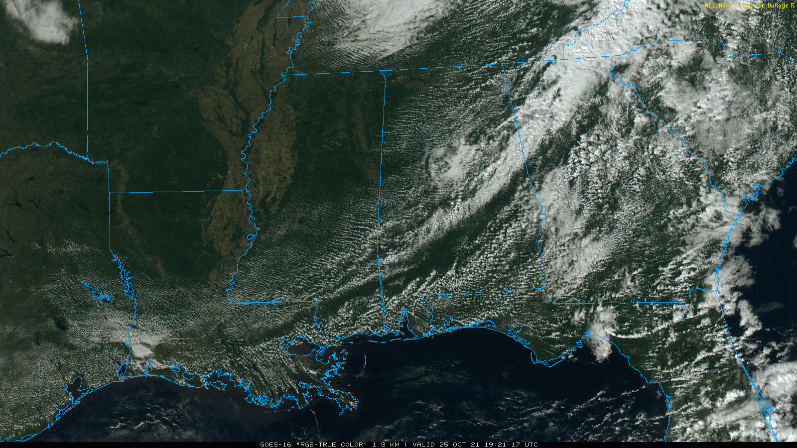
RADAR CHECK: Showers are pretty much out of the state this afternoon… we are seeing just a few patches of drizzle over East Alabama. The sky is clearing over the northwest counties, and all of the state will be clear tonight. We expect a low in the upper 40s for most places early tomorrow morning.
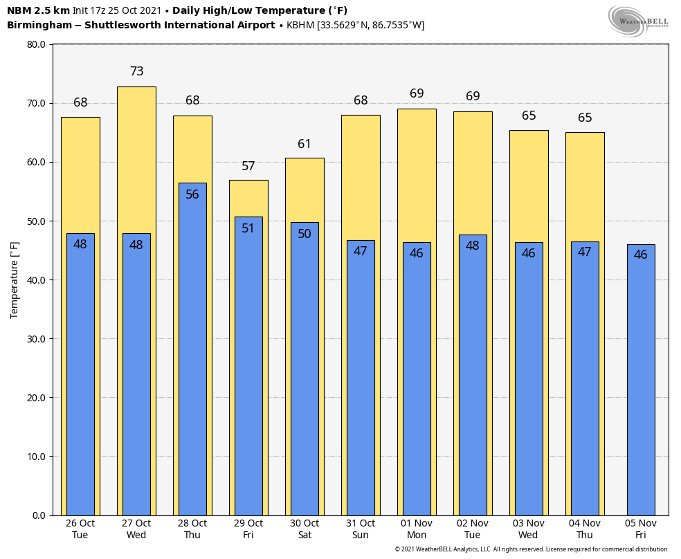
Tomorrow will be a picture perfect autumn day, with sunshine in full supply along with a high around 70 degrees.
RAIN RETURNS: Clouds will increase during the day Wednesday ahead of a dynamic weather system that will bring widespread rain to the state late Wednesday night into Thursday morning. The most significant rain will likely fall from about midnight Wednesday night until noon Thursday, although light rain will continue at times through Thursday night.
SPC maintains a “slight risk” (level 2/5) of severe thunderstorms for much of Mobile County, and the eastern shore of Mobile Bay for Wednesday night, with a “marginal risk” (level 1/5) as far north as Butler, Monroeville, and Brewton. A few storms over far Southwest Alabama could produce gusty winds, and an isolated tornado can’t be ruled out.
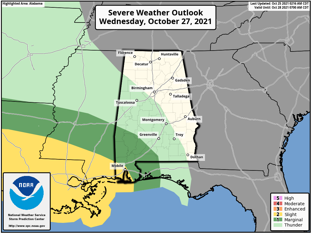
But, for most of the state there won’t be any surface based instability, and no threat of severe storms. Rain amounts Wednesday night into Thursday morning will be generally in the 1/2 to 3/4 inch range.
The high Wednesday will be in the low 70s, but temperatures will hover in the low 60s all day Thursday with clouds and rain.
FRIDAY AND THE WEEKEND: A deep upper low just northeast of Alabama Friday will keep clouds over much of the state, with a few periods of light rain likely. It will feel more like winter Friday with temperatures holding in the 50s all day. Then, on Saturday, we will forecast gradual clearing. The day should be mostly sunny for South Alabama, but clouds could linger over the northern counties much of the day. Sunday will be a day with a sun filled sky as dry air takes over. The high Saturday will be in the low 60s, followed by a high near 70 Sunday afternoon.
NEXT WEEK: For now the week looks dry with temperatures below average… highs mostly in the 60s and low in the 40s. See the Weather Xtreme video for maps, graphics, and more details.
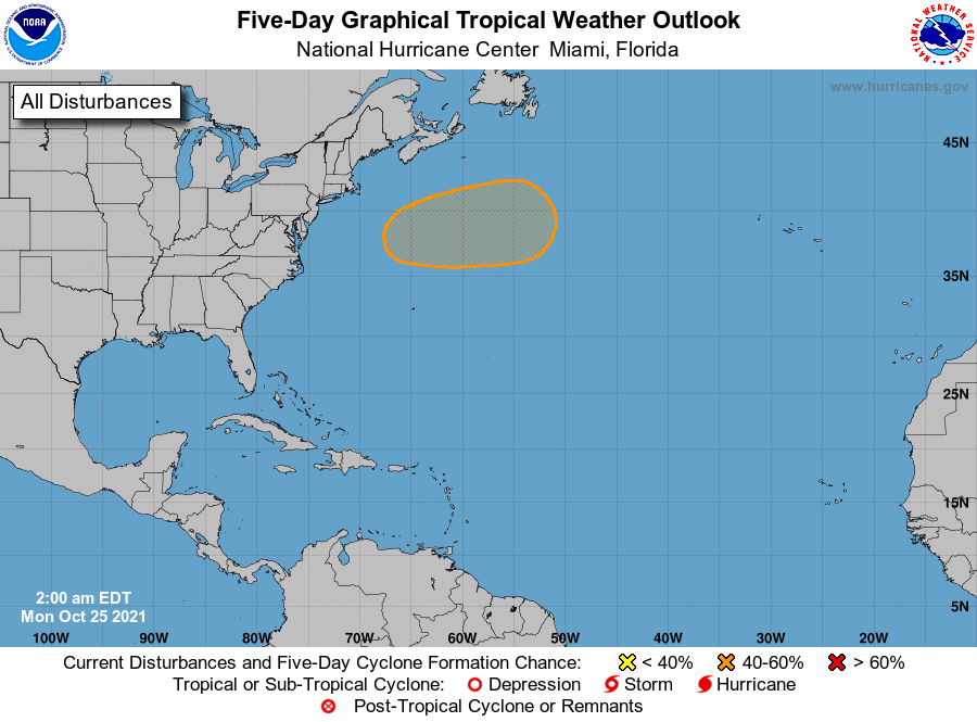
TROPICS: The Atlantic basin is quiet this afternoon. A deep, non tropical low (a nor’easter) will form by mid-week off the upper Atlantic Coast, there is some chance it acquires some tropical characteristics as it moves eastward over the open water of the North Atlantic, but it won’t be a threat to land.
RAIN UPDATE: Here are rain totals for the year so far, and the departure from average…
Mobile 74.31″ (+18.15″)
Birmingham 63.12″ (+16.39″)
Tuscaloosa 61.27″ (+18.18″)
Huntsville 57.41″ (+14.05″)
Dothan 54.98″ (+10.41″)
Muscle Shoals 54.95″ (+11.14″)
Montgomery 49.18″ (+7.50″)
Anniston 41.45″ (=0.71″)
ON THIS DATE IN 1921: A devastating category 3 hurricane struck near Tarpon Springs, Florida. The storm caused 8 fatalities and is the latest in the calendar year a category 3 hurricane or stronger made landfall in the US.
ON THIS DATE IN 2017: The high temperatures in Denver, Colorado was 84 degrees. By the morning hours on the 27th, the temperature fell to 13 degrees, a 71-degree change.
BEACH FORECAST: Click here to see the AlabamaWx Beach Forecast Center page.
WEATHER BRAINS: Don’t forget you can listen to our weekly 90 minute show anytime on your favorite podcast app. This is the show all about weather featuring many familiar voices, including our meteorologists here at ABC 33/40.
CONNECT: You can find me on all of the major social networks…
Look for the next Weather Xtreme video here by 6:00 a.m. tomorrow…
Category: Alabama's Weather, ALL POSTS, Weather Xtreme Videos
About the Author (Author Profile)
James Spann is one of the most recognized and trusted television meteorologists in the industry. He holds the AMS CCM designation and television seals from the AMS and NWA. He is a past winner of the Broadcast Meteorologist of the Year from both professional organizations.Subscribe
If you enjoyed this article, subscribe to receive more just like it.


