Mild Again Tomorrow… Showers Thursday, Then Cooler
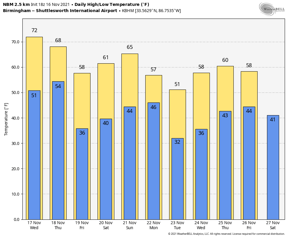
MILD NOVEMBER AFTERNOON: The sky is partly to mostly sunny across Alabama this afternoon with temperatures in the 70-75 degree range… the average high for Birmingham on November 16 is 65. Tonight will be mostly fair with a low in the 48-55 degree range.
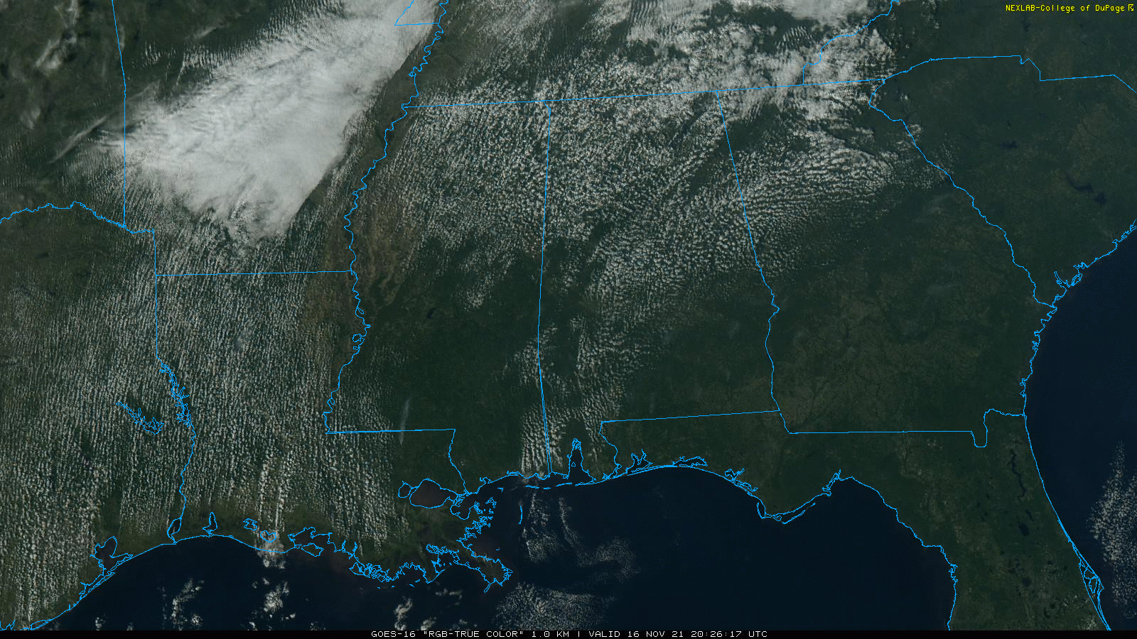
The high tomorrow will rise back into the low to mid 70s with a partly to mostly sunny sky. But, it will be the last day with a high in the 70s for a while. Clouds return Thursday ahead of a cold front, and a few showers will likely pass thorough Thursday afternoon. Moisture will be limited, and rain amounts should be 1/4″ or less for most places. The high Thursday will be in the mid 60s.
FRIDAY AND THE WEEKEND: Friday will be sunny and cooler with a high in the upper 50s for most places. Sunny weather continues Saturday… after a low in the 30s the high will be in the mid 60s, perfect college football weather. Sunday will be partly sunny with a high in the upper 60s… clouds will increase Sunday night.
THANKSGIVING WEEK: Monday will be cloudy and cooler with a chance of showers as another cold front passes through… the high will drop into the low to mid 50s. Then, cool, dry weather will continue Tuesday and Wednesday. The latest global model set suggests there will be some risk of rain Thanksgiving Day for the northern third of Alabama… See the Weather Xtreme video for maps, graphics, and more details.
RAIN UPDATE: Here are rain totals since January 1, and the departure from average…
Mobile 77.58″ (+18.20″)
Birmingham 64.01″ (+14.45″)
Tuscaloosa 62.55″ (+16.45″)
Huntsville 58.30″ (+12.26″)
Muscle Shoals 56.74″ (+10.37″)
Dothan 56.69″ (+9.79″)
Montgomery 50.96″ (+6.84″)
Anniston 43.13″ (-2.08″)
ON THIS DATE IN 1989: Snow squalls moved across North Alabama with temperatures in the low 30s, making for challenging conditions for tornado recovery efforts in Huntsville. The day before an F4 tornado tore through the southern part of the city, killing 21 people and injuring almost 500.
ON THIS DATE IN 2006: An early morning F3 tornado killed eight people, injured 20 others and left 100 people homeless in Riegelwood, North Carolina. This storm was the second deadliest tornado in the state in the past 50 years.
ON THIS DATE IN 2011: An EF-1 tornado touched down in northeast Macon County near Notasulga… it continued northeastward into Lee County and caused extensive tree damage which resulted in damage to dozens of homes and mobile homes on the western side of Auburn. Several residences were totally destroyed. The tornado crossed the southern edge of Auburn University’s Campus and caused damage to homes and the baseball facilities at Auburn High School. The tornado moved across Lake Harding and into Georgia. The tornado moved across Harris County Georgia for another 26 miles and strengthened to an EF2. The total tornado path length was 59 miles long.
BEACH FORECAST: Click here to see the AlabamaWx Beach Forecast Center page.
WEATHER BRAINS: Don’t forget you can listen to our weekly 90 minute show anytime on your favorite podcast app. This is the show all about weather featuring many familiar voices, including our meteorologists here at ABC 33/40.
CONNECT: You can find me on all of the major social networks…
Look for the next Weather Xtreme video here by 6:00 a.m. tomorrow…
Category: Alabama's Weather, ALL POSTS, Weather Xtreme Videos
About the Author (Author Profile)
James Spann is one of the most recognized and trusted television meteorologists in the industry. He holds the AMS CCM designation and television seals from the AMS and NWA. He is a past winner of the Broadcast Meteorologist of the Year from both professional organizations.Subscribe
If you enjoyed this article, subscribe to receive more just like it.


