Dry, Mild Today; Windy Tomorrow With Strong Storms By Late Afternoon
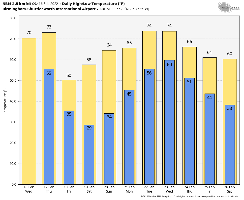
ONE MORE DRY DAY: With a partly sunny sky, temperatures rise to near 70 degrees across Alabama this afternoon for a another nice spring preview. The average high for Birmingham on February 16 is 59. Clouds will thicken across the region tonight.
SEVERE STORMS POSSIBLE LATE TOMORROW: We expect an active weather day tomorrow for Alabama ahead of a dynamic storm system. SPC has defined a “slight risk” (level 2/5) of severe thunderstorms for areas west of a line from Weiss Lake to Rockford to Prattville to Grove Hill. The rest of the state (East and South Alabama) is in a “marginal risk” (level 1/5).
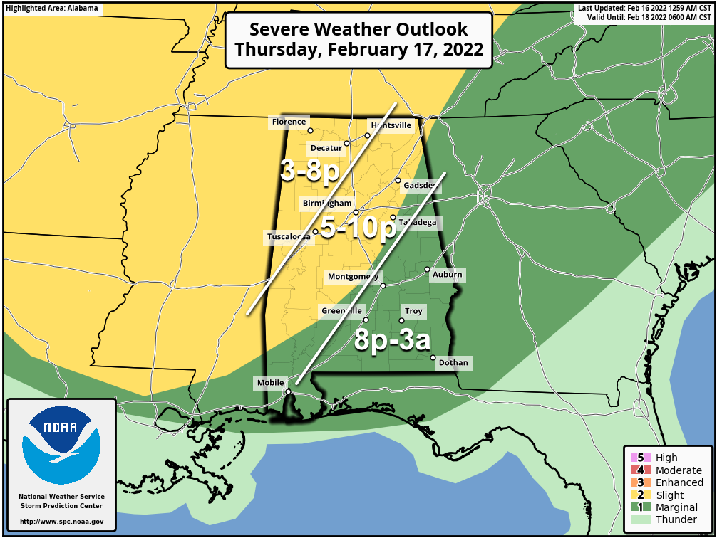
The main limiting factor tomorrow will be the lack of surface based instability. Models show only a very limited amount of CAPE (Convective Available Potential Energy), and that limit the overall threat. Should instability values be higher than models suggest, the risk will be greater. Plenty of low level shear will be available.
GRADIENT WIND: Strong south winds will develop across the state tomorrow (not related to thunderstorms) thanks to a tight pressure gradient. Winds will average 15-30 mph, with gusts to 40 mph possible. This could even bring some scattered tree and power line damage.
TIMING: The window for the heavier storms will open up around 3:00 p.m. over Northwest Alabama, with the risk expanding to the south and east tomorrow evening. For places like Birmingham, Tuscaloosa, Anniston, and Gadsden, the core threat comes from about 5:00 until 10:00 p.m.
THREATS: Heavier storms will be capable of producing strong winds and hail. A few tornadoes are possible mainly in the “slight risk” over the western half of the state.
RAIN: Rain amounts will be around one inch for most places; flooding is not expected.
This kind of day is routine for February in Alabama… this is our tornado season (November through May). Just be sure you have a reliable way of hearing warnings (never a siren!), and know your safe place.
FRIDAY AND THE WEEKEND: Friday will be a noticeably cooler day… with a clearing sky the high will be around 50 degrees. Then, for the weekend look for sunny days and a warming trend. The high Saturday will be in the upper 50s, followed by mid 60s Sunday.
NEXT WEEK: Much of next week looks wet at times. Moisture returns quickly Monday with a chance of showers, and we will have some risk of rain on a daily basis through Thursday… models suggest drier air will return by Friday (February 25)… See the Weather Xtreme video for maps, graphics, and more details.
ON THIS DATE IN 1989: A surge of arctic air on February 16-17th produced all-time record high barometric pressure readings of 31.08 inches at Duluth, Minnesota, 30.97 inches at Chicago, Illinois, and 30.94 inches at South Bend, Indiana. Readings of 31.00 inches at Milwaukee, Wisconsin, and 30.98 inches at Rockford, Illinois, tied their all-time records. Unseasonably warm weather prevailed across the southeastern U.S. Highs of 81 degrees at Athens, Georgia, 87 degrees at Charleston, South Carolina, 85 degrees at Macon, Georgia, and 86 degrees at Savannah, Georgia, were records for February.
ON THIE DATE IN 2001: A derecho (a long-lived and widespread convective wind storm) moved through Alabama. The line of storms reached the western Alabama border around 2 pm. Around the same time, a section of the squall line began to bulge out, or bow, in Pickens County. Through the next 3 hours, the derecho would move across the entire width of the state, producing wind gusts approaching 100 mph, and widespread damage similar to a F0 to F1 category. Officially recorded wind gusts include 60 mph at the Tuscaloosa and Anniston/Oxford Airports, and 68 mph at the Birmingham Airport and Gadsden/Etowah County EOC.
BEACH FORECAST: Click here to see the AlabamaWx Beach Forecast Center page.
WEATHER BRAINS: Don’t forget you can listen to our weekly 90 minute show anytime on your favorite podcast app. This is the show all about weather featuring many familiar voices, including our meteorologists here at ABC 33/40.
CONNECT: You can find me on all of the major social networks…
Look for the next Weather Xtreme video here by 3:00 this afternoon… enjoy the day!
Category: Alabama's Weather, ALL POSTS, Weather Xtreme Videos
About the Author (Author Profile)
James Spann is one of the most recognized and trusted television meteorologists in the industry. He holds the AMS CCM designation and television seals from the AMS and NWA. He is a past winner of the Broadcast Meteorologist of the Year from both professional organizations.Subscribe
If you enjoyed this article, subscribe to receive more just like it.


