Clearing, Cooler Weather For Alabama Today
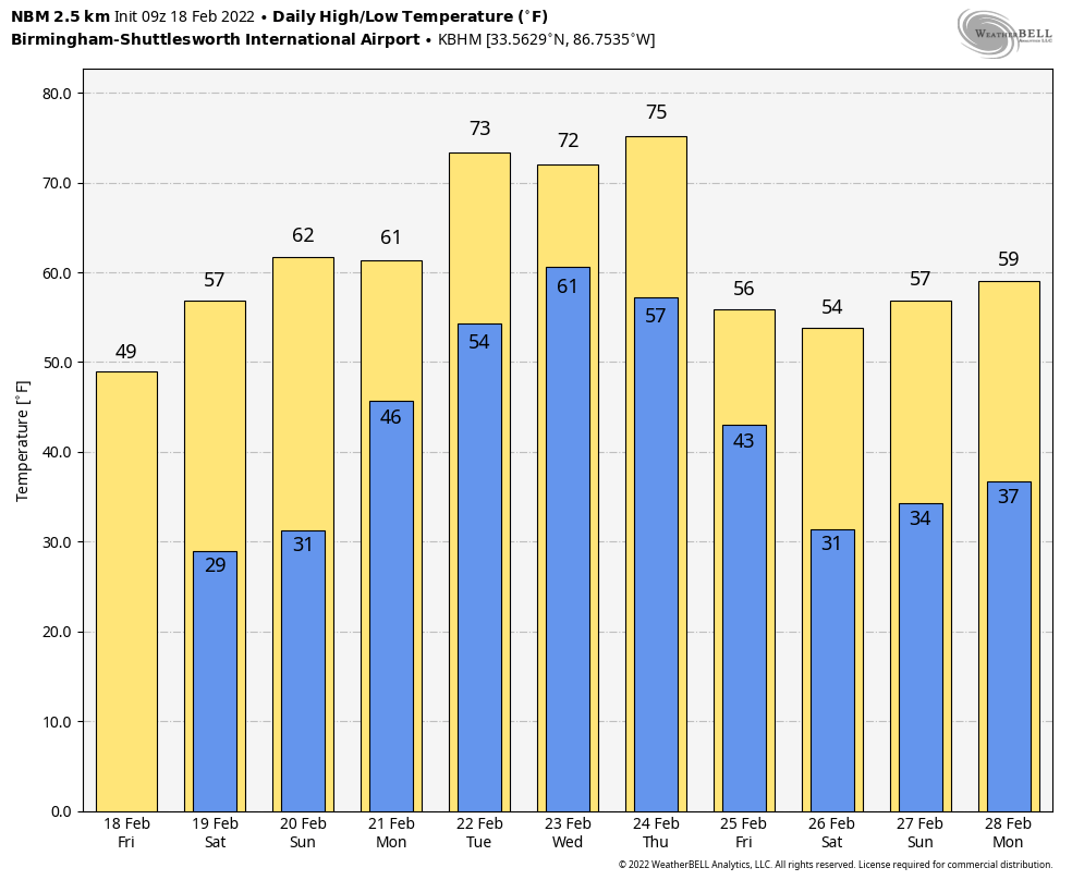
CALMER DAY: A cold front is pushing through far South Alabama early this morning… it will bring colder air down into the state today with a clearing sky. Despite sunshine this afternoon… most places north of Birmingham won’t get out of the 40s. The average high for Birmingham on February 18 is 60. Tonight will be clear and cold; temperatures will drop into the upper 20s by daybreak tomorrow.
The weekend will feature sunny days with a warming trend… the high tomorrow will be in the upper 50s, followed by low 60s Sunday.
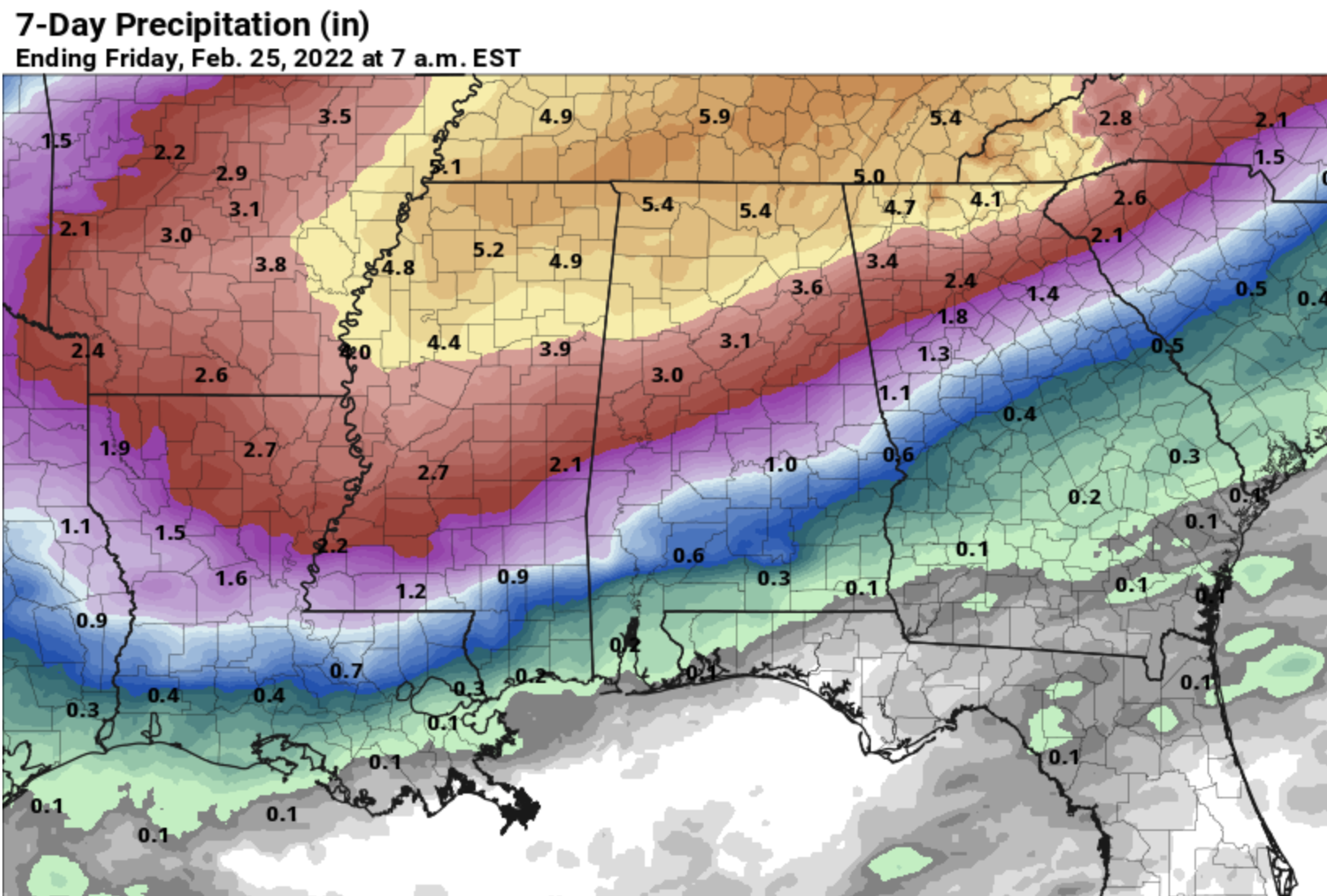
NEXT WEEK: A very wet period is likely for much of next week for Alabama and the Deep South. A northward moving warm front will bring rain into the state Monday. By Tuesday, the front should be near the Tennessee state line, and temperatures will rise into the 70s across Alabama with showers possible; the heaviest rain Tuesday should be north of the front across parts of Arkansas and Tennessee. Mild, showery weather continues Wednesday and Thursday, and then a cold front will bring a chance of stronger storms into the state Thursday night. Too early to know if this will be a severe weather setup.
Some guidance suggests rain amounts will be around 5 inches next week across the Tennessee Valley of far North Alabama, with around 3 inches for places like Tuscaloosa/Birmingham/Anniston/Gadsden. This could be some flooding issues next week… See the Weather Xtreme video for maps, graphics, and more details.
STORM SURVEYS: NWS Birmingham is sending survey teams into the field today to review damage around Boley Springs in Fayette County, Graysville in Jefferson, and along Highway 119 from Greystone to Leeds. We will know later today how many tornadoes touched down, and their rating.
ON THIS DATE IN 1992: A thunderstorm spawned a powerful F4 tornado for so far north for the time of the year in southern Van Wert County in Ohio. The tornado touched down just west of US Route 127 and traveled northeastward for about 3 miles. One house was completely leveled, and nine others experienced severe damage. Six people were injured.
ON THIS DATE IN 2021: Cold, Arctic air covered Alabama… and snow amounts of 2-5 inches were common across counties like Madison, Limestone, Morgan, Lauderdale, Cobert, Lawrence, Marion, and Winston.
BEACH FORECAST: Click here to see the AlabamaWx Beach Forecast Center page.
WEATHER BRAINS: Don’t forget you can listen to our weekly 90 minute show anytime on your favorite podcast app. This is the show all about weather featuring many familiar voices, including our meteorologists here at ABC 33/40.
CONNECT: You can find me on all of the major social networks…
Look for the next Weather Xtreme video here by 3:00 this afternoon… enjoy the day!
Category: Alabama's Weather, ALL POSTS, Weather Xtreme Videos
About the Author (Author Profile)
James Spann is one of the most recognized and trusted television meteorologists in the industry. He holds the AMS CCM designation and television seals from the AMS and NWA. He is a past winner of the Broadcast Meteorologist of the Year from both professional organizations.Subscribe
If you enjoyed this article, subscribe to receive more just like it.


