Mostly Dry Today; A Few Strong Storms Tonight/Tomorrow
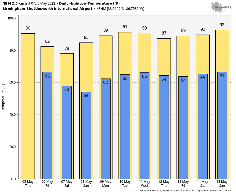
ANOTHER SUMMER-LIKE DAY AHEAD: Temperatures will rise into the 87-90 degree range across most of Alabama today… for some it will be the warmest day so far this year. The sky will be partly sunny, and any showers that form this afternoon should be few and far between.
Thunderstorms will likely push into Alabama tonight from the west ahead of a cold front, and some of the heavier ones could produce some hail and strong gusty winds. SPC has a “marginal risk” (level 1/5) in place tonight for the Tennessee Valley of North Alabama, and the far western counties of the state for this activity.
TOMORROW: Storms will likely weaken early tomorrow morning, but will increase in intensity again by mid-morning into the early afternoon hours over the eastern half of the state. Those storms will likely push into Georgia by mid-afternoon.
SPC has defined a “slight risk” (level 2/5) for areas east of a line from Fort Payne to Gadsden to Hoover to Thomasville, with a “marginal risk” (level 1/5) for the rest of the state.
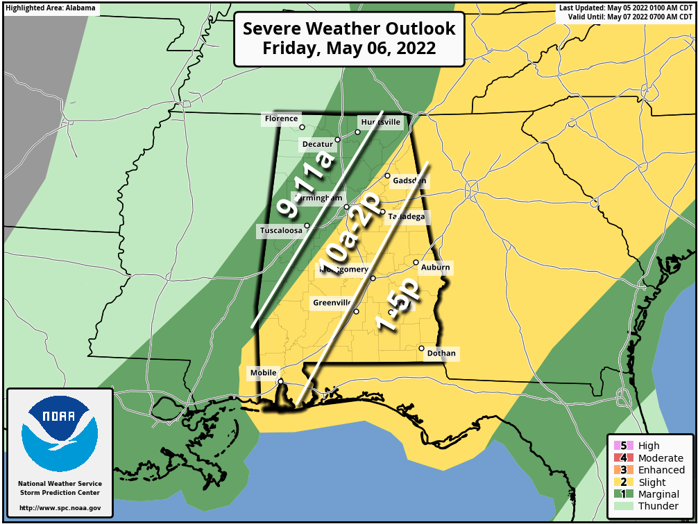
A few notes about tomorrow…
*It will not rain all day. The sun could break out at times.
*We are not expecting any tornadoes, based on forecast wind profiles. The main threat with heavier storms will come from hail and strong, gusty winds
*Higher severe thunderstorm probabilities will be over the eastern half of the state during the midday and early afternoon hours (9am-2pm)
*A few scattered showers could form late tomorrow afternoon and evening ahead of the cold front over North Alabama, but there is little instability available by then.
*Most of Alabama will be dry tomorrow night.
The high tomorrow will be in the 77-81 degree range for most communities.
MOTHERS DAY WEEKEND: The weather will be dry and pleasant. Saturday will feature a partly sunny sky with a high in the mid to upper 70s… Sunday will be a sunny day with a high between 80 and 85 degrees.
NEXT WEEK: The weather stays dry Monday through Wednesday… a few showers could return Thursday and Friday as moisture levels rise from the east. Temperatures will be close to 90 by mid-week, giving us another summer preview. See the Weather Xtreme video for maps, graphics, and more details.
ON THIS DATE IN 1933: Early in the morning of May 5, 1933, a tornado that was at times a third of a mile wide swept through Bibb and Shelby counties. It carved a track 35 miles long, and killed 20 people as they slept. Of those deaths, 14 came in Helena, where rescue efforts were hampered by the darkness and the heavy rains that followed the twister. It has been categorized by the NWS as an F4, and destroyed most of the town of Helena… it roared through at 2:30 a.m.
ON THIS DATE IN 1995: A supercell thunderstorms brought torrential rains and large hail up to four inches in diameter to Fort Worth, Texas. This storm also struck a local outdoor festival known as the Fort Worth Mayfest. At the time the storm was the costliest hailstorm in the history of the US, causing more than $2 billion in damage.
BEACH FORECAST: Click here to see the AlabamaWx Beach Forecast Center page.
WEATHER BRAINS: Don’t forget you can listen to our weekly 90 minute show anytime on your favorite podcast app. This is the show all about weather featuring many familiar voices, including our meteorologists here at ABC 33/40.
CONNECT: You can find me on all of the major social networks…
Look for the next Weather Xtreme video here by 3:00 this afternoon… enjoy the day!
Category: Alabama's Weather, ALL POSTS, Weather Xtreme Videos
About the Author (Author Profile)
James Spann is one of the most recognized and trusted television meteorologists in the industry. He holds the AMS CCM designation and television seals from the AMS and NWA. He is a past winner of the Broadcast Meteorologist of the Year from both professional organizations.Subscribe
If you enjoyed this article, subscribe to receive more just like it.


