Another Hot Summer Day With Scattered Strong Storms This Afternoon
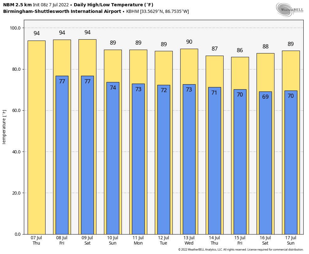
AIR YOU CAN WEAR: The typical summer weather pattern continues across Alabama today. Hot, humid, and random, scattered showers and storms around during the afternoon and evening hours. Highs will be mostly in the mid 90s, and a “heat advisory” remains in effect for about the northern 2/3 of the state, where some spots could see the heat index touching 105 this afternoon. An “excessive heat warning” remains in effect for Lauderdale, Colbert, Limestone, and Madison counties, where the heat index could briefly touch 110 before afternoon storms form. But understand it will be hot and humid statewide.
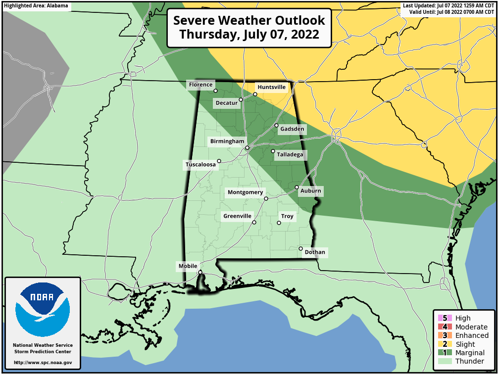
We note SPC has defined a “slight risk” (level 2/5) of severe thunderstorms for the northeast corner of the state today, with a “marginal risk” (level 1/5) down to Russellville, Birmingham, and Phenix City. There is potential for a few wet microbursts this afternoon (localized areas of strong straight line winds) with stronger storms that form.
Not much change tomorrow; the weather will be partly sunny, hot, and humid with highs in the in the mid 90s along with random, scattered afternoon thunderstorms around.
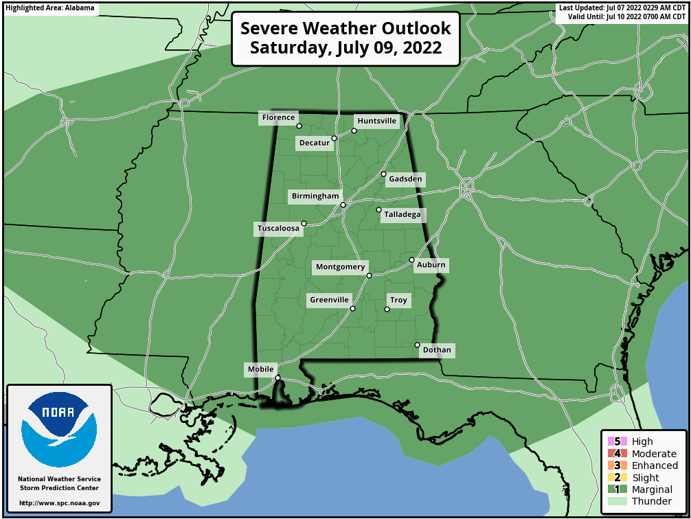
THE ALABAMA WEEKEND: Heat levels should become to come down as the core of the upper high shifts to the west. Highs will be in the 88-92 degree range Saturday and Sunday… we will have a mix of sun and clouds both days with a higher coverage of showers and thunderstorms. Still, it won’t everywhere, but any one spot stands a 60-70 percent chance of seeing at least one shower or storm over the weekend. We note SPC has all of Alabama in a “marginal risk” (level 1/5) of severe storms Saturday… again the main threat will come from strong gusty winds with heavier storms.
NEXT WEEK: For now it looks like highs will hold in the 88-92 degree range most days with the usual chance of afternoon and evening thunderstorms in scattered spots. The most intense heat in the nation shifts to the western states… See the daily Weather Briefing video for maps, graphics, and more details.
TROPICS: All remains very quiet across the Atlantic basin, and tropical storm formation is not expected through the weekend.
ON THIS DATE IN 1905: The mercury soared to 127 degrees at Parker, Arizona to tie the state record established at Fort Mohave on the 15th of June in 1896. The current record for Arizona is 128 degrees set in Lake Havasu City on 6-29-1994.
ON THIS DATE IN 2004: A tornado occurred in the Rockwell Pass area of Sequoia National Park, California. Since the elevation of the tornado’s ground circulation was approximately 12,156 ft MSL, this is the highest-elevation tornado documented in the United States.
BEACH FORECAST: Click here to see the AlabamaWx Beach Forecast Center page.
Look for the next Weather Briefing video here by 3:00 this afternoon… enjoy the day!
Category: Alabama's Weather, ALL POSTS, Weather Xtreme Videos
About the Author (Author Profile)
James Spann is one of the most recognized and trusted television meteorologists in the industry. He holds the AMS CCM designation and television seals from the AMS and NWA. He is a past winner of the Broadcast Meteorologist of the Year from both professional organizations.Subscribe
If you enjoyed this article, subscribe to receive more just like it.


