Wet/Stormy Day Wednesday; Much Colder Air Arrives Late This Week
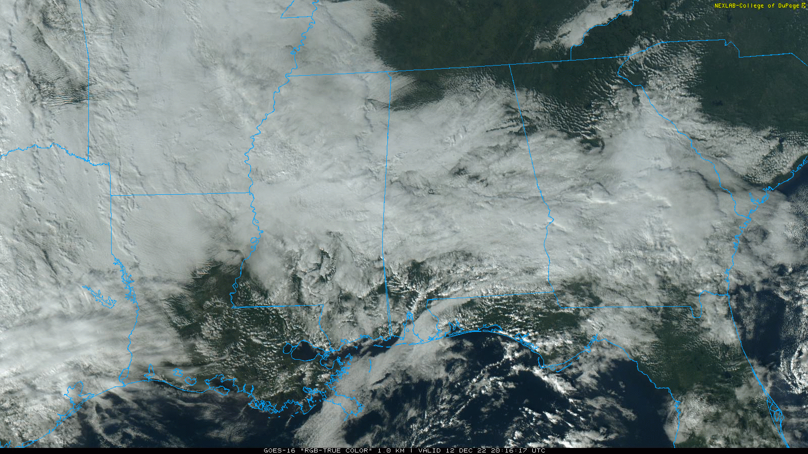
RADAR CHECK: While the sky is mostly cloudy, there is basically no rain on radar across Alabama at mid-afternoon. Temperatures range from the 50s over the northern counties, to around 70 at Mobile. There are some breaks in the overcast in spots, but the sky will be mostly cloudy tonight.
We don’t expect much change tomorrow; a mostly dry day for the state with more clouds than sun. Highs will be generally in the 60s.
ACTIVE DAY WEDNESDAY: A dynamic storm system will bring the risk of heavy rain and strong thunderstorms to Alabama Wednesday. SPC has defined a “slight risk” (level 2/5) for areas south of a line from York to Greenville to Abbeville, and a “marginal risk” as far north as Eutaw, Montgomery, and Eufaula.
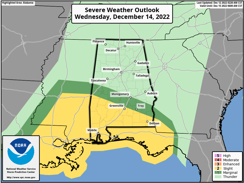
Thunderstorms over the southern third of the state Wednesday will have some tornado potential as veering/increasing flow with height anticipated across the area will be favorable for supporting evolution of rotating updrafts/supercells. For now it looks like the core severe weather threat for South Alabama Wednesday will come from about 4:00 p.m until 10:00 p.m.
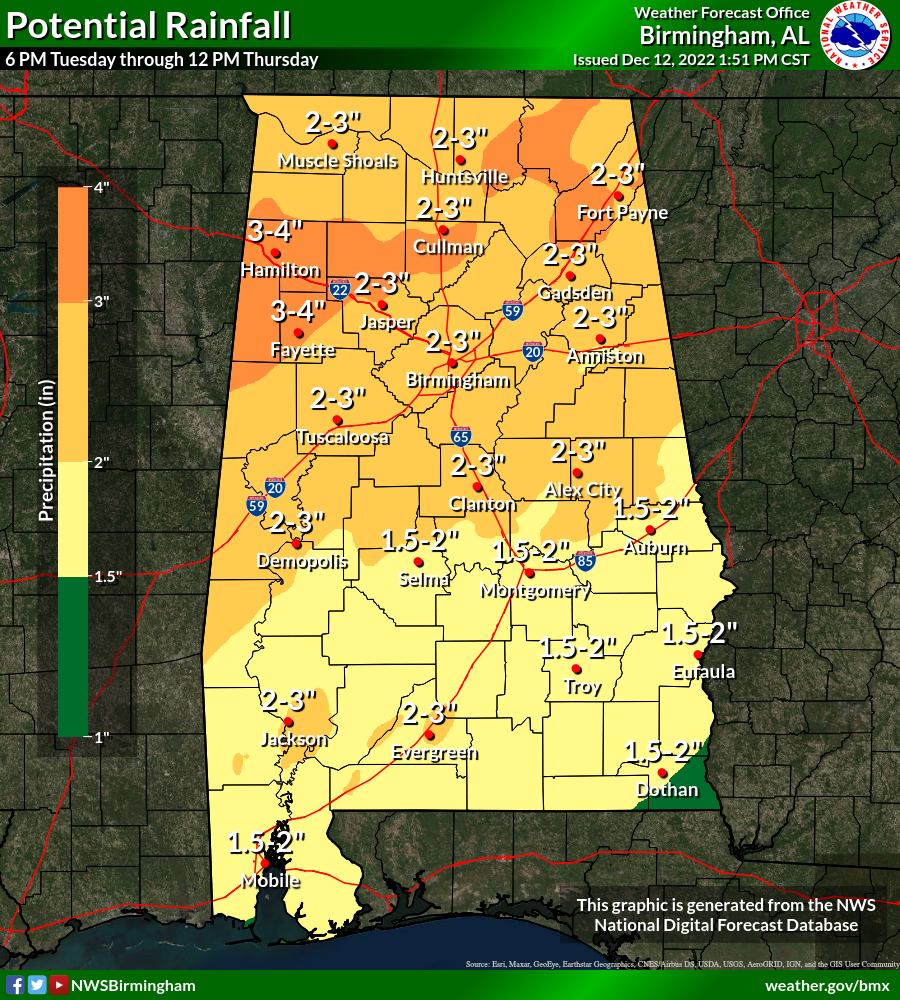
The lack of surface based instability means that storms over North Alabama will likely remain below severe limits, but heavy rain is possible statewide, with amounts of 2-3 inches very possible. Some flooding issues could evolve by afternoon.
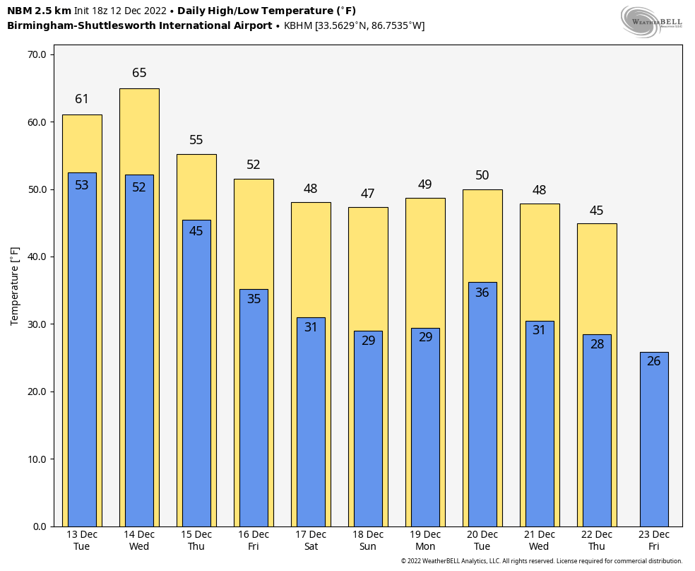
Rain will end very early Thursday morning, followed by a clearing sky along with temperatures holding in the 50s with a cool north wind.
FRIDAY AND THE WEEKEND: Friday and Saturday will be dry and colder. The high Friday will be 50s, and in the 46-51 degree range Saturday. Temperatures go below freezing Saturday morning for the first time since December 1. Sunday looks cold and dry… the high will be in the 40s over North Alabama, with 50s for the southern counties of the state.
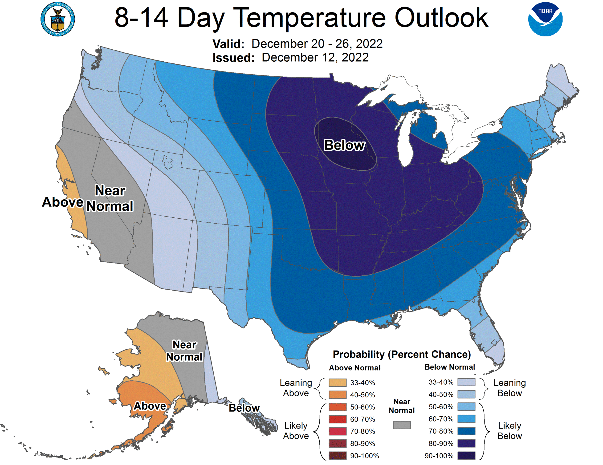
NEXT WEEK: Forecast confidence is low concerning specific weather events with a complex pattern in place; some rain is possible early in the week based on the reliable European global model. It is likely that temperatures through the week will remain below average as a cold pattern develops for much of the continuous U.S. There is potential for a cross-polar flow to develop next week, which will keep temperatures here below average through Christmas. See the daily Weather Briefing video for maps, graphics, and more details.
ON THIS DATE IN 1967: From December 12th through the 20th a series of snowstorms buries Flagstaff, Arizona with nearly 85 inches of snow.
BEACH FORECAST: Click here to see the AlabamaWx Beach Forecast Center page.
Look for the next Weather Briefing video here by 6:00 a.m. tomorrow…
Category: Alabama's Weather, ALL POSTS, Weather Xtreme Videos
About the Author (Author Profile)
James Spann is one of the most recognized and trusted television meteorologists in the industry. He holds the AMS CCM designation and television seals from the AMS and NWA. He is a past winner of the Broadcast Meteorologist of the Year from both professional organizations.Subscribe
If you enjoyed this article, subscribe to receive more just like it.


