Scattered Light Rain Through Tomorrow; Soaking Rain Thursday
RADAR CHECK: Rain is falling in the vicinity of a cold front over the northwest corner of Alabama early this morning; the rest of the state is cloudy. We note a dense fog advisory is in effect for much of East and South Alabama, where visibility is very restricted.
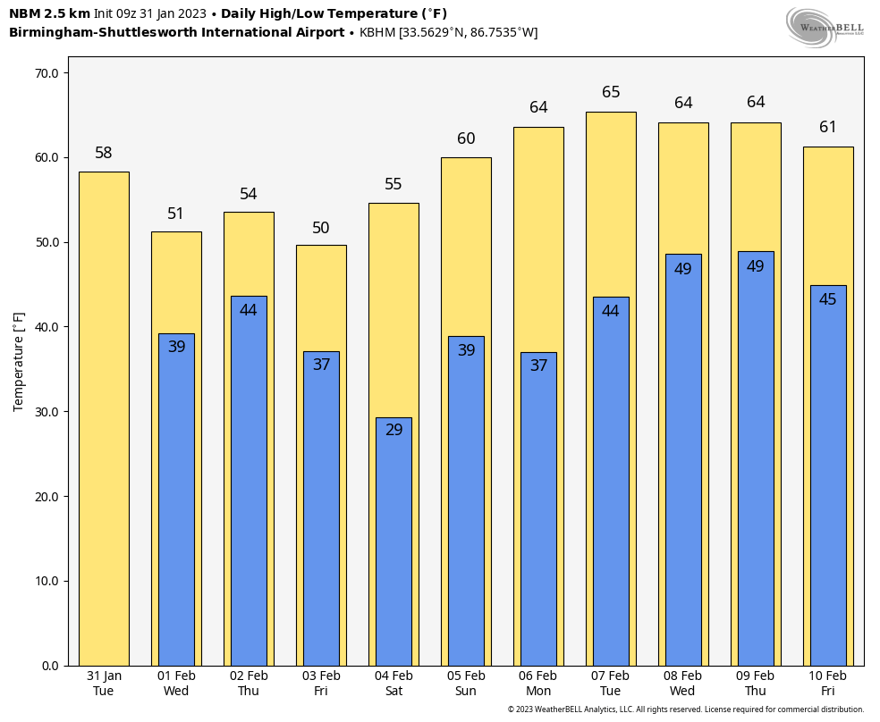
Today will be cloudy with some scattered light rain. There will be a big thermal range as the front sags southward… temperatures in the Shoals could fall into the 30s today, while Mobile and Dothan will enjoy a high in the 70s. For much of the state we are expecting 50s and 60s.
ICE IS NOT NICE: An ice storm warning remains in effect for parts of West Tennessee (including Memphis), extreme Northwest Mississippi, and Arkansas where freezing rain will bring ice accumulation and potential for major travel impact and power outages. It will be a very close fall for far North Alabama (communities near the Tennessee state line) tonight and tomorrow morning, where light rain will fall with temperatures in the 31-35 degree range. For now there are no advisories in effect for any parts of Alabama; if freezing rain develops warm soil temperatures should help to mitigate any big problems, but if you are driving in that area just know some patchy bridge icing can’t be ruled out.
Tomorrow will be cloudy with some light rain possible; temperatures will be in the 30s and 40s over North Alabama, with 50s and 60s over the southern counties of the state as the big contrast continues. Then, expect a soaking rain Thursday and Thursday night as the main storm system to the west lifts out. Rain amounts of 1-2 inches are likely over the northern 2/3 of the state, with 1/2 to 1 inch for far South Alabama.
We note SPC has introduced a “marginal risk” (level 1/5) of severe thunderstorms Thursday for areas near the Gulf Coast… a few storms there could produce gusty winds, and there is a low end threat of a brief tornado or two.
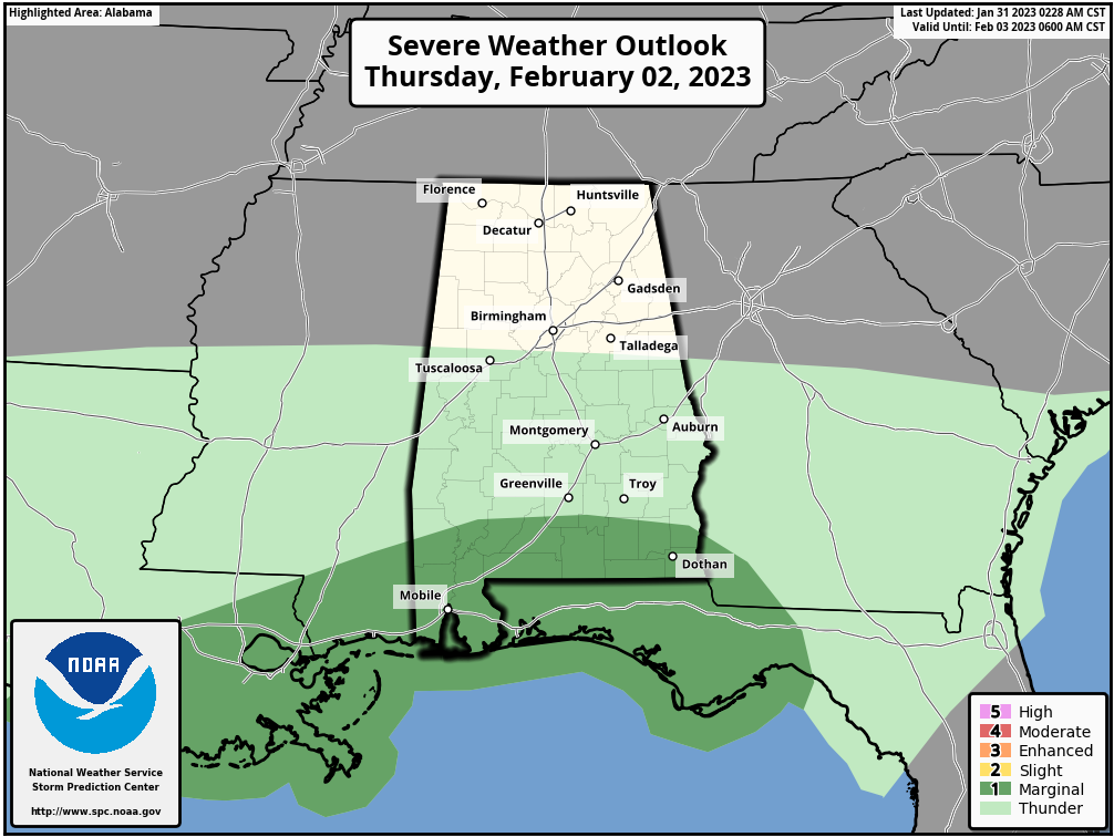
But, for most of Alabama, there will be little to no thunder Thursday with a cool, stable airmass in place.
FRIADY AND THE WEEKEND: Dry air returns. Expect a good supply of sunshine Friday and Saturday; the high Friday will be in the 40s over North Alabama, with 50s to the south. Then, on Saturday, highs will be in the 50s and 60s after a cold start. A disturbance will bring scattered clouds Sunday, but at this point the air looks too dry for any meaningful rain. A few isolated showers could form near the Georgia border, but most of the state should be dry with a. mix of sun and clouds.
NEXT WEEK: The weather looks dry and mild Monday and Tuesday; a front will bring a chance of showers, and possibly a thunderstorm, by Wednesday and Thursday. Temperatures should be above average through the week… See the daily Weather Briefing video for maps, graphics, and more details.
ON THIS DATE IN 1979: A winter storm that started on the previous day and ended on this day spread 2 to 4 inches of rainfall in 24 hours over much of coastal Southern California and two inches of snow in Palm Springs. Snow fell heavily in Palm Springs, and 8 inches fell at Lancaster. All major interstates into Los Angeles were closed. Snow drifts shut down Interstate 10 on both sides of Palm Springs, isolating the city.
BEACH FORECAST: Click here to see the AlabamaWx Beach Forecast Center page.
Look for the next Weather Briefing video here by 3:00 this afternoon…
Category: Alabama's Weather, ALL POSTS, Weather Xtreme Videos
About the Author (Author Profile)
James Spann is one of the most recognized and trusted television meteorologists in the industry. He holds the AMS CCM designation and television seals from the AMS and NWA. He is a past winner of the Broadcast Meteorologist of the Year from both professional organizations.Subscribe
If you enjoyed this article, subscribe to receive more just like it.


