Big Temperature Contrast Again Today; Soaking Rain Tomorrow
THIS MORNING: A cold front bisects Alabama early this morning… temperatures are in the 30s and 40s north of the front, mild air is south of front with 60s across much of Southeast Alabama. Some light rain and drizzle continues in the cold air north of the front, and a winter weather advisory remains in effect for Colbert, Lauderdale, and Limestone counties. Thankfully temperatures there are generally a degree or two above freezing, but still watch for patchy bridge ice through mid-morning across the northwest corner of the state.
We have potential for some patchy light rain/drizzle through the day, but the more meaningful precipitation will unfold west of Alabama, where winter storm and ice storm warnings are in effect for much of Texas, Arkansas, and West Tennessee. Temperatures today won’t get out of the 40s across North Alabama, but communities near the Gulf Coast will see low 70s.
As the main upper trough lifts out of the southwest U.S… we expect a big soaking for the northern 2/3 of the state tomorrow and tomorrow night. With rain amounts of 1-2 inches. Amounts will be lighter over the southern quarter of the state, but a few strong storms are possible there during the afternoon and evening hours; SPC has defined a “marginal risk” (level 1/5) for areas south of a line from Jackson to Evergreen to Ozark.
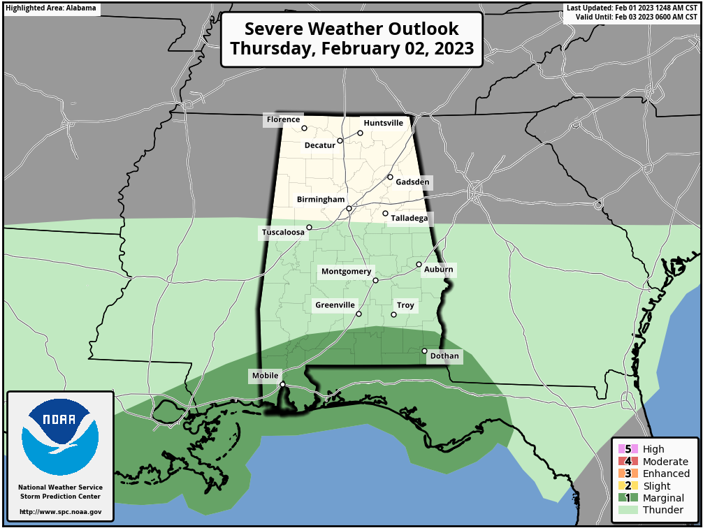
Storms across far South Alabama tomorrow afternoon/evening could produce gusty winds, and a brief, isolated tornado can’t be ruled out. But, for most of Alabama, it will be just rain in a cool, stable airmass.
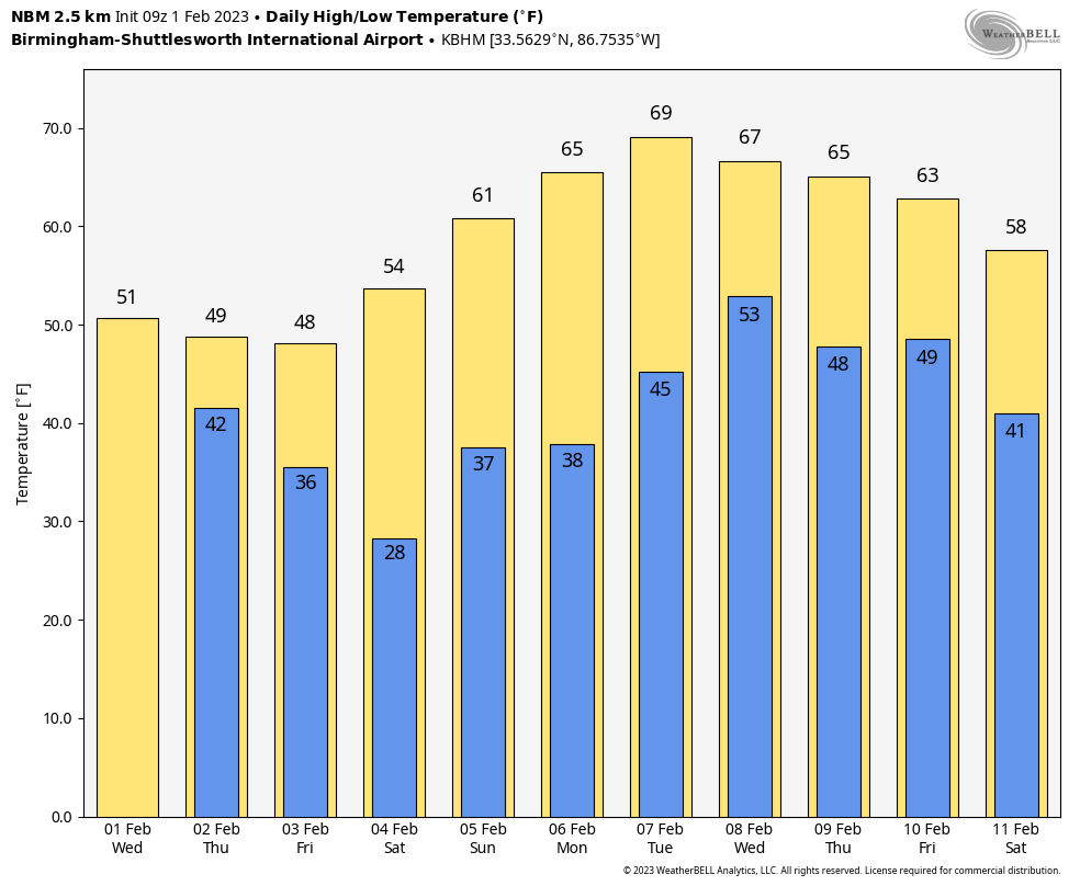
FRIDAY AND THE WEEKEND: Dry weather returns. The sky becomes mostly sunny Friday, and the weekend looks dry with a sunny sky Saturday, and a partly sunny sky Sunday. The high on Friday will be in the 40s and 50s, followed by 50s and 60s over the weekend.
NEXT WEEK: Monday and Tuesday will be dry and mild with highs in the 60s over North Alabama, with 70s to the south. There will be some risk of rain in the Wednesday-Thursday time frame, followed by another shot of drier air by the end of the week. Still no sign of any bitterly cold Arctic air for the Deep South through mid-February. See the daily Weather Briefing video for maps, graphics, and more details.
ON THIS DATE IN 1955: Seen first as a “well-defined cone-shaped funnel” over the Mississippi River, this F3 tornado cut a path from Commerce Landing to Clark in northeastern Mississippi. This tornado killed 20 and injured at least 141 individuals. Most of the deaths were in a plantation school.
ON THIS DATE IN 1996: A period of freezing rain followed by light snow brought traffic to a complete standstill across North Alabama. Ice accumulations up to 1 inch downed numerous trees and caused power outages. A number of chicken houses in the northern part of the state collapsed under the weight of the ice and snow.
BEACH FORECAST: Click here to see the AlabamaWx Beach Forecast Center page.
Look for the next Weather Briefing video here by 3:00 this afternoon… enjoy the day!
Category: Alabama's Weather, ALL POSTS, Weather Xtreme Videos
About the Author (Author Profile)
James Spann is one of the most recognized and trusted television meteorologists in the industry. He holds the AMS CCM designation and television seals from the AMS and NWA. He is a past winner of the Broadcast Meteorologist of the Year from both professional organizations.Subscribe
If you enjoyed this article, subscribe to receive more just like it.


