A Few Showers Today; Widespread Rain Late Tonight
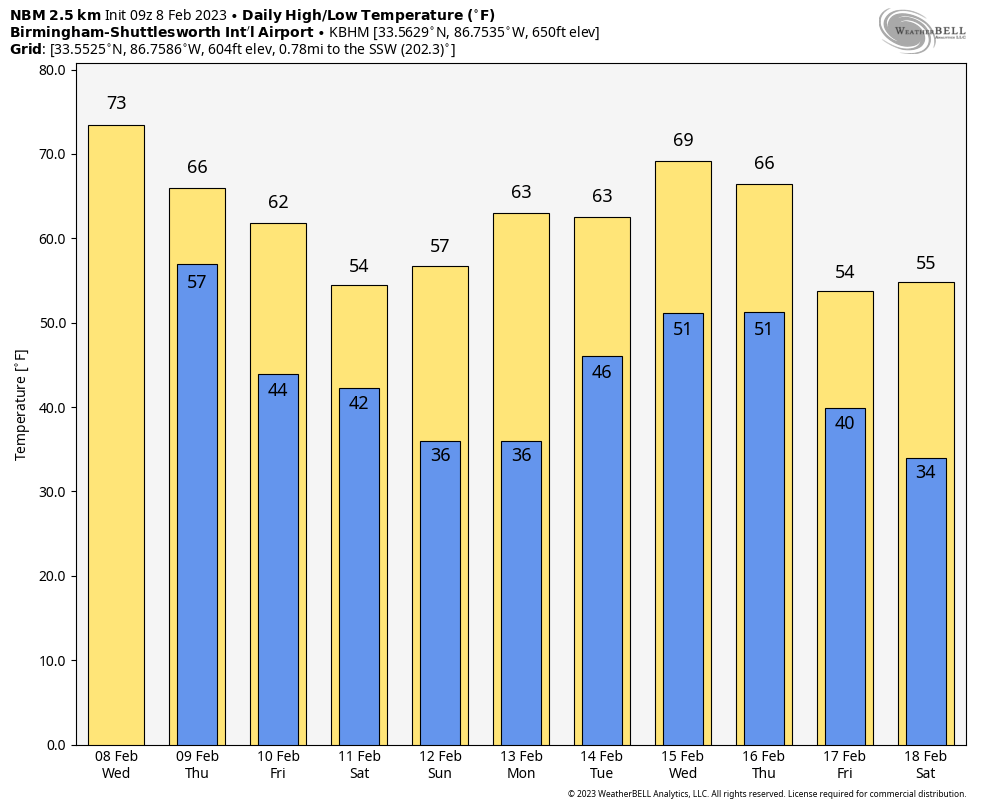
ANOTHER SPRING-LIKE TODAY AHEAD: Temperatures reach the 70s this afternoon across Alabama for another nice preview of spring. The average high for Birmingham on February 8 is 58. The sky will be mostly cloudy, and we will see a few spotty, widely scattered showers during the day. Rain becomes widespread late tonight after midnight, and SPC maintains a low end “marginal risk” (level 1/5) of severe thunderstorms for the western half of the state.
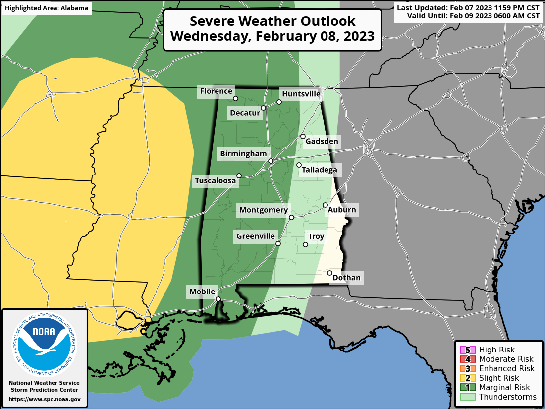
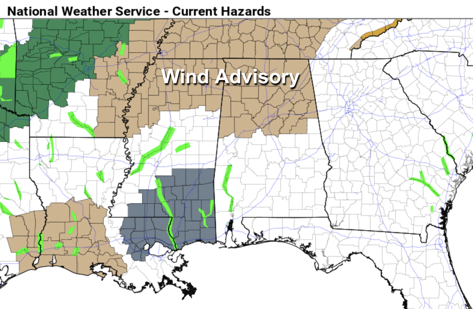
There is basically no surface based instability across Alabama, which means the risk of severe storms late tonight over West Alabama is very low; the main threat will be to the west over parts of Mississippi, Arkansas, and Louisiana. Most Alabama communities won’t hear any thunder. The main issue late tonight will be gradient winds (not related to thunderstorms)… winds could gust to 35/40 mph in spots ahead of the big mass of rain. A wind advisory has been issued for the northern half of the state.
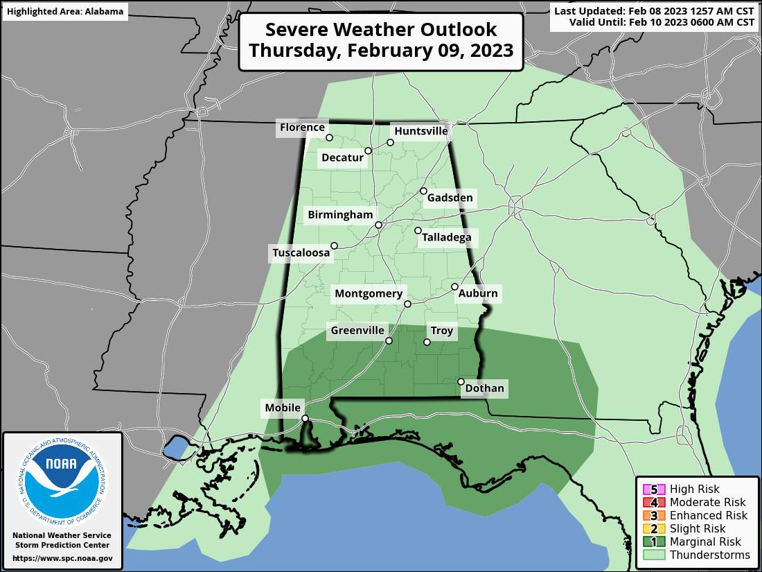
Rain will gradually diminish over North/Central Alabama tomorrow morning, but will continue over the southern counties. SPC maintains a “marginal risk” over South Alabama for storms tomorrow afternoon that might produce strong, gusty winds.
Temperatures will fall into the 50s over North Alabama tomorrow, with 60s to the south. Friday will be dry for must of the state, although rain is possible across the southeast counties. The high Friday will be mostly in the 60s.
FRIDAY NIGHT THROUGH SUNDAY: A deep upper trough, possibly evolving into a closed upper low, will move slowly through the state Friday night and Saturday with periods of light rain likely. There might be a snow flake in the mix Friday night or Saturday morning over the Tennessee Valley, but if that happens there won’t be any impact or accumulation. The high Saturday will be in the 50s. Then, on Sunday, the sky becomes sunny with highs in the 50s and 60s.
NEXT WEEK: Global models suggest we will deal with rain, and possibly a few thunderstorms Tuesday night into early Wednesday, and then again Thursday and Thursday night. Highs will be mostly in the 60s through the week; still no sign of any bitterly cold air for the Deep South for the next 10-15 days. See the daily Weather Briefing video for maps, graphics, and more details.
ON THIS DATE IN 2010: Snow fell across parts of the Tennessee Valley of North Alabama; heavier totals were around Muscle Shoals with 6 inches there.
ON THIS DATE IN 2013: A nor’easter produced heavy snowfall over the New England states. In Boston, Massachusetts, total snowfall reached 24.9 inches, the fifth-highest total ever recorded in the city. New York City officially recorded 11.4 inches of snow at Central Park, and Portland, Maine, set a record of 31.9 inches.
BEACH FORECAST: Click here to see the AlabamaWx Beach Forecast Center page.
Look for the next Weather Briefing video here by 3:00 this afternoon… enjoy the day!
Category: Alabama's Weather, ALL POSTS, Weather Xtreme Videos
About the Author (Author Profile)
James Spann is one of the most recognized and trusted television meteorologists in the industry. He holds the AMS CCM designation and television seals from the AMS and NWA. He is a past winner of the Broadcast Meteorologist of the Year from both professional organizations.Subscribe
If you enjoyed this article, subscribe to receive more just like it.


