Strong Storms Possible This Evening Across South Alabama; Weekend Snow Flakes?
**No afternoon Weather Briefing today; I am traveling**
RADAR CHECK: A few showers are across Southeast Alabama this afternoon, but the sky has cleared over the northwest counties of the state. Temperatures are mostly in the 60s, but a few spots in South Alabama are in the low 70s.
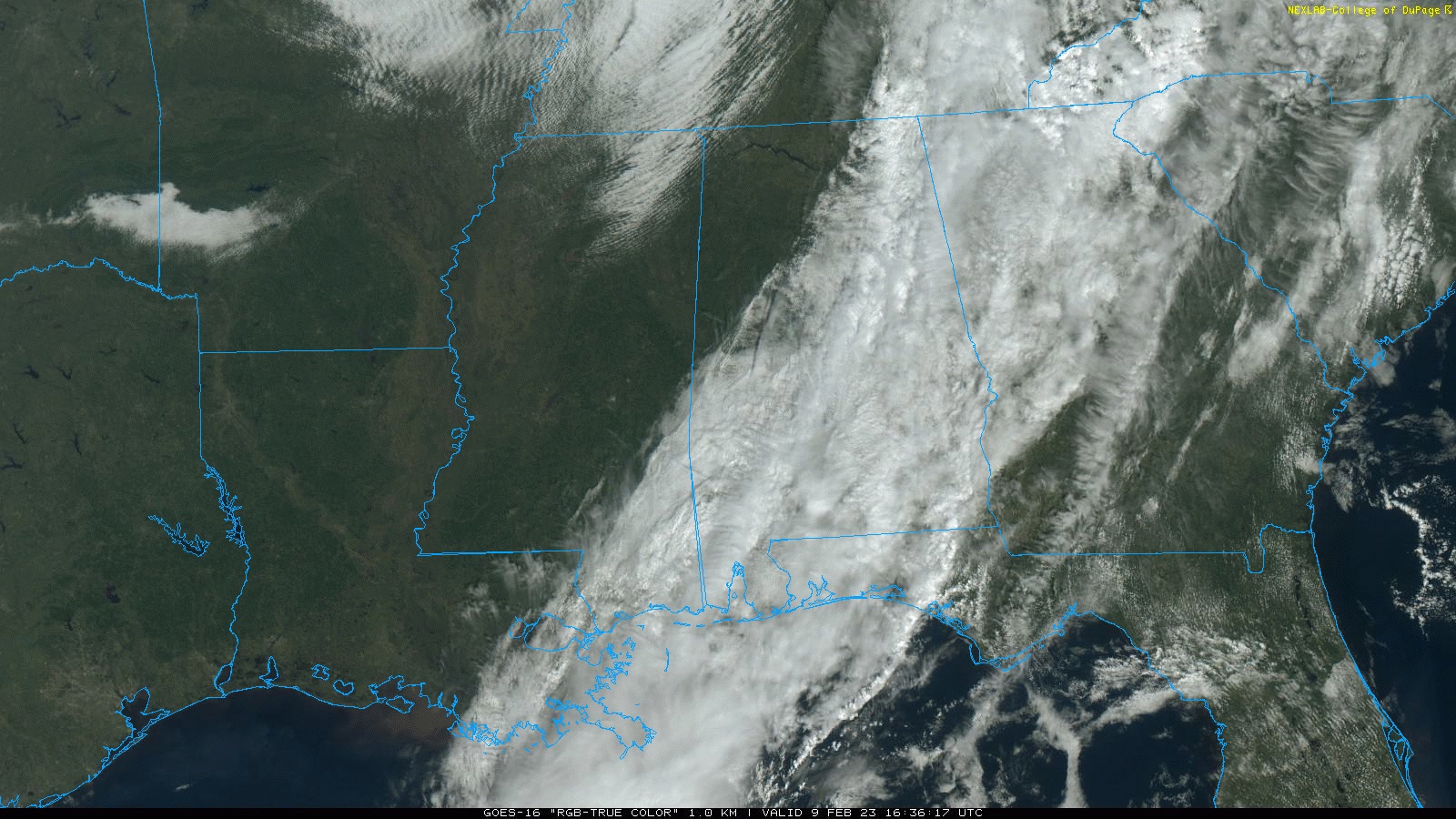
SPC maintains a low end “marginal risk” (level 1/5) of severe thunderstorms for parts of East and South Alabama…
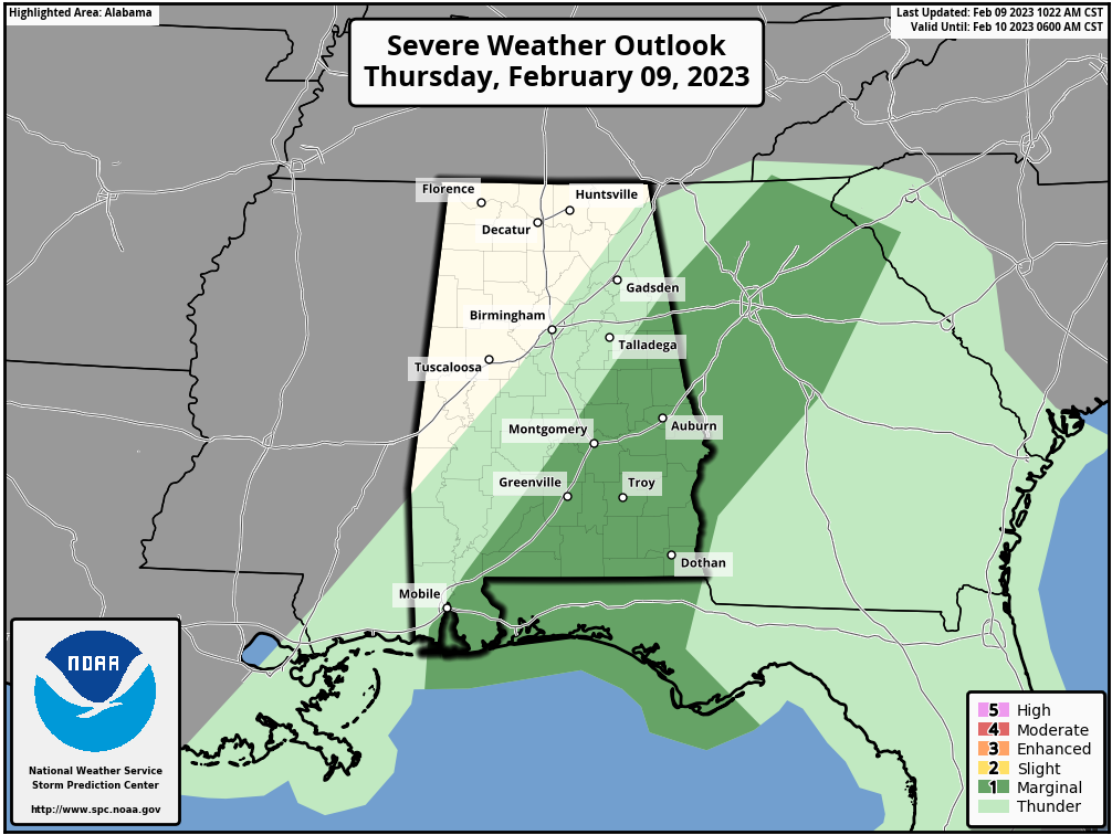
Storms are expected to increase in intensity this evening south of a line from near Roanoke to Mobile; a few storms there could produce strong, gusty winds. North Alabama will be dry tonight with a low in the 40s.
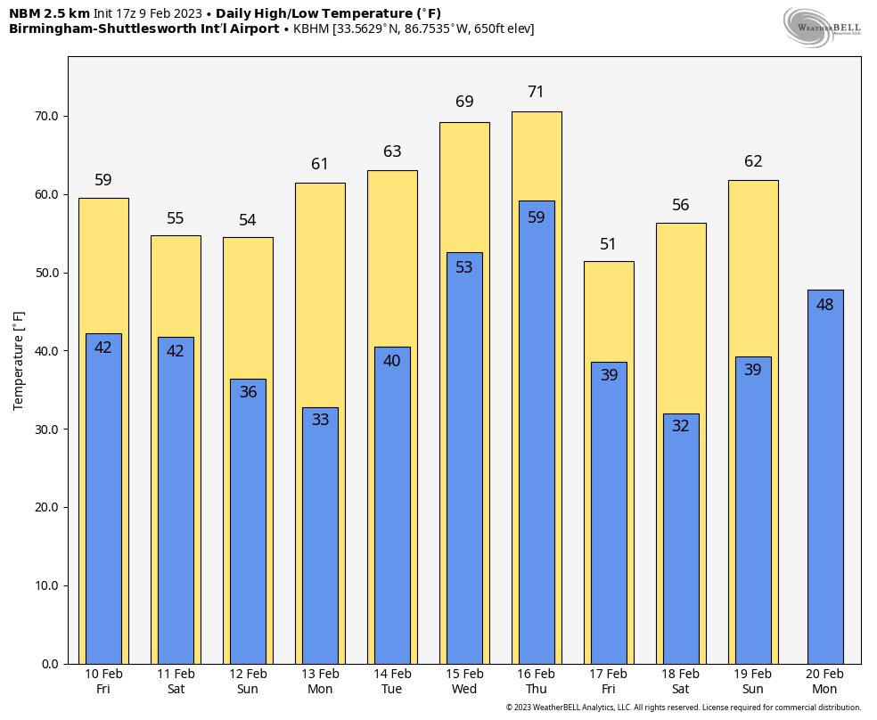
TOMORROW THROUGH THE WEEKEND: Most of the state will be dry tomorrow with only a few showers over the southern quarter of the state; the sun could peek out at times, and the high will be generally in the 60s.
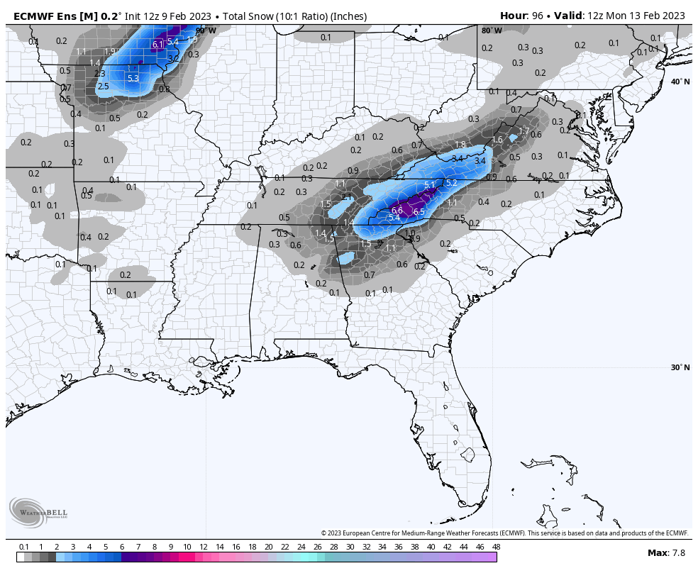
Over the weekend, a cold core upper trough will pass over the state. This will bring periods of rain Saturday with temperatures in the 40s and 50s. Then, Saturday night and early Sunday, there is a chance the rain could change to light snow over parts of North and East Alabama thanks to dynamic cooling under the trough. Temperatures will be in the low to mid 30s; for now major impacts are not expected. But, with these cold core systems they can bring some surprises, so watch for potential forecast changes.
The sky will clear Sunday afternoon with a high in the low to mid 50s.
NEXT WEEK: Monday will be dry and pleasant with afternoon temperatures reaching the 60s. Rain and a few storms return Tuesday night into early Wednesday, followed by another batch of storms Thursday. Some global models suggests a severe weather threat could develop Thursday, but it is too earl to know for sure. Afternoon temperatures through the week will be in the 60s; a few spots could reach the low 70s.
ON THIS DATE IN 1973: One of the greatest snowstorms in Southeastern United States history occurred February 9-11, 1973. This storm dropped one to two feet of snow across a region that typically sees only an inch or two of snow per year. In Alabama, the heaviest snow was over the southeast counties of the state, where almost one foot was measured in some parts of Butler and Crenshaw counties, south of Montgomery.
ON THIS DATE IN 1994: A devastating ice storm struck Mississippi, Louisiana, and extreme northwest Alabama. Freezing rain began falling over northern Mississippi during the early morning hours and continued until midday on the 10th. Ice accumulated 3 to 6 inches thick on exposed objects in the affected area. Due to the weight of the ice, power lines, trees, and tree limbs were down. Nearly one million people were without power after the storm, some for a month.
In Alabama, seven counties over the northwest part of the state were devastated. Trees blocked roads, which were already impassable because of the ice glaze. Three to five inch rainfall amounts occurred, resulting in a heavy glaze and even causing flooding elsewhere.
BEACH FORECAST: Click here to see the AlabamaWx Beach Forecast Center page.
Look for the next Weather Briefing video here by 6:00 a.m. tomorrow…
Category: Alabama's Weather, ALL POSTS
About the Author (Author Profile)
James Spann is one of the most recognized and trusted television meteorologists in the industry. He holds the AMS CCM designation and television seals from the AMS and NWA. He is a past winner of the Broadcast Meteorologist of the Year from both professional organizations.Subscribe
If you enjoyed this article, subscribe to receive more just like it.


