Stormy Through Tonight; Colder, Drier Tomorrow
**No afternoon video briefing today**
EYE ON RADAR TRENDS: Showers and storms continue to increase across West-Central Alabama early this afternoon, otherwise most of Alabama is dry. Some sun is peeking through the clouds occasionally, and temperatures are in the 70s.
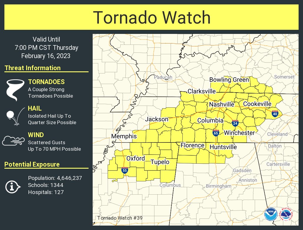
A tornado watch is in effect for parts of the Tennessee Valley of North Alabama until 7p CT; additional watches will be needed for other parts of Alabama soon.
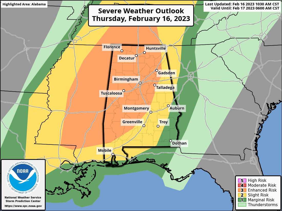
Much of North and West Alabama is in an “enhanced risk” (level 3/5) of severe thunderstorms through tonight… the rest of the state remains in a level one or two risk.
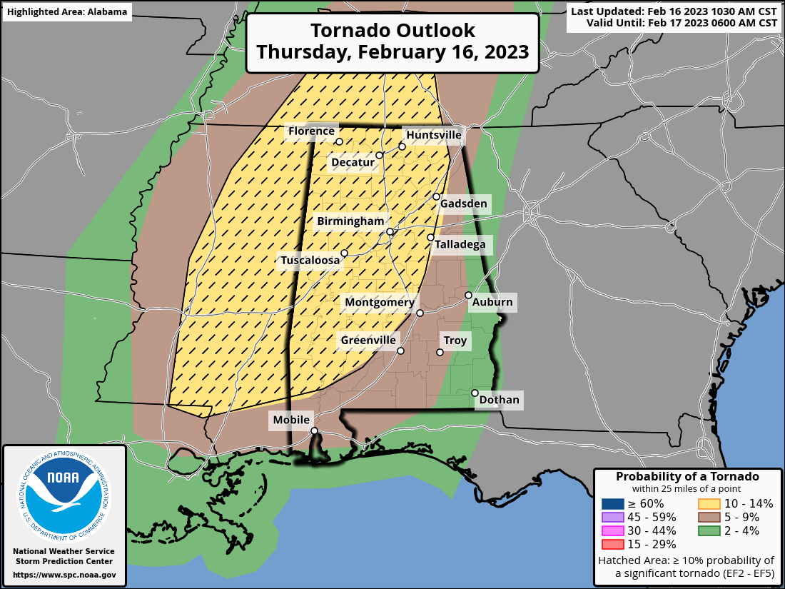
Highest tornado probabilities are in the “enhanced risk”, where a strong tornado or two (EF-2 or higher) is possible.
A capping inversion (a layer of warmer air aloft) is over much of Alabama early this afternoon, but as that erodes scattered storms will begin to form over the next few hours, and those could become severe with potential for hail, strong straight line winds, and a few tornadoes. Then, early tonight a line of storms will form ahead of a cold front. This line will sweep through the state with potential for strong winds and an isolated tornado.
The severe weather threat will wind down soon after midnight over Southeast Alabama.
Stay weather aware; have a reliable way of getting warnings and know your safe place. We will provide long form coverage on ABC 33/40 if tornado warnings are issued.
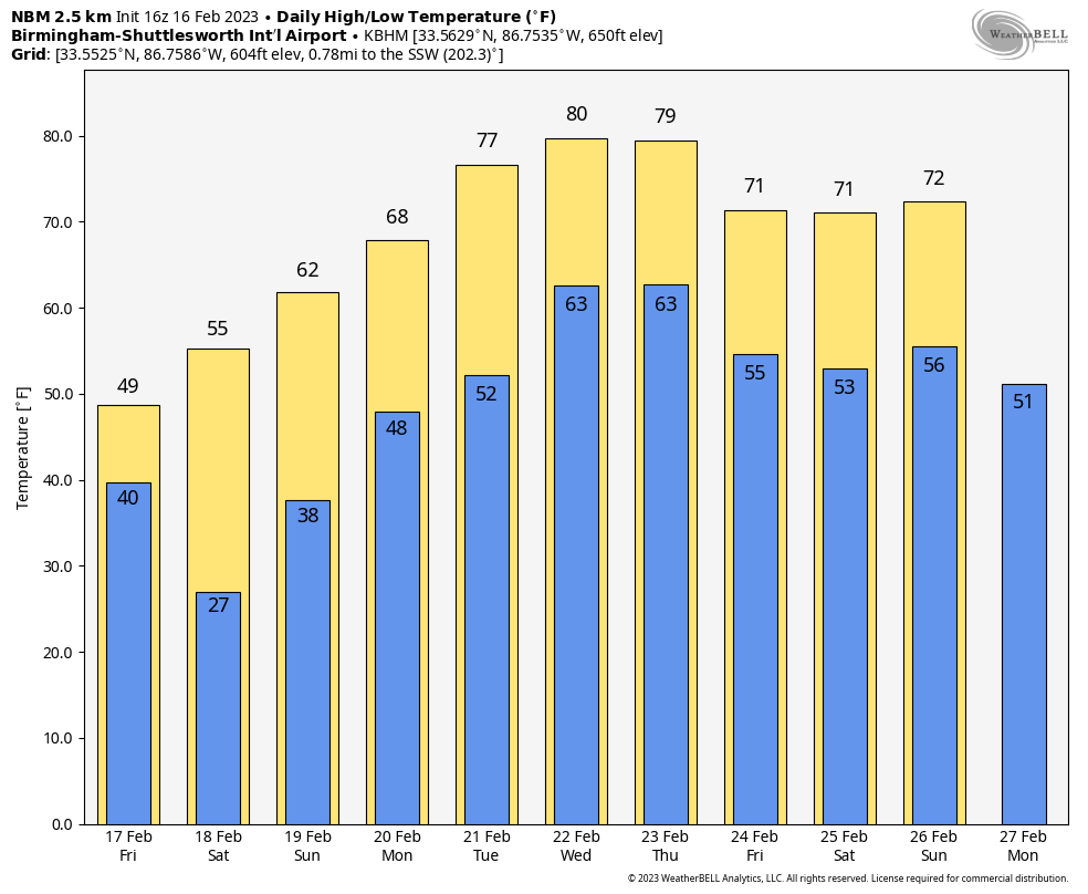
TOMORROW AND THE WEEKEND: The sky becomes partly to mostly sunny tomorrow, but the day will be windy and much colder with temperatures holding in the 40s north of Birmingham. Expect lows in the 20s by early Saturday morning… followed by a warming trend. With sunny days and fair nights, expect a high in the 50s Saturday, followed by 60s Sunday.
NEXT WEEK: It looks like the warmest week so far this year, with afternoon temperatures near 80 degrees by mid-week. Showers are possible at some point Tuesday through Thursday, but for now it doesn’t look like an especially big rain event, and no risk of severe storms.
ON THIS DATE IN 1995: A pre-dawn tornado tore through the communities of Joppa and Arab in Cullman and Marshall counties. The F3 tornado chewed its way across the southern side of Arab, reaching US-231 at 5:08 a.m. One person was killed in Cullman County. Five died in Marshall County. A total of 130 people were injured along the tornado’s 14 mile path. Joppa Elementary School was destroyed.
BEACH FORECAST: Click here to see the AlabamaWx Beach Forecast Center page.
Look for the next video weather briefing here by 6:00 a.m. tomorrow…
Category: Alabama's Weather, ALL POSTS
About the Author (Author Profile)
James Spann is one of the most recognized and trusted television meteorologists in the industry. He holds the AMS CCM designation and television seals from the AMS and NWA. He is a past winner of the Broadcast Meteorologist of the Year from both professional organizations.Subscribe
If you enjoyed this article, subscribe to receive more just like it.


