Showers/Storms For South Alabama Today
RADAR CHECK: Areas of rain along with a few thunderstorms are over the southern quarter of Alabama early this morning… the rest of the state is dry and cooler. The best chance of showers and storms today will remain over South Alabama, and SPC maintains a “marginal risk” (level 1/5) of severe thunderstorms south of a line from Grove Hill to Troy to Eufaula.
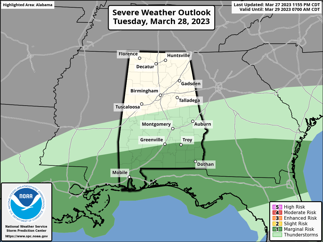
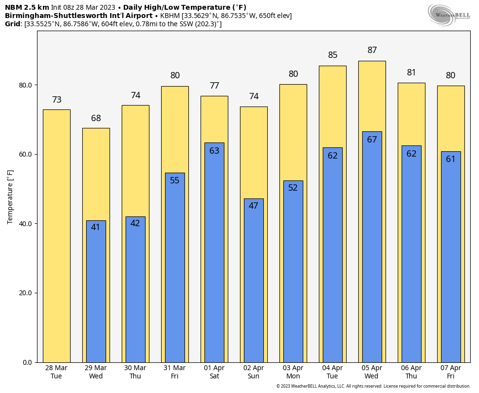
Heavier storms across South Alabama will produce strong wind gusts and possibly some hail. For the northern counties of the state, today will feature a mix of sun and clouds with a high in the 60-65 degree range. The average high for Birmingham on March 28 is 70.
The weather will be dry tomorrow and Thursday with a good supply of sunshine both days; highs will be in the 60s and 70s. We note mornings will be pretty chilly for late March, and colder spots over the northern half of the state will be in the mid to upper 30s. A little light frost can’t be ruled out.
FRIDAY AND THE WEEKEND: The day Friday will be dry and mild with a high in the 70s. A band of showers and thunderstorms will push into the state Friday night into Saturday morning ahead of cold front… SPC has defined a risk of severe thunderstorms for areas north and west of Birmingham in their “Day 4” outlook, which runs through 7:00 a.m. Saturday.

While the main dynamic support will be passing well to the north of Alabama, the air will be unstable, and severe storms certainly could develop. Once we get within 60 hours of the event (range of the high resolution convection allowing models) we will have a much better look at the situation. And we note SPC could very well expand the risk into a larger part of Alabama in future outlooks.
By Saturday afternoon, the best chance of showers and storms will shift into the southern half of the state. And, Sunday looks dry with a partly to mostly sunny sky. Highs Saturday will be in the 70s, and on Sunday North Alabama will hold in the 60s as cooler air drops in.
NEXT WEEK: Moisture returns Monday with some risk of showers and storms, and the week looks generally unsettled with multiple rounds of rain and thunderstorms likely. Too early to know the severe weather risk, but the first week of April usually brings some very active weather to the Deep South. Highs will be in the 70s and 80s… See the video briefing for maps, graphics, and more details.
ON THIS DATE IN 1920: A long track tornado moved from near Deatsville to West Point, Georgia, killing 17 people. Some of the greatest destruction was in Tallapoosa County in the vicinity of Susanna, Agricola, and the Red Ridge settlement. This tornado was part of an outbreak which saw 38 tornadoes hit the Midwest and the Deep South states. Over 380 people died, and at least, 1,215 were injured during the Palm Sunday outbreak.
ON THIS DATE IN 1963: A decision was handed down in the case of Whitney Bartie vs. the United States of America. Bartie sued the U.S. Weather Bureau for negligence in failing to provide a warning about Hurricane Audrey in 1957. Bartie’s wife and five children were killed after the 12-foot storm surge struck Cameron Parish, LA on the morning of June 27, 1957. It was ruled that the evidence presented did not establish negligence on the part of the Weather Bureau.
BEACH FORECAST: Click here to see the AlabamaWx Beach Forecast Center page.
Look for the next video briefing here by 3:00 this afternoon… enjoy the day!
Category: Alabama's Weather, ALL POSTS, Weather Xtreme Videos
About the Author (Author Profile)
James Spann is one of the most recognized and trusted television meteorologists in the industry. He holds the AMS CCM designation and television seals from the AMS and NWA. He is a past winner of the Broadcast Meteorologist of the Year from both professional organizations.Subscribe
If you enjoyed this article, subscribe to receive more just like it.


