

Showers/Storms Fire Up Again Today Across Alabama
RADAR CHECK: A few showers are over Northwest Alabama just before daybreak, otherwise most of the state is dry with a mostly cloudy sky along with temperatures in the mid to upper 60s. Like recent days, showers and storms will fire up, and they will be most active this afternoon and early tonight. SPC maintains a “marginal risk” (level 1/5) of severe thunderstorms for about the southern 2/3 of the state..
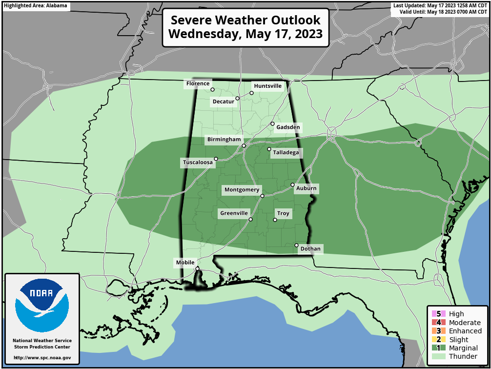
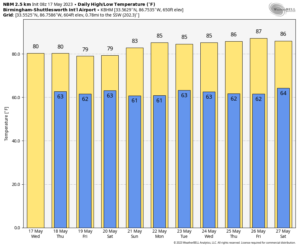
Heavier thunderstorms today will be capable of producing strong, gusty winds, small hail, heavy rain, and lots of lighting. Otherwise, today will be occasionally cloudy with a high in the 77-81 degree range.
Scattered showers and storms are likely again tomorrow, but they should be a little fewer in number Friday. Highs will remain in the upper 70s and low 80s, which is below average for mid-May in Alabama.
THE ALABAMA WEEKEND: A surface front will pass through the state Saturday, and a few passing showers or thunderstorms are likely. It won’t rain all day, and it won’t rain everywhere. Saturday’s high will remain close to 80 degrees. Then, a drier, continental airmass will drop into the state Sunday with lower humidity and a mostly sunny sky. The high Sunday will be in the low 80s.
NEXT WEEK: A few isolated afternoon showers can’t be ruled out, but for now it looks like much of next week will be dry with mostly sunny days and fair nights. Highs will be in the 80s, with lows in the 60s. See the video briefing for maps, graphics, and more details.
TROPICS: While the hurricane season doesn’t begin until June 1, NHC is already issuing seven day outlooks for the Atlantic basin. All is quiet for now.
ON THIS DATE IN 1896: An estimated F5 tornado tracked 100 miles through northeastern Kansas and extreme southeastern Nebraska. Seneca, Oneida, Sabetha, and Reserve, Kansas sustained severe damage. While passing through Reserve, the tornado was 2 miles wide. 25 people were killed, and 200 were injured.
ON THIS DATE IN 1979: A reading of 12 degrees at Mauna Kea Observatory established a record low for the state of Hawaii.
Look for the next video briefing here by 3:00 this afternoon… enjoy the day!
Category: Alabama's Weather, ALL POSTS, Weather Xtreme Videos
About the Author (Author Profile)
James Spann is one of the most recognized and trusted television meteorologists in the industry. He holds the AMS CCM designation and television seals from the AMS and NWA. He is a past winner of the Broadcast Meteorologist of the Year from both professional organizations.Subscribe
If you enjoyed this article, subscribe to receive more just like it.


