Showers/Storms Likely Tomorrow/ Drier Sunday
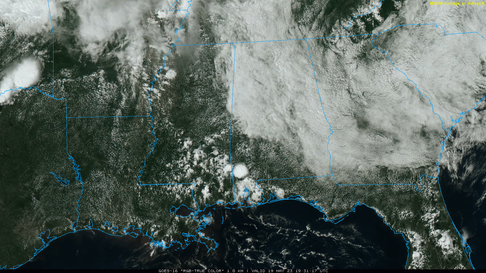
RADAR CHECK: As expected, showers are fewer in number across Alabama today. We note a few strong thunderstorms over the southwest counties of the state at mid-afternoon; otherwise the sky is mostly cloudy over the northern half of the state with temperatures only in the 70s, well below average for mid to late May. The sky will remain mostly cloudy tonight with a low in the 60s.
THE ALABAMA WEEKEND: An approaching front will bring scattered to numerous showers and thunderstorms to the Deep South tomorrow. Understand it won’t rain all day, and it won’t rain necessarily everywhere. But, a few passing showers and storms are likely during the day, and SPC maintains a “marginal risk” (level 1/5) of severe thunderstorms for most of Alabama.
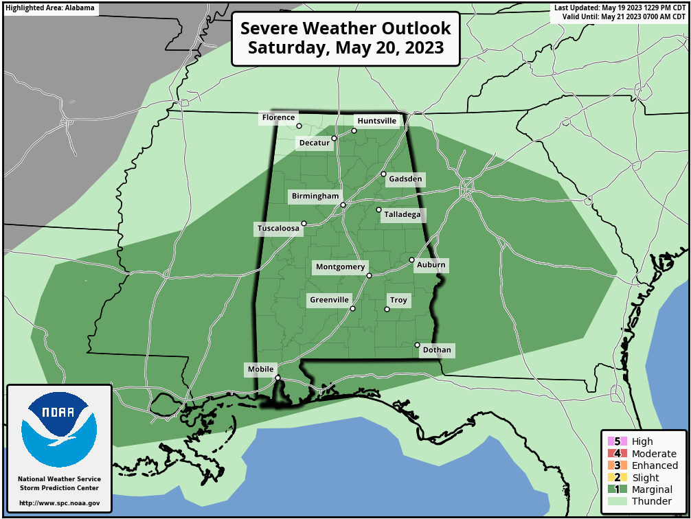
Heavier storms tomorrow will be capable of producing hail, strong winds, and lots of lightning. Most of the stronger storms will come from 2:00 until 9:00 p.m. Otherwise, tomorrow will be mostly cloudy with a high close to 80 degrees.
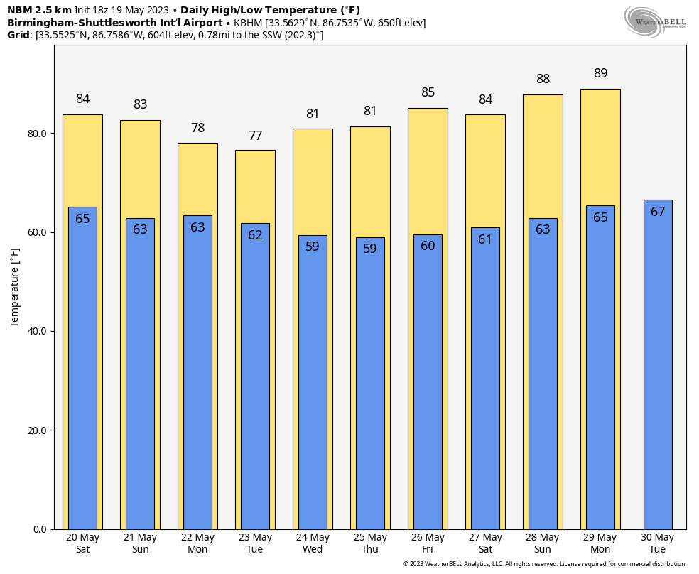
Then, on Sunday, drier air will creep into the northern and western counties of the state with slightly lower humidity. Showers will remain possible over East and South Alabama, however, south of the front. Sunday’s high will be in the low 80s.
NEXT WEEK: The front dissipates and moisture surges northward Monday, so scattered showers and storms are possible statewide. And, we will need to mention scattered showers and storms on a daily basis through the week, most active during the afternoon and evening hours. Daytime temperatures will likely remain below average with highs in the upper 70s and low 80s… See the video briefing for maps, graphics, and more details.
ON THIS DATE IN 1915: A spring storm came to an end after producing widespread snow. Total snowfall from the storm included: 17.6 inches in Scottsbluff, Nebraska, 8 inches at Cheyenne, Wyoming, 7 inches at Chadron and 3.9 inches in North Platte, Nebraska.
ON THIS DATE IN 1973: An F2 tornado chewed its way across the northern part of Fort Payne on Saturday evening, May 19, 1973; a total of 35 people were injured in the storm. Other tornadoes touched down the same day in parts of Madison and Jackson counties.
Look for my next video briefing here by 6:00 a.m. Monday… enjoy the weekend!
Category: Alabama's Weather, ALL POSTS, Weather Xtreme Videos
About the Author (Author Profile)
James Spann is one of the most recognized and trusted television meteorologists in the industry. He holds the AMS CCM designation and television seals from the AMS and NWA. He is a past winner of the Broadcast Meteorologist of the Year from both professional organizations.Subscribe
If you enjoyed this article, subscribe to receive more just like it.


