Only Isolated Showers Through The Weekend; Hot Afternoons
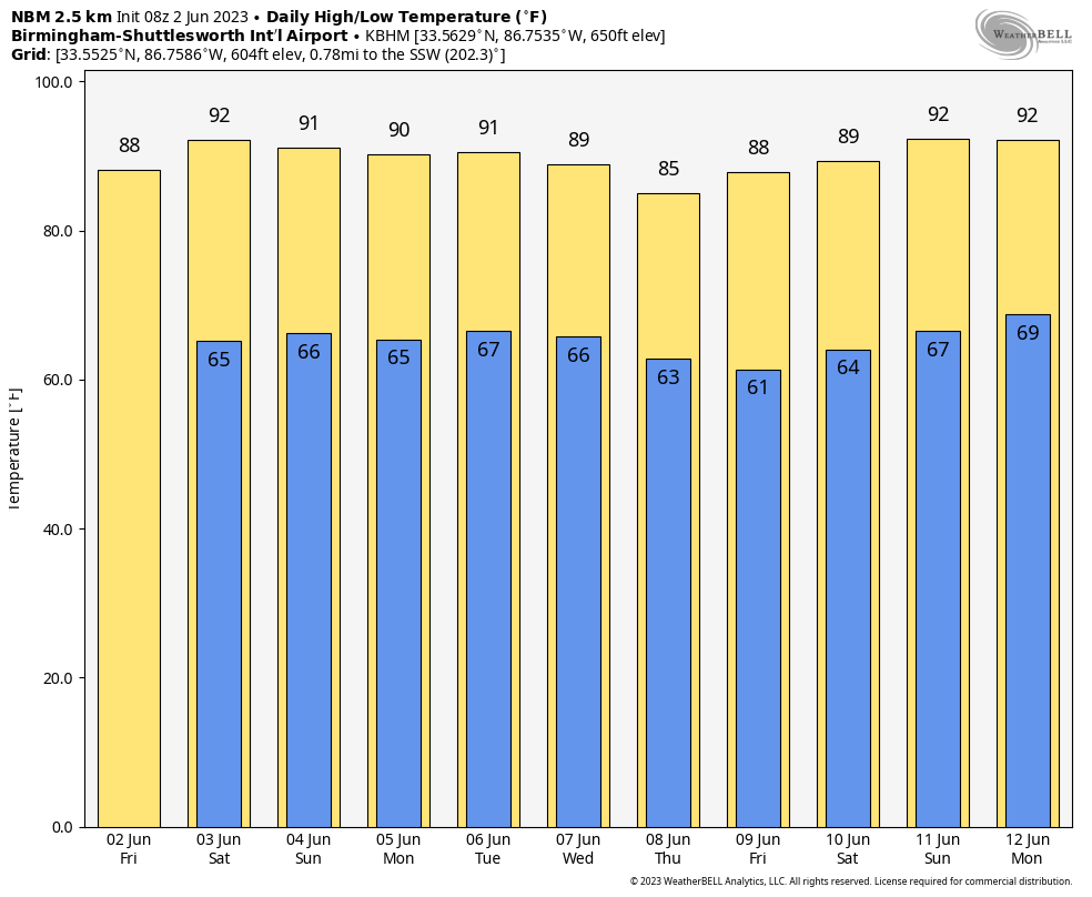
FEELING LIKE SUMMER: We project afternoon highs in the 87-92 degree range through the weekend with partly sunny days and fair nights. The summer feel to the weather is here with higher heat and humidity levels. And, as is usually the case, we will have a few isolated showers around. We note a couple of them early this morning over North Alabama, but most of the showers will come from 2:00 until 9:00 p.m. The chance of any one spot seeing rain each day is 10-20 percent.
NEXT WEEK: The benign pattern continues with just a few isolated/widely scattered showers or storms around each day. Highs will be near 90 for the first half of the week, but global models are hinting at a drier, slightly cooler airmass by Thursday and Friday with highs dropping back into the mid 80s. See the video briefing for maps, graphics, and more details.
TROPICS: Tropical Depression 2 is in the Gulf of Mexico, about 285 miles west of Fort Myers, Florida. The system remains very disorganized, and top winds are 35 mph. It appears that the window of opportunity for the system to strengthen is closing, or has already closed. Vertical shear is likely to remain strong or become even stronger as the system moves farther south underneath an upper-tropospheric jet over the southeastern Gulf of Mexico. This shear, combined with some drier air to the west of the trough over the extreme eastern Gulf, should cause a weakening trend to commence by this evening. The official intensity forecast shows the system degenerating into a remnant low over the weekend.
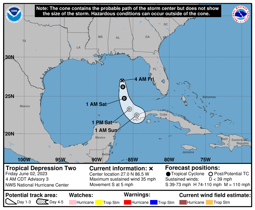
TD2 will have no direct impact to Florida other than a slightly higher coverage of showers across the peninsula today.
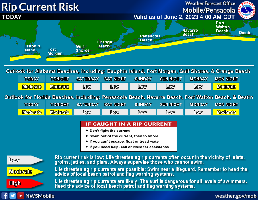
For the Central Gulf Coast (Gulf Shores to Panama City Beach), there is a moderate rip current danger today, followed by a low risk over the weekend. The weather here will be fine with mostly sunny days, fair nights, and the occasional pop up shower or storm through early next week.
The rest of the Atlantic basin is very quiet.
ON THIS DATE IN 1889: The same storm that caused the historic dam failure in Johnstown, PA, also affected Washington, D.C. The streets and reservations in the center of the city and all the wharves and streets along the riverfront were under water. Pennsylvania Avenue was flooded from 2nd to 10th Streets. The Potomac River crested at the Aqueduct Bridge at 19.5 feet on June 2.
ON THIS DATE IN 1998: This was the first tornado to “officially” be rated an “F4” in the State of Maryland. The storm entered Garrett County, Maryland striking the town of Finzel. It then moved up and over Big Savage Mountain in Allegany County and ripped through the northern portion of Frostburg. It reached its peak strength as it crossed the ridge. Winds were estimated between 210 and 250 mph; there were no deaths.
Look for the next video briefing here by 3:00 this afternoon… enjoy the day!
Category: Alabama's Weather, ALL POSTS, Weather Xtreme Videos
About the Author (Author Profile)
James Spann is one of the most recognized and trusted television meteorologists in the industry. He holds the AMS CCM designation and television seals from the AMS and NWA. He is a past winner of the Broadcast Meteorologist of the Year from both professional organizations.Subscribe
If you enjoyed this article, subscribe to receive more just like it.


