Summer Mix Of Sun And Storms Will Continue Through The Week
**No afternoon video today; we are on a holiday schedule**
RADAR CHECK: Showers and strong to severe thunderstorms continue across the Tennessee Valley of North Alabama at mid-afternoon; a flash flood warning has been issued for parts of Lawrence, Morgan, and Madison counties where some spots have received over two inches of rain. Other scattered storms are developing over the rest of the state, and those are strong.
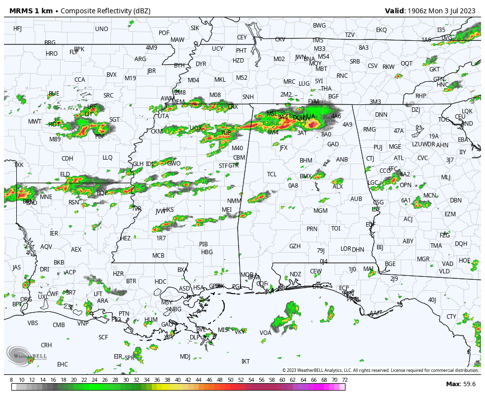
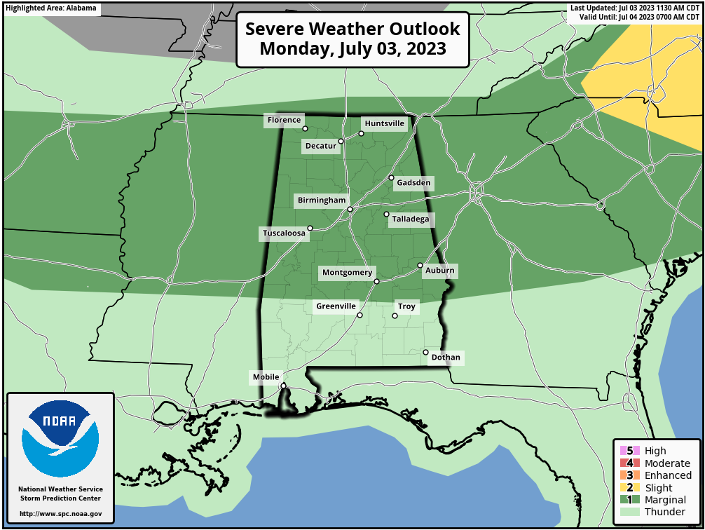
SPC maintains a “marginal risk” (level 1/5) of severe thunderstorms for the northern 2/3 of the state through the evening hours, as storms will continue to have potential for strong winds and hail.
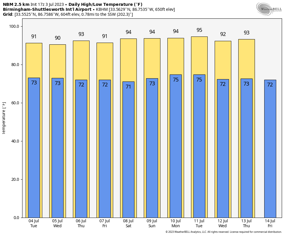
Expect the same conditions through the week with morning sun and afternoon storms. The storms will be random and scattered, so it won’t rain everywhere… but where the storms form they could produce strong winds and hail. Most (but not all) of the showers and storms will come from 2 until 9 p.m… and the odds of any one given location seeing rain daily are in the 40-60 percent range. Highs will be mostly in the low 90s.
THE ALABAMA WEEKEND: No real change. Partly sunny days with “scattered, mostly afternoon and evening showers and thunderstorms” Saturday and Sunday with highs in the low to mid 90s. Exactly what you expect in Alabama in summer.
NEXT WEEK: We will stick with a persistence forecast. The risk of random, scattered afternoon/evening storms daily, otherwise partly sunny days and mostly fair nights with highs in the low 90.
TROPICS: The Atlantic basin is very quiet, and tropical storm formation is not expected this week.
ON THIS DATE IN 1975: Up to 3 inches of rain caused flash flooding throughout Las Vegas, NV. The main damage occurred to vehicles at Caesars Palace with approximately 700 damaged or destroyed with several cars found miles away. North Las Vegas was hardest hit with $3.5 million in damage. Two people drowned in the flood waters.
ON THIS DATE IN 2014: Hurricane Arthur made landfall at 03:15 UTC over North Carolina’s Shackleford Banks, positioned between Cape Lookout and Beaufort at category two strength with winds of 100 mph. It was the earliest known hurricane to make landfall in the U.S. state of North Carolina during the calendar year.
Look for the next video update here by 6:00 a.m. tomorrow…
Category: Alabama's Weather, ALL POSTS, Weather Xtreme Videos
About the Author (Author Profile)
James Spann is one of the most recognized and trusted television meteorologists in the industry. He holds the AMS CCM designation and television seals from the AMS and NWA. He is a past winner of the Broadcast Meteorologist of the Year from both professional organizations.Subscribe
If you enjoyed this article, subscribe to receive more just like it.


