Hot, Humid Summer Days With Scattered Showers/Storms
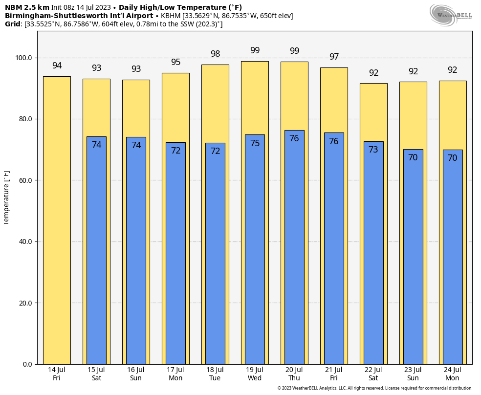
CLASSIC MID-SUMMER WEATHER: Alabama’s weather will feature the classic summer mix of sun, heat, humidity, and storms through Sunday. Afternoon highs will be generally in the 89-94 degree range, and most (but not all) of the showers and storms will come from 2:00 until 9:00 p.m. The chance of any one spot seeing rain today and tomorrow is 50-60 percent, and 40-50 percent Sunday.
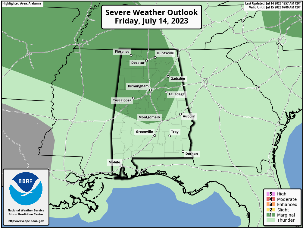
SPC has defined a “marginal risk” (level 1/5) of severe thunderstorms for about the northern 2/3 of the state this afternoon; heavier storms that form could produce strong winds.
We also note a “heat advisory” is in effect for parts of Central and West Alabama, where the heat index could touch 105 today. But understand all of the state will be hot and humid.
NEXT WEEK: The upper ridge will grow stronger, and accordingly heat levels will rise, and coverage of scattered storms will drop during the week. Highs will be in the mid to upper 90s, with lows in the 70s. Heat advisories will be needed through the week with heat index values exceeding 100 degrees daily. Afternoon storms are possible, but they should be widely spaced most days. See the video briefing for maps, graphics, and more details.
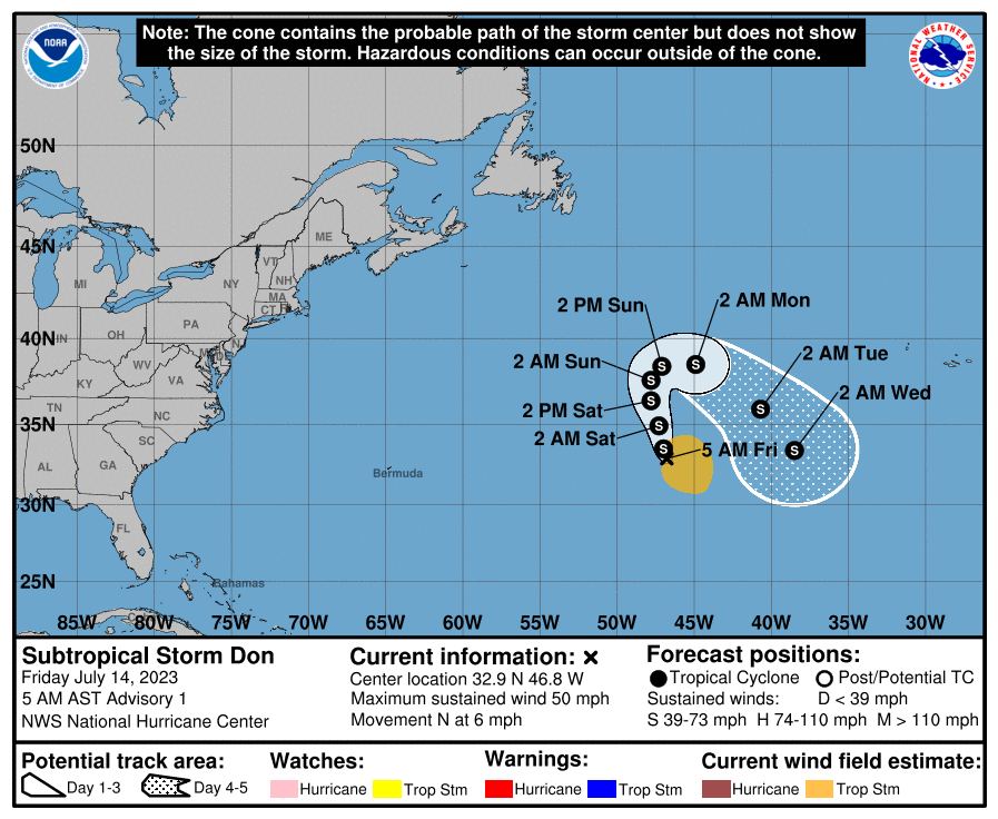
TROPICS: “Subtropical Storm Don” has formed in the middle of the Atlantic with winds of 50 mph. Don is a junk system that will remain far from land, and the rest of the Atlantic basin, including the Gulf of Mexico, remains very quiet.
ON THIS DATE IN 1995: Thunderstorms producing severe weather were occurring over Upper Michigan and adjacent portions of Ontario near Sault Saint Marie. By late evening the storms had evolved into a bowing line just northwest of the Mackinac Bridge. At 10:17 PM EDT, the thunderstorm gust front hit the bridge, and a gust to 90 mph was measured. Sustained winds of 80 mph continued on the bridge for ten more minutes. Thus began the intense “Ontario-Adirondacks Derecho” that would cause hundreds of millions of dollars’ worth of damage, several deaths, and many injuries as it raced southeast from the northern Great Lakes to the Atlantic coast.
ON THIS DATE IN 2006: Tropical Storm Bilis tracks across northern Taiwan before making landfall in southeastern China’s Fujian province with maximum sustained winds near 65 mph. The storm causes at least 575 deaths in Fujian, Guangdong, and Hunan provinces and direct economic losses near $3.3 billion.
Look for the next video briefing here by 3:00 this afternoon… enjoy the day!
Category: Alabama's Weather, ALL POSTS, WeatherBrains
About the Author (Author Profile)
James Spann is one of the most recognized and trusted television meteorologists in the industry. He holds the AMS CCM designation and television seals from the AMS and NWA. He is a past winner of the Broadcast Meteorologist of the Year from both professional organizations.Subscribe
If you enjoyed this article, subscribe to receive more just like it.


