Strong/Severe Storms Today; Heat Levels Down Tomorrow
RADAR CHECK: A persistent band of showers and thunderstorms is over the Tennessee Valley region of North Alabama early this morning, and a flash flood warning is in effect for parts of Limestone and Madison counties just before sunrise, where 3-5 inches of rain has fallen overnight.
The band will slowly drift southward today, and SPC has a “slight risk” of severe thunderstorms defined today as far south as Greensboro, Montgomery, and Eufaula. A “marginal risk” extends are far south as Thomasville, Chapman, and Dothan.
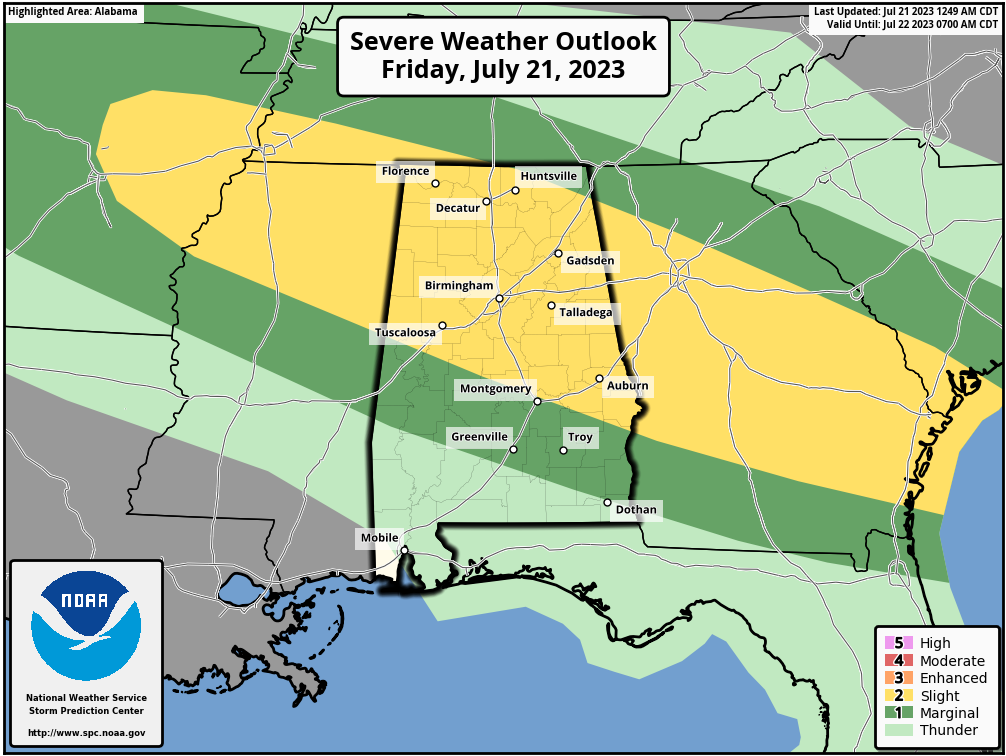
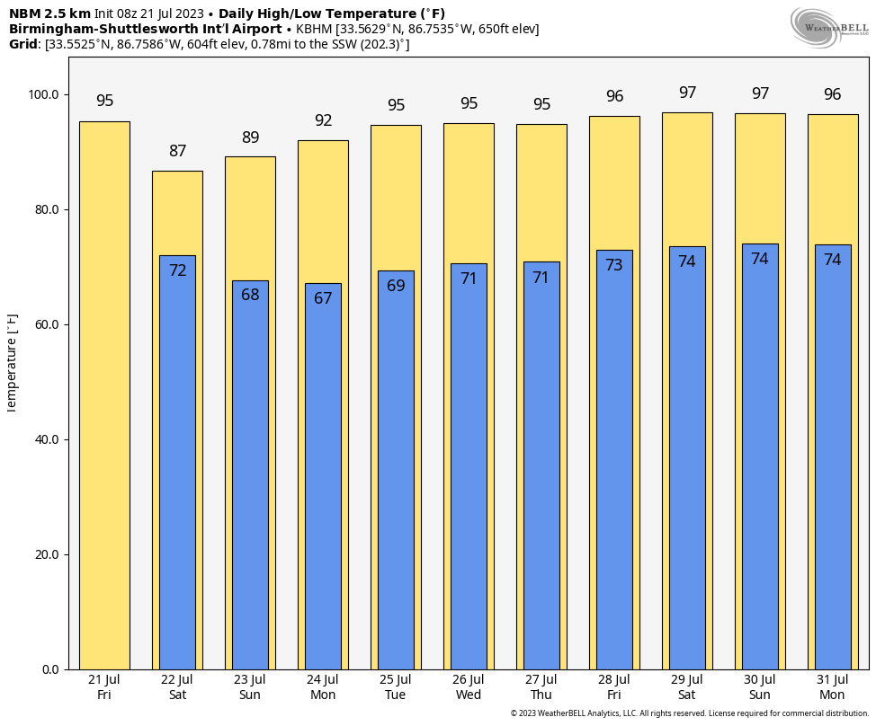
Heavier storms this afternoon and tonight will be capable of producing strong straight line winds and possibly some small hail. Away from the storms today will be another hot, humid summer day with a partly sunny along with a high in the mid 90s.
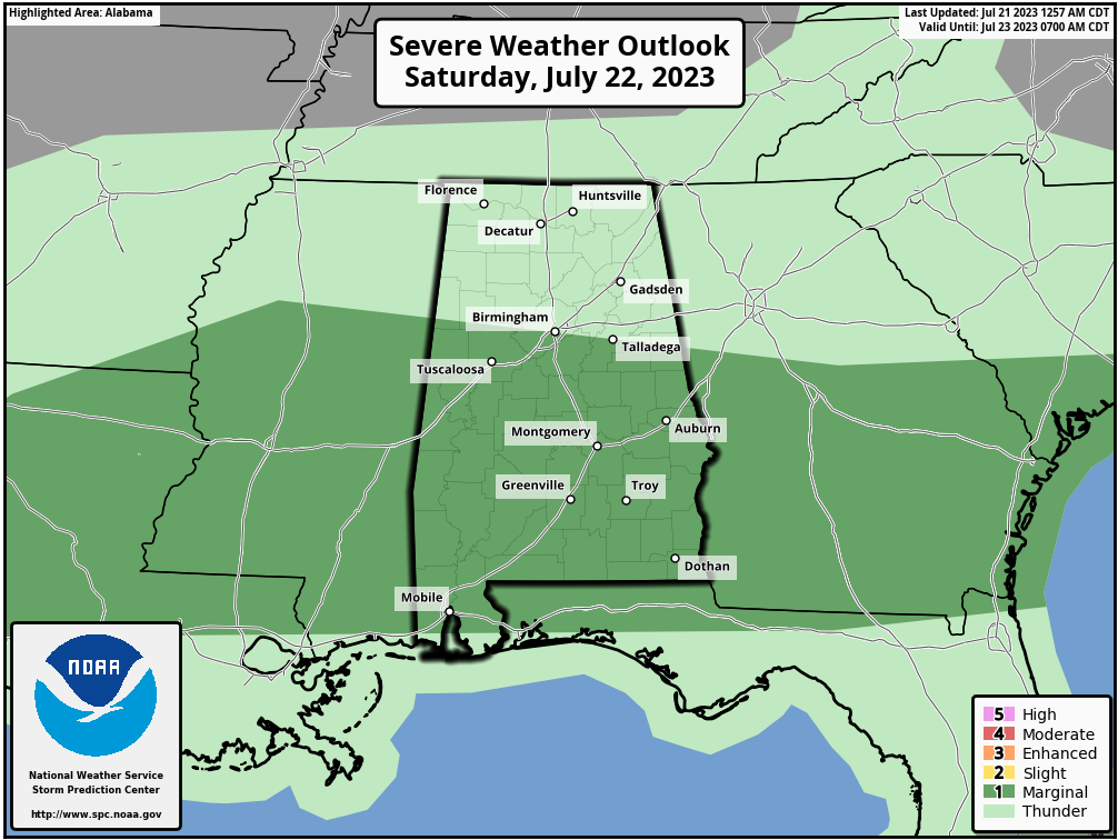
THE ALABAMA WEEKEND: Showers and storms could linger tomorrow morning over North Alabama, but by afternoon the activity will shift into the southern counties as dry air begins to push into the state. A “marginal risk” (level 1/5) of severe thunderstorms is defined roughly from I-20 south.
Heat levels will drop… the high tomorrow will be in the 85-89 degree range over the northern half of the state, with low 90s to the state. Temperatures drop into the 60s early Sunday with a clear sky and dry air in place, and the day will be mostly sunny and less humid with a high around 90. The exception is far South Alabama and areas near the Gulf Coast, where a few scattered thunderstorms will be possible.
NEXT WEEK: At this point next week looks mostly dry with mostly sunny days and fair nights… highs will be in the low to mid 90s. Afternoon storms should be few and far between… See the video briefing for maps, graphics, and more details.
TROPICS: Tropical Don, with sustained winds of 50 mph, continues to meander over the Atlantic far from land. It will become post-tropical late this weekend over the cooler waters of the North Atlantic.
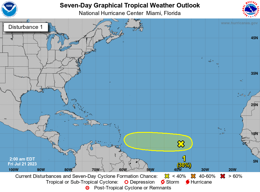
Elsewhere, an area of low pressure, located several hundred miles west-southwest of the Cabo Verde Islands, is interacting with a tropical wave to its east and producing an elongated area of showers and thunderstorms over the eastern and central tropical Atlantic. While environmental conditions appear marginal due to dry air to the north, some slow development of this system is possible through early next week, as it moves westward across the central tropical Atlantic. NHC gives the system a 30 percent chance of becoming a depression or storms over the next seven days.
There are no tropical systems near the Gulf of Mexico or the U.S.
ON THIS DATE IN 1983: At Vostok Station in Antarctica, the temperature dropped to 128.6 degrees below zero. This reading is the coldest temperature ever recorded on Earth.
ON THIS DATE IN 1987: An F4 tornado ravages the Teton Wilderness and Yellowstone National Park in Wyoming. The tornado’s violent winds destroy millions of trees on a 24.3-mile track that traverses the Continental Divide at an elevation of 10,170 feet.
Look for the next video briefing here by 3:00 this afternoon… enjoy the day!
Category: Alabama's Weather, ALL POSTS, Weather Xtreme Videos
About the Author (Author Profile)
James Spann is one of the most recognized and trusted television meteorologists in the industry. He holds the AMS CCM designation and television seals from the AMS and NWA. He is a past winner of the Broadcast Meteorologist of the Year from both professional organizations.Subscribe
If you enjoyed this article, subscribe to receive more just like it.


