Active Summer Thunderstorm Pattern Continues
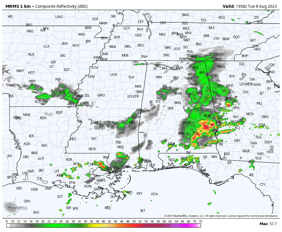
THIS AFTERNOON: While North Alabama is enjoying rain cooled air with temperatures in the 70s, severe thunderstorms are moving through the southeast corner of the state with strong winds. Multiple counties there are under severe thunderstorm warnings… all of the storms should be in Georgia by 4p CT. Most of the state will be dry tonight with lows in the 60s and 70s.
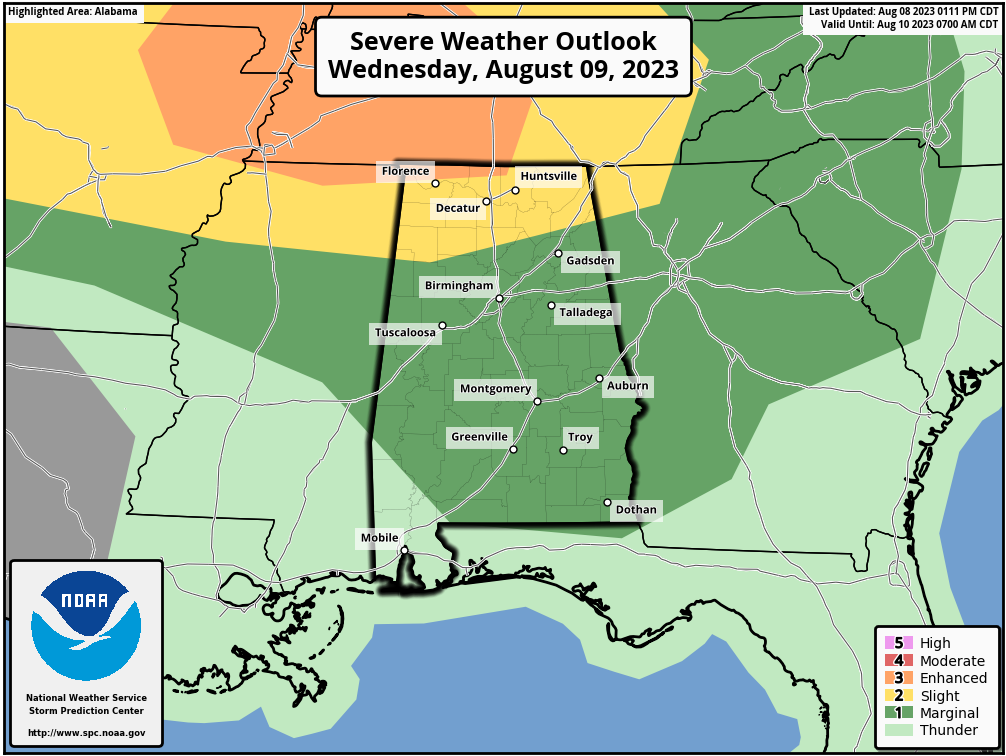
TOMORROW: Another active day of thunderstorms is expected. Not raining all day, not raining everywhere, but where storms do develop that will pack a punch. The far northwest corner of the state has been placed in an “enhanced risk” (level 3/5) of severe thunderstorms. We have a “slight risk” (level 2/5) down to Winfield, Cullman, and Collinsville. And, a “marginal risk” (level 1/5) covers the rest of the state (Central and South Alabama).
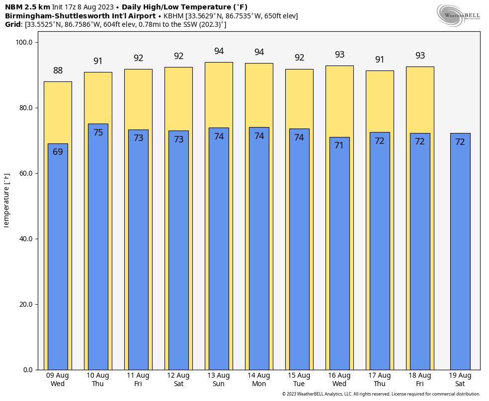
REST OF THE WEEK: A northwest flow pattern will persist across the state, with some risk of showers and strong storms Thursday and Friday. The higher coverage of storms will be over the northern half of Alabama, and most of them (but not all) will come in the noon to midnight window. Highs will be mostly in the low 90s.
THE WEEKEND AND NEXT WEEK: It looks like some pretty classic summer weather for Alabama with partly sunny, hot, humid days along with some risk of scattered showers and thunderstorms daily, most active during the afternoon and evening hours. Highs will be in the low to mid 90s; the most intense heat remains to the west. See the video briefing for maps, graphics, and more details.
TROPICS: Again today the Atlantic basin is calm as it ever gets in August. Tropical storm formation is not expected for at least the next seven days. Lot of dry air and subsidence (sinking air) in place.
LIGHTNING DEATH: One person was killed by lightning yesterday in Alabama; this happened in Florence. Police identified the victim as a 28 year old male on Kendall Drive in the Florence Industrial Park.
ON THIS DATE IN 2007: A tornado bounces across Staten Island and Brooklyn, New York, ripping off roofs and damaging dozens of buildings. The EF-2 twister hop-scotched through Brooklyn’s Bay Ridge and Sunset Park neighborhoods around 6:30 am.
Look for the next video briefing here by 6:00 a.m. tomorrow…
Category: Alabama's Weather, ALL POSTS, Weather Xtreme Videos
About the Author (Author Profile)
James Spann is one of the most recognized and trusted television meteorologists in the industry. He holds the AMS CCM designation and television seals from the AMS and NWA. He is a past winner of the Broadcast Meteorologist of the Year from both professional organizations.Subscribe
If you enjoyed this article, subscribe to receive more just like it.


